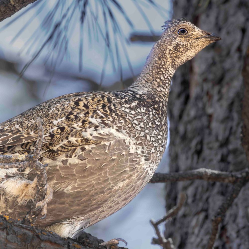
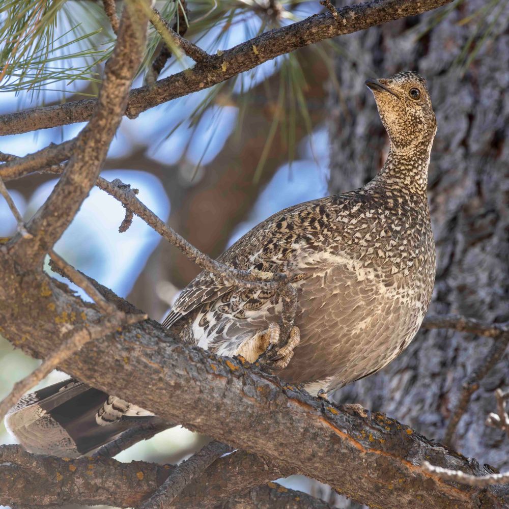
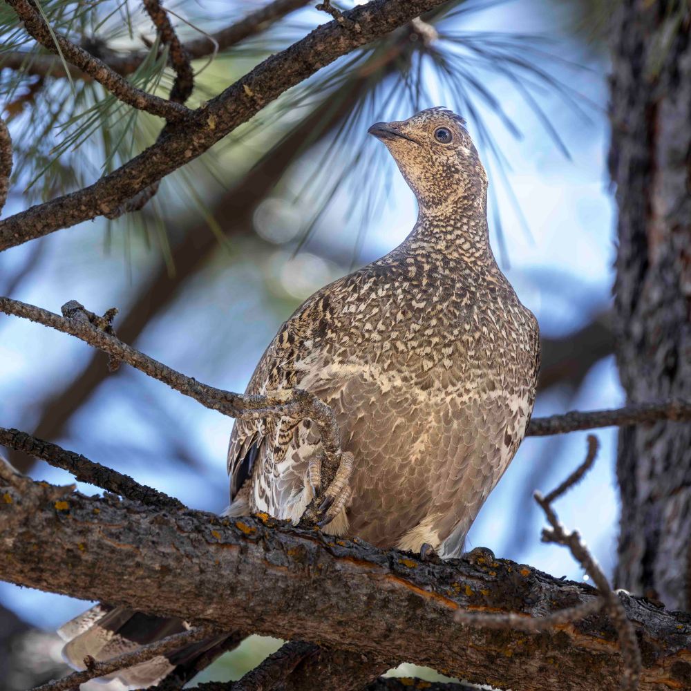
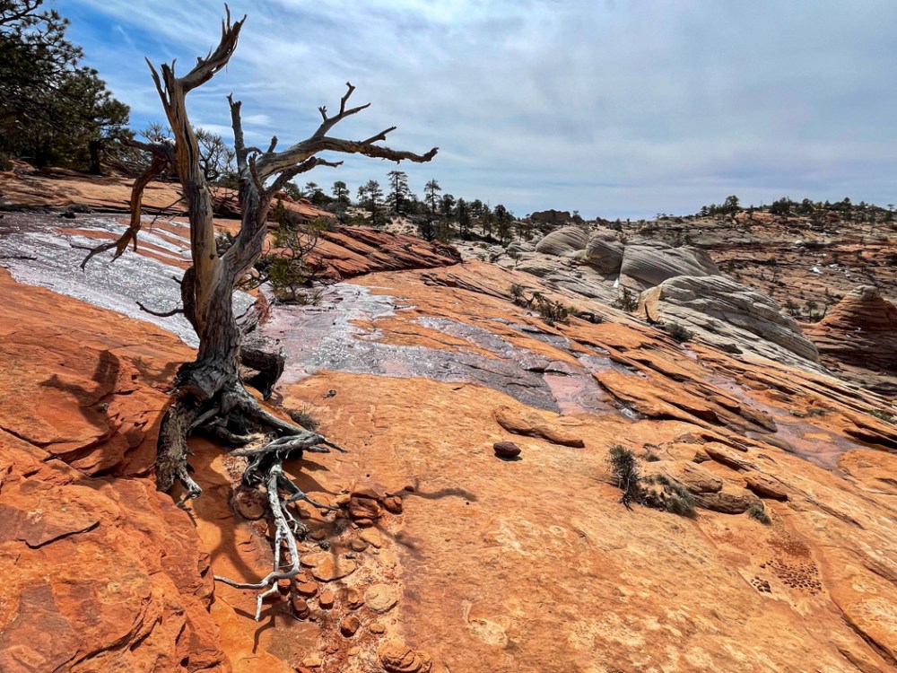
ザイオン国立公園の西側、標高2,890フィート (2.4km)にあるラバポイントというなの展望台近くで見つけました。 We found it on the west side of Zion National Park at an elevation of 2,890 feet (2.4 km) near an overlook called Lava Point.
この日の朝ブラックホークに出会って十分満足していた私は、その後、何も期待していませんでした。でも、この鳥との出会いに誕生日とクリスマスのプレゼントを一緒にもらってしまった気がしました。きっと、他のグループメンバー6人も同じように超ラッキーだと思ったに違いありません。 I was happy enough with my encounter with the Black Hawk that morning, so I had no expectations after that. But I felt like I had received a birthday and Christmas present together with this encounter with the bird. I am sure the other six group members must have felt super lucky as well.
この鳥に再び出会える確実はきっと限りなくゼロに近いと思いながら、アオライチョウが飛び去って行った後も、この出会いに深く感謝していました。 Even after the blue grouse flew away, I was deeply grateful for this encounter, knowing that the certainty of seeing this bird again was surely close to zero.
ザイオン国立公園内のウェストリムトレイル (West Rim Trail) は全長16.1マイル (26km), 高度差は3624フィート (1105m)です。 The West Rim Trail in Zion National Park is 16.1 miles (26 km) long with an elevation gain of 3624 feet (1105 m).
Appleマップによると9時間39分で歩けるそうですが、実際は10-16時間かかると言われています。逆に、Lava Point からロッジまで北から南に歩くと下り坂なので9-10時間、1日で完歩可能な範囲内です。ただ、高度7,897フィート (2,407m)を考えると、苦しいですよね。健脚向きです。 Apple Maps says the hike will take 9 hours and 39 minutes, but in reality it will take 10-16 hours. Conversely, walking from north to south from Lava Point to the lodge is a downhill hike and should take 9-10 hours, well within the range of a one-day hike. However, considering the altitude of 7,897 feet (2,407 meters), it is a strenuous walk. It is suitable for able-bodied people.
アップルの地図によるトレイルの全行程 Full trail route with Apple maps
この日、私たちはザイオンロッジからグロットを経て、北に向かい、行けるところまで行って引き返してくることにしました。 On this day we decided to head north from Zion Lodge via the Grotto, going as far as we could go and turning back.
ジグザグの苦しい登りからの眺め View from the painful zigzag climb
上の写真の景色を過ぎて、渓谷内に入ると、ビッグホーンシープが向かいの岸壁からこちらを見ていました。以下、ビデオです。 As we passed the view in the photo above and entered the canyon, a bighorn sheep was watching us from the opposite cliff. Here is the video
ビッグホーンシープのビデオ Bighorn Sheep Video
このトレイルは有名なエンジェルスランディングへいく道でもあります。 This trail is also the road to the famous Angel’s Landing.
ナイフの刃のように尖った上を歩いていくとエンジェルスランディングに辿り着きます。 Walking on the sharp edge of the knife like trail, you will reach Angel’s Landing.
ここは事前に申し込んで、抽選によって許可証がもらえた人たちだけが Scout Lookout から南下して行ける場所です。非常に人気があるので、私たちは未だに行った事がありません。 Only those who apply in advance and receive a permit by lottery can go south from Scout Lookout. It is very popular and we have not been there yet.
下の写真に示しているBig Bendからは、カリフォルニアコンドルが観察できる場所で有名です。 From Big Bend, shown in the photo below, is a famous place where California condors can be observed.
そんな分岐点を過ぎて北に向かい、下の図に示した折り返し点まで行きました。右上の方には、ザイオンのバスの終点があります。そこからさらに歩いていくと、有名な The Narrow という渓谷に行く事ができます。ここも人気スポットです。 After Angel’s landing turnoff, we headed north to the turn back point shown in the map below. In the upper right corner is the end of the Zion bus line. From there, you can walk further to the famous Zion Narrow’s canyon. This is another popular spot.
下の写真では、ザイオン渓谷を中世代から削り出してきたバージンリバーがうねうねとカーブして流れているのが見えます。ここがまさにザイオン国立公園の奥の景色です。 In the photo below, you can see the Virgin River, which has been carved out of Zion Canyon from the Mesozoic Era, undulating and curving its way through the valley. This is truly the landscape of Zion National Park.
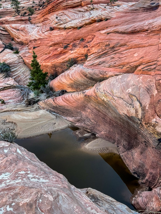
ナバホ砂岩層の上方部は大抵白いです。ところが、下に下がると赤茶色なっています。その理由は、砂岩層内の鉄分の酸化によって変色しているわけですが、雨が砂岩層の中に浸透することにより変色した鉄分は下に移動していった。だからナバホ砂岩層は下の方が赤茶色なのだと聞いています。 The upper part of the Navajo Sandstone Formation is usually white. However, the lower part is reddish brown. The reason for this is that the discoloration is caused by the oxidation of iron in the sandstone layer, and as rain permeates the sandstone layer, the discolored iron migrates downward. This is why the Navajo sandstone layer is reddish brown at the bottom.
ここから先、終点のラバポイントまではまだ10-12時間かかると言われているので、人の量もグッと少なくなり、トレイルもゴツゴツとした険しい道になりました。 From this point on, the number of people decreases dramatically and the trail becomes more rugged and steep, as it will still take 10-12 hours to reach the end of the trail at Lava Point.
でも、景色は更に素晴らしくなって行きました。 But the scenery became even more spectacular.
そこには、なんとも言えない心地よい神秘的な空気が漂っていました。 There was a pleasant, mysterious air that was indescribable.
今まで一度も感じたことのない、まるで「お帰りなさい」と言われているような優しい景色に包まれていました。 I had never had such a feeling, as if I was being welcomed home.
バンちゃんも私ももう少し先まで行ってこの不思議な気持ちを確かめてみたいと思っていましたが、帰りの道のりを考えて断念しました。氷った地面も所々で見えていたし、気温も下がって来ていました。 Both Banchan and I wanted to go a little farther to check out this wonder, but we decided against it for the return walk. Ice on the ground was visible in places and the temperature was dropping.
凍った地面を見て帰ることにした折り返し地点。 The turnaround point where we saw the frozen ground and decided to go home.
全体の行程に比べるとほんの3分の1までしか歩けませんでした。 We walked only a third of the entire route.
Walking time: 5:07, Round trip walking distance: 9.45 miles (15.2 km), Altitude gain: 2,297 ft (700 m)
でも、ザイオンロッジにたどり着いた時は満足感に満たされていました。 But when we reached Zion Lodge, we were filled with satisfaction.
次回はもっと早くスタートして、カメラを持って、もう少し先まで行きたいです。あの、神秘的な景色を捉えてみたいです。 Next time I would like to start much earlier, take my camera and go a little further. I want to capture that mystical scenery.
暑いので、私たちは朝3時半に起きてザイオン国立公園の西に向かいました。 It was hot, so we got up at 3:30 AM and headed to the west side of Zion National Park.
日の出前だったので、月が山の後ろに見えていました。 Just before sunrise, the moon was visible behind the mountains.
これがザイオン国立公園の全体像です。ほとんどの観光客は南ゲートから入り、赤い線で引かれた中心部の渓谷を見て帰ります。残念なことにここはシーズン中は世界中から来てくださる人たちで溢れかえっています。 This is the overall view of Zion National Park. Most visitors enter through the south gate, see the central canyon outlined in red, and leave. Unfortunately, this place is overflowing with people from all over the world during the season.
だから私たちはそこには滅多にいきません。そして、今回は西側に位置するノースゲイトピークに登りました。 So we seldom go there. And this time we climbed Northgate Peak West.
西ノースゲイトピークからは北のガーディアンエンジェルが目の前に見えます。南のガーディアンエンジェルはその後ろに位置します。 From Northgate Peaks West, the North Guardian Angel is visible in front of it. The South Guardian Angel is located even further behind it.
地図を西ノースゲイトピークからの写真に置き換えると、こうなります。 Replacing the map with a photo from Northgate Peaks West, it looks like this:
北と南のガーディアンエンジェルスはその間を流れる川、フォークノースクリークをガードしている山だったんですね。そして、この川こそ知る人ぞ知る、サブウェイと呼ばれる、健脚向けの16kmのハイキングコースです。許可がないと入れません。 So the two Guardian Angels, North and South, were the mountains guarding the river that runs between them, the Left Fork North Creek. And it is along this river that those in the know call the Subway, a 10 mile round trip hiking trail for strong hikers. BTW, You cannot enter without a permit.
ここからの景色を見ながら、ザイオンの全体像が少しわかってきました。 The view from here gave me a little more of an overall picture of Zion.
以下の赤い点線が昨日歩いたコースです。青い点線は先週歩いた山で、パインバレーピークと名付けられています。 The red dotted line below is the trail we hiked yesterday. The blue dotted line is the mountain we hiked last week, named Pine Valley Peak.
地図上でわかるように、長いアプローチの後、白い部分に入ります。つまり、ここから本格的な山登りが始まるわけです。 As you can see on the map, after a long approach, you enter a white section. In other words, this is where the real mountain climbing begins.
トレイルがあるわけではなく急勾配なので、頂上に近い場所は特に神経を使って一歩前に踏み込んで、また次の踏み込み場所を探すというスリリングな山登りをしました。 There is no trail, but it is steep, so we had a thrilling climb up the mountain, especially near the top, where we nervously took one step forward and then looked for the next place to climb again.
Here is a short trivia break: The rocks in Zion National Park are Navajo sandstone. They were formed by sedimentation when the area was once an ocean. So they are covered with sandy flow lines. And then erosion over a long period of time exposed the sandstone. Then water washed the heavy iron downward through the sandstone, so the lower part is a rusty red and the upper part has lost its color and is white.
さて、突然ですが、なぜハイキングが好きなんですかと聞かれた、どう答えますか? Well, it’s a sudden question but if someone asked you why you like hiking, how would you answer?
私の答えは、ハイキングでなくても、ただ外を歩いているだけでも同じです。たくさんの発見があるから楽しくてしょうがないんです。 My answer is the same, even if I am not hiking, just walking outside. I have so much fun because I discover many things during the walk.
発見がたくさんありすぎて消化しきれません。山道を歩いていると、地面の石ころでさえ面白い。下の写真は、コンクリーションが進んでいるものです。何千年もの時を越えて変化していく様を垣間見ているようです。 There are too many discoveries to digest. Even the stones on the ground are interesting when walking along the mountain paths. The photo below shows a concretion in progress. It is like catching a glimpse of change over thousands of years.
こちらはマツヨイグサ。朝見た時は元気だったのに、帰りにはもう萎んでいました。たった数時間の間の出来事です。こんな小さな発見に心を動かされます。 This is Fragrant Evening Primrose. It was healthy like the picture below when I saw it in the morning, but it had already wilted on the way back to our car. It happened in just a few hours. I am moved by such a small discovery.
発見は感動につながります。美しいものはそのままで感動を呼び起こしてくれます。 Discoveries are inspiring. Beautiful things evoke an emotional response just as they are.
苦しい登り道も、体を動かして汗を流すことも楽しいです。美味しいものを食べられるから。 I enjoy the painful uphill climb and the physical exertion and sweat. Because I can enjoy eating good food.
でも、早起きはやっぱり好きになれないなぁ。 But I still don’t like getting up early.
ザイオン国立公園の西側、パインバレーピークのトレイル沿いに咲いていました。 It was blooming along the Pine Valley Peak trail on the west side of Zion National Park.
この花がなぜ州の花に指定されているかというと、昔、飢饉で食糧難になった時に、この花を食べて命を繋いだと言う話が残されているからです。いろいろなレシピがあるようです。 The reason why this flower is designated as the state flower is because there is a story that in the past, when there was a shortage of food, people ate this flower to save their lives. Even today, there are various recipes for this flower.
ところで、このハイキングですが、気温が40度近くまで上がるので、6時半ごろから歩き始めました。 This hike, by the way, started around 6:30 a.m. because the temperature rises to nearly 105F degrees.
久しぶりのザイオンは気持ちが良かったです。雪もすっかり溶けて、水溜りもあまり残っていませんでしたが、いくつか見つけた所ではカエルが気持ちよさそう泳いでいました。 I hadn’t been to Zion in a long time and it felt good. The snow had melted and there were not many puddles left, but there were frogs swimming happily in some of the places we found.
また、こちらのビデオはアメンボウとオタマジャクシが狭い水の中でひしめき合っているところ。 Also, here is a video of water striders and tadpoles that are crammed together in a tiny pool.
朝5時半に家を出て、夜7時半に帰宅。ザイオン国立公園の東、パラヌウィープのルートのないルートを一周して帰ってくるハイクは17km、670mの標高差、所要時間10時間のハイキングでした。 We left home at 5:30 am, and returned home at 7:30 pm. This hike, in the east side of Zion National Park, is a total of 10.5 miles, 2,300 feet elevation gain, and 10 hours of hiking.
バンちゃん提供 Courtesy of Banchan
多分、私のハイキング歴の中でも一番苦しいハイクだったかもしれません。 It was probably the hardest hike of my hiking history.
ただ、息を呑む絶景だったことは確かです。 However, the views were breathtaking.
このハイクが予想以上に苦しいものになった大きな理由は、二つ。一つ目は、雪がまだ残っていたことと。 There were two main reasons why this hike turned out to be more difficult than expected. The first was that there was still snow on the ground.
二つ目は、雨の日が続いていたので、岩の至る所から水が流れてきていた事、ひいては普段はない乾いた川に水が流れていた事でしょう。 Second, it had been raining, so water was flowing out from the rocks, and by extension, usually dry washes, were flowing rivers.
橋のない川を渡るという洗礼を受け、クイックサンドに飲み込まれないように歩いていきました。ここでかなり神経をすり減らしてしまいました。下の写真の彼は膝の上まであっという間に沈んでしまいました。 We had the baptism of crossing a river with no bridge, and walked through the wash trying to avoid being swallowed by quicksand. I lost a lot of nerve here. The person in the photo below sank quickly above his knees.
ザイオン公園内はイースターバケーションでものすごく混んでいましたが、私たちのハイクは道のないルートなので、勿論、車を降りてから帰ってくるまで、私たち以外誰も見かけませんでした。 It was extremely crowded in Zion because of Easter Vacation, but our hike was on a trail-less route, so of course we saw no one but us from the time we got out of the car until we returned.
登りはお互いの足に捕まったり、お尻を押し上げてもらったりして急な岩場を登りました。 We climbed the steep rocky terrain using each other’s legs to hold onto and sometimes getting a helping hand to push our butts up.
降りは、お尻をズリズリと滑らせました。On the descent, we often slid down on our butts.
水が岩の隙間から流れ出していて、岩肌が滑りやすくなり、実際、仲間の一人が滑って転んでしまいました。その際、肩を脱臼してしまい、途中で下山し、病院に担ぎ込まれました。 Water was flowing out of the crevices of the rocks, making the rock face slippery. And in fact, one of our group members slipped and fell. In doing so, she dislocated her shoulder and was taken down the mountain to the hospital by a couple of our hikers.
雪投げをして楽しそうなハイクリーダーの隣で、私は小さな雪だるまを作ってあげました。 While our hike leader was having fun throwing snowballs, I made a little snowman for myself.
パルヌウィープの高原は1850mぐらいです。だから、それほど高いわけではないです。それでも頂上で生きる植物の生存のための努力は大変なものだろうと思われます。 The top of Parunuweap is about 6,200 feet. So it is not that high. Even so, survival for the plants plants living on the summit must be very hard.
下の写真には、左にウェストテンプル、右にイーストテンプルと、両方のテンプルが収まっています。 In the photo below, both temples fit together, with the West Temple on the left and the East Temple on the right.
崖の上から下を見下ろすと、バージン川が細くウネウネと流れていました。 Looking down from the top of the cliff, I saw the Virgin River flowing in what looked like a thin stream. far below.
頂上に溜まっていた水。これから暑くなると一気になくなってしまいます。 Water that had accumulated in a pool at the top, will disappear once it gets hot.
さあ、十分に頂上でくつろいだので、(とはいえ、大抵10分以内ですが)これから下の写真の下白い頭のフーデューの森を超えて下っていきます。 Now that we’ve had enough of relaxing at the top (though usually less than 10 minutes), we will now descend beyond the lower white-headed hoodoo forest in the photo below.
どこまで行っても自然が作り出したフォームは美しい。 Wherever you go here, the forms created by nature are beautiful.
私たちは謙虚な気持ちでそんな美しさの中を歩かせてもらいました。 We were humbled to walk in such beauty.
何回か携帯を落とし、一度は15mぐらい下に転がってしまい、もうダメかと思いましたがなんとか事でした。ただ、この写真を最後に、バッテリー切れとなりました。 I dropped my phone several times and once it rolled down about 50 feet and I thought it was done for. My cell phone was somehow safe, but after this picture, the battery ran out.
最後に、ザイオンのモキボールについて書きます。大きいです。家の近くのモキボールはこのぐらいです。Lastly, I would like to write about Zion’s Moqui Balls. They are big. The moqui balls near my house are about this big.
でも、ザイオンの茂木ボールは、こんなに大きい。 But Zion’s Moqui Balls are so much bigger.
私の顔と同じぐらいの大きさ。ザイオンの自然はデッカイ! About the same size as my face. Nature in Zion is huge!
週末、今年7番目のハイキングをするためにザイオン国立公園のコロブキャニオンズ地区に行きました。 We went to Kolob Canyons district of Zion National Park last weekend to do the 7th hike of this year.
雪と氷を全く予想していなかったので、トレイル入口で断念しました。標高2000m以上はまだ冬。アイゼンやストックを持って行けば、さぞかし楽しいハイクができたことでしょう。 We didn’t even think about ice and snow, but there it was. So we gave up at the trail entrance as we didn’t bring crampons and hiking sticks. The elevation, over 7,000 ft, was still very much in winter.
車で65kmも走ってきたので諦めきれず、近くの町のスプリングクリークというトレイルに向かいました。 We felt we had to do some hike since we drove 40 miles to get there. So went to near-by Spring Creek trail.
比較的平らなので、多少の登りや下りはあっても、気をつけて歩けば雪道も怖くないと思ったからです。 We thought the snow covered trail wasn’t that bad as long as we walked carefully because the trail was rather flat.
しばら歩いていくと、一歩踏み込んだ時の靴音が違うのに気づきました。 We noticed that the sound from under our boots was different after a while.
これは、もしかして、いや、まさに、小川の上を歩いていた!!! We were possibly… let me rephrase it, we were absolutely walking on a river!!!
橋の上を歩くと聞こえる太鼓を叩くような音。気がついたら、小川のせせらぎが聞こえていました。氷の橋だ! The sound I heard was very similar to the sound that we could hear when we walk on a bridge. Then, I noticed the sound of the creek. It was an ice bridge!
さらにいつくかの小さな氷の橋を渡り、気分も爽やかでしたが、1.5kmぐらい歩いた所でガリー(深い谷)に遭遇し、断念しました。 I felt so good walking on the snow and crossing a few more ice bridges. But then, we needed to give up at 1 mile because a deep gully full of thick mud was ahead of us.
10kmぐらい歩きたいと思っていたのに、3kmしか歩けませんでした。でも、初めて氷の橋を渡ることができたから、ラッキー。 We wanted to hike longer than 6 miles, but it was only less than 2 miles. But that’s all right. We could walk over ice bridges which I have never done before!
早朝、私たちは再びザイオンを訪れました。まだ暗かったので公園の入口近くのクリスマス用のイルミネーションが綺麗でした。 We visited Zion National Park again the following morning. We saw pretty Christmas illuminations near the park entrance because it was still so dark.
この日はザイオンの東側に行き、朝日を浴びたザイオンの写真を撮るのが目的でした。 Our purpose this day was to see the morning sunrise from the east side of Zion.
トンネルの向こうの東ザイオンの風景は渓谷内とは少し違います。 The scenery is different once you go through the tunnel because it is no longer in the valley.
渓谷ではないので、なだらかです。 Because of that, peaks and slopes are more gentle.
クロスベッドの地層がよくわかります。 We can see the cross-bed strata very well.
まだ早朝だったのでラッセル車の前後を走りました。仕方がないので東の公園入り口まで走り、見送りました。 Because it was so early, we drove pretty much together with a snowplow. So we waited a little for it to drive ahead at the east entrance so we wouldn’t block it.
少しづつ朝日が差し込んでくる予感がします。 We sensed that the morning light was gradually coming through the thick clouds.
遠くの崖の上に私のクリスマスツリーを見つけました。見えるでしょうか。いつかこの木が朝日に照らされている写真を撮りたいです。 I found my Christmas tree at the tip of the rock. Can you see it? I decided that I will take pictures of the tree illuminated by the morning light one of these days.
ところで、このツララ、何かがおかしい。重力の法則に従ってない。まっすぐ下に伸びてないんですね。どうしてでしょうか。 By the way, look at these icicles. Do you agree with me that something is wrong? It’s against the law of gravity. They were not hanging down straight. Why did such a thing happen?
そんな疑問は突然眼前に現れた景色に吹き飛ばされ、息を呑みます。 In any case, we were awed by the sight that suddenly appeared right in front of us.
ついに朝日が雲間から現れました。 The morning light had finally broken through the clouds.
景色が再び一変します。 The scenery had changed its look again dramatically.
The hills breathed again for a new day with the light.
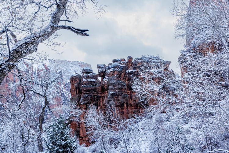
再びトンネルを抜けて渓谷に帰ってきた時には車の量も増えて数珠繋がり状態になっていました。でも、景色の素晴らしいこと! When we exited the tunnel on our way back to the valley, we found so many cars already lined up on the road. Ugh! But what a stunning view it was!
車を止めて、朝の渓谷の写真を撮ることにしました。 So we stopped our car and started taking pictures.
午後には用事があるので帰途を急ごうとしていた私たちですが、サイドビューミラーを見ても、素晴らしい景色が私たちを引き止めようとします。 Because we had an errand in the afternoon, we were hurriedly going out from the park. But even the reflection of the side view mirror tried to stop us leaving there because it was so gorgeous.
しばらくサイドビューミラーの景色を楽しんでいたら、セルフィーが撮れました。微かにカメラを構えている私が見えます。 I enjoyed the view through the side view mirror for a while. Later, I realized that I took a selfy shot capturing views from the side view mirror. Can you see me faintly holding my camera?
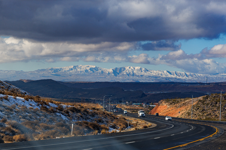
帰途、遠くに見えたビーバーダムマウンテンにも雪が積もっていました。美しい景色は見るだけで幸せ度をグンとあげてくれるんですね。 On the way back home from the road, we saw the snow covered Beaver Dam mountains. It is very true for me that my happiness gauge goes up so high when seeing beautiful views like this.
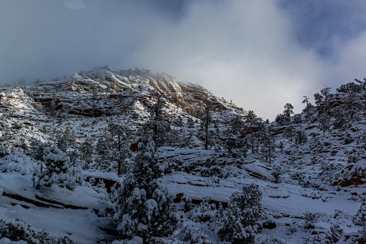
ザイオン国立公園に雪が降るとの天気予報を聞き、初雪の写真を撮りに出かけました。 We went to Zion National Park to take pictures because the weather report said it was going to snow.
近くなるにつれて雪がドンドン降ってきました。 As the park got closer, the snow got heavier.
期待した通りでした。公園に着いたら雪の世界が広がっていました。 And just like we wanted, the park changed to a snow wonderland.
とりあえずザイオンロッジに向かいました。 We went to the Zion lodge first.
深い雪雲で大きな岩壁は見えないものの、時折の雲間から見える渓谷の景色に大満足です。 We enjoyed the grand views from the lodge very much even though we couldn’t see the peaks as the thick clouds covered them.
ロッジからバージンリバーを渡り、トレイルを歩きました。 We crossed the Virgin river from the lodge, and walked on a trail.
雪に覆われるとどうしてこんなに風景が美しくなるんでしょうね。 Why is that scenery becomes so beautiful once snow covers the land?
魔法の杖が一振りされたんですね、きっと。 I guess someone had waved a magic wand.
トレイルはツルツルで、アイゼンを持ってくるのを忘れてしまったことに後悔しました。While we walked the slippery trail, we regretted that we didn’t bring our crampons.
早々に引き上げ、車に戻ってきた時には私たちにも雪が積もっていました。 So we soon gave up walking and came back to our car. When we got to the parking lot, we realized that the snow was on us as well.
牡鹿の立派な角にも雪が積もっていました。 The snow was on the buck’s gorgeous antlers as well.
久しぶりのザイオンの東、7.5km、ナバホ砂岩層の登り300m以上、全行程7.5kmをぐるりと回るハイクでした。The hike was in the east side of Zion National Park, 4.5 miles round trip with 1000 feet of climbing. It’s been a while since I came to Zion for a hike.
朝3時半に起き、ハイク仲間と5時に待ち合わせ、まだ真っ暗な中を歩き始めました。 We woke up at 3:30am, met our hike friends at 5am, and started walking when it was still dark.
暑くなる前にハイキングを終わらせるためです。 We wanted to finish the hike before it got hot.
太陽の光が差し始めました。The light from the Sun started shining on the cliff.
山間の高台に着いた時には、イーストテンプルが光を受けて私たちを迎えてくれました。 When we got to a mesa between the canyons, the majestically lit East temple greeted us.
そこでしばらく休憩です。涙が出るほど美しい。 We had a short break there. It was so beautiful that it made me almost cry.
その後しばらくイーストテンプルの方向に歩いて行きます。 We continued toward the East temple after that.
最近の嵐で水が流れ、水溜りが沢山できていました。 Because of the recent storms, many pools were created.
水溜りを避けながら、さらにズンズン進みます。 We kept going on avoiding the pools.
私たちのハイクも後半に入りました。下りが多くなります。 In the second half of our hike, we started going down more than going up.
それでも魅了される景色ばかり。 How majestic it was!
この雄大な景色の中、ただひたすら嬉しくて、やっぱりハイキングが大好きなんだと実感しました。 I was simply so happy in the grand nature, and realized again that I like hiking here.
トレイルのない山道です。だから観光客はほぼ皆無。静寂の世界。 There are no trails there, so almost no tourists go there. It was so peaceful.
昨日、標高2,405m、ザイオン国立公園のラバポイントに行ってきました。風が強く、雨が降りそうな暗い曇り空。寒かった。We went to Lava Point in Zion National Park yesterday. The altitude is 7,890 feet. It was a cold, dark, and windy day.
ミドリトウヒチョウをカメラに収めたくて、鳴き声を追いかけて30-40分歩き回りました。何しろ、前回ここに来て撮ったショットにはシッポと頭の上だけだったので、リベンジ戦です。I was determined to capture the Green-tailed Towhee yesterday because last time we came here, I was not able to capture the Towhee’s face.
その甲斐あって、ついに遠い枯れ木の枝に見つけました。 上の鳥はロビンです。Following the calling sounds for 30-40 minutes, I finally found it on a faraway tree branch below a Robin.
狙いを定めて、ジャンプ。 Aim, Set, and Jump!
ロビンと比べると大きさと色の違いが分かります。緑というか、薄緑色のシッポですね。 We can see the size and color well by comparing it to the robin. The Green-tailed towhee’s tail is not quite green, but light green.
木の上で、どんな会話がなされていたんでしょうか。昨日のような寒い日には、友達がいるって、いいですよね。 I wonder what kind of conversation they had on the tree. In any case, it’s nice to have friends on a cold day like yesterday.