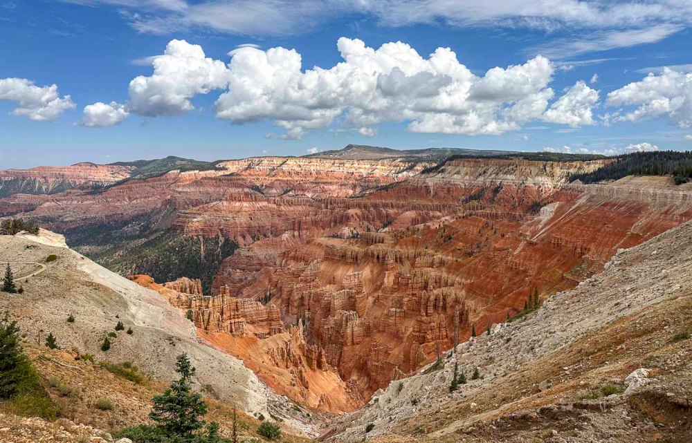
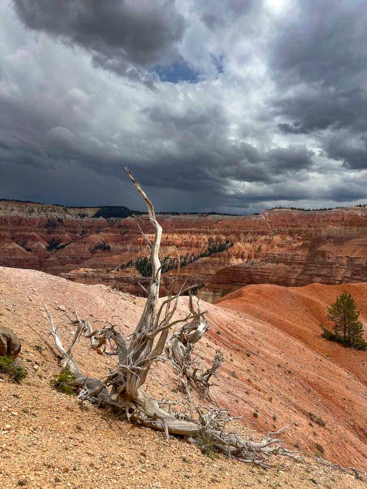
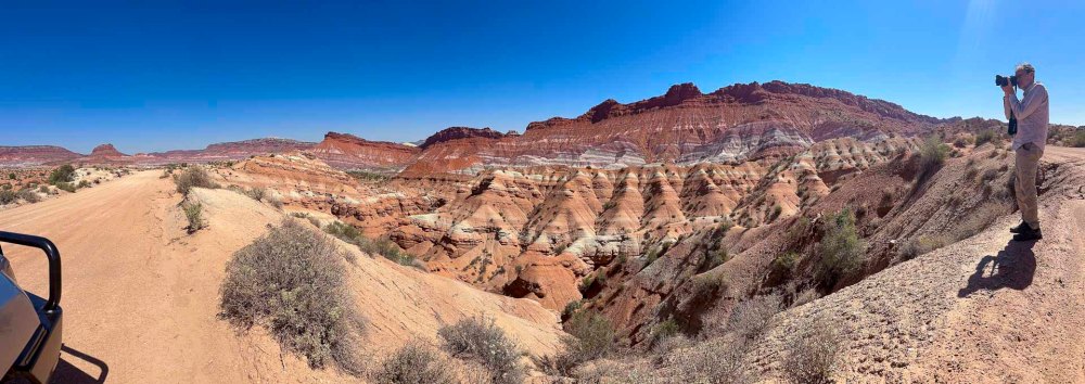
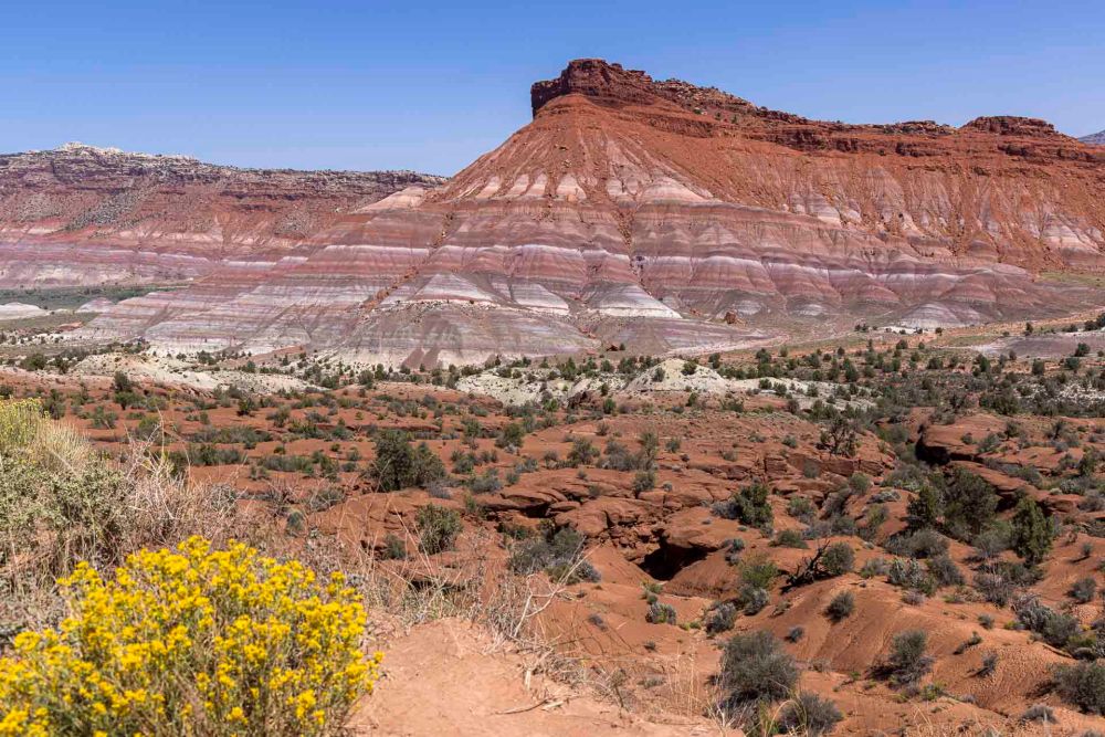
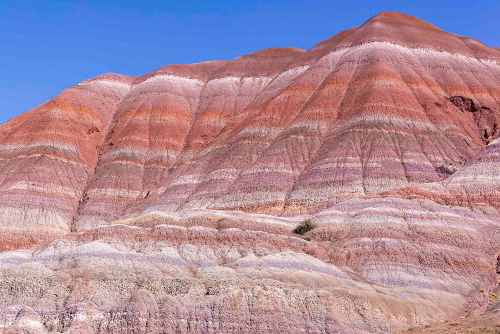
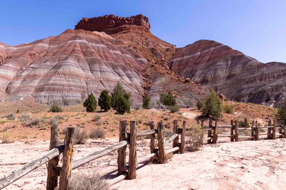
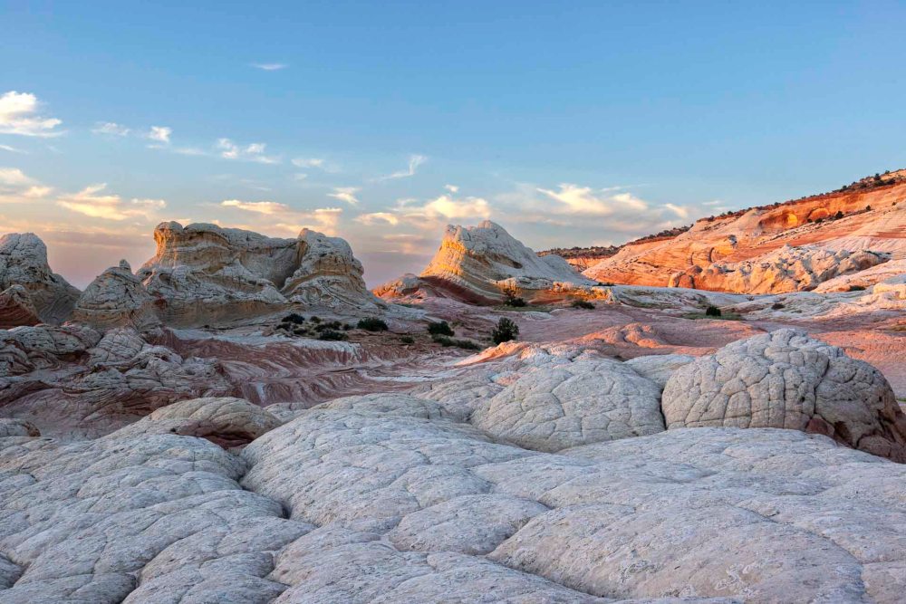
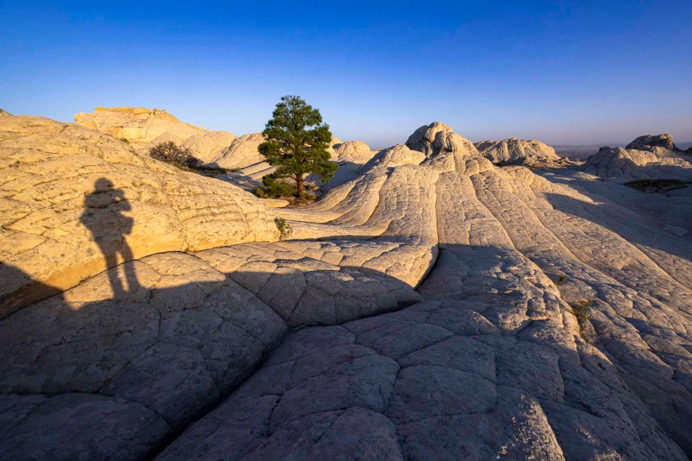
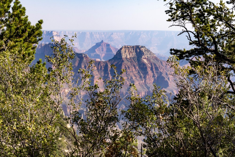
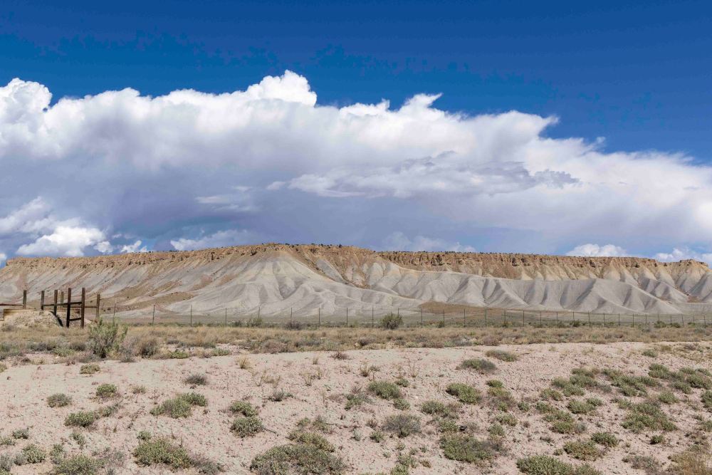
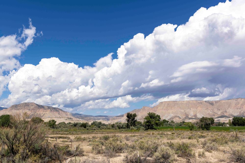
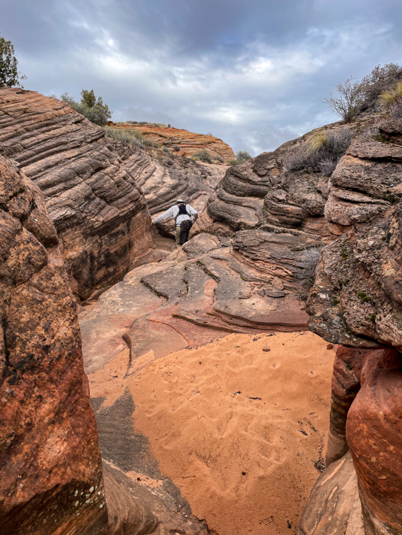
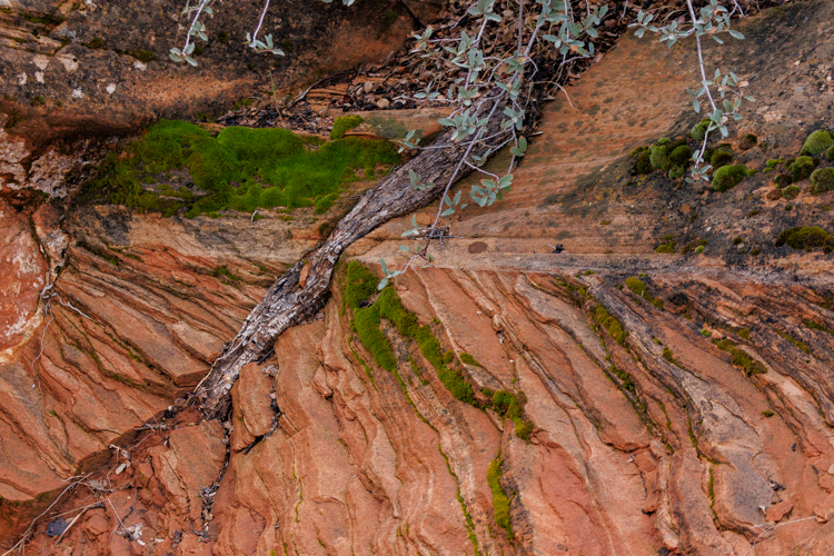
標高 10,000 フィート(3,000m) 以上、コロラド高原の西端に位置するのがシーダーブレイクス国定公園です。石灰化されたクラレン層で覆われています。 Cedar Breaks National Monument is located at an elevation of over 10,000 feet (3,000 meters) on the western edge of the Colorado Plateau. It is covered by the calcified Claron Formation.
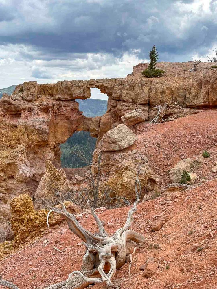
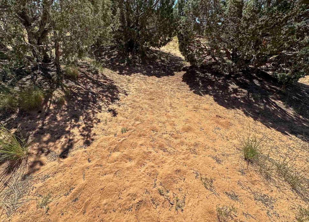
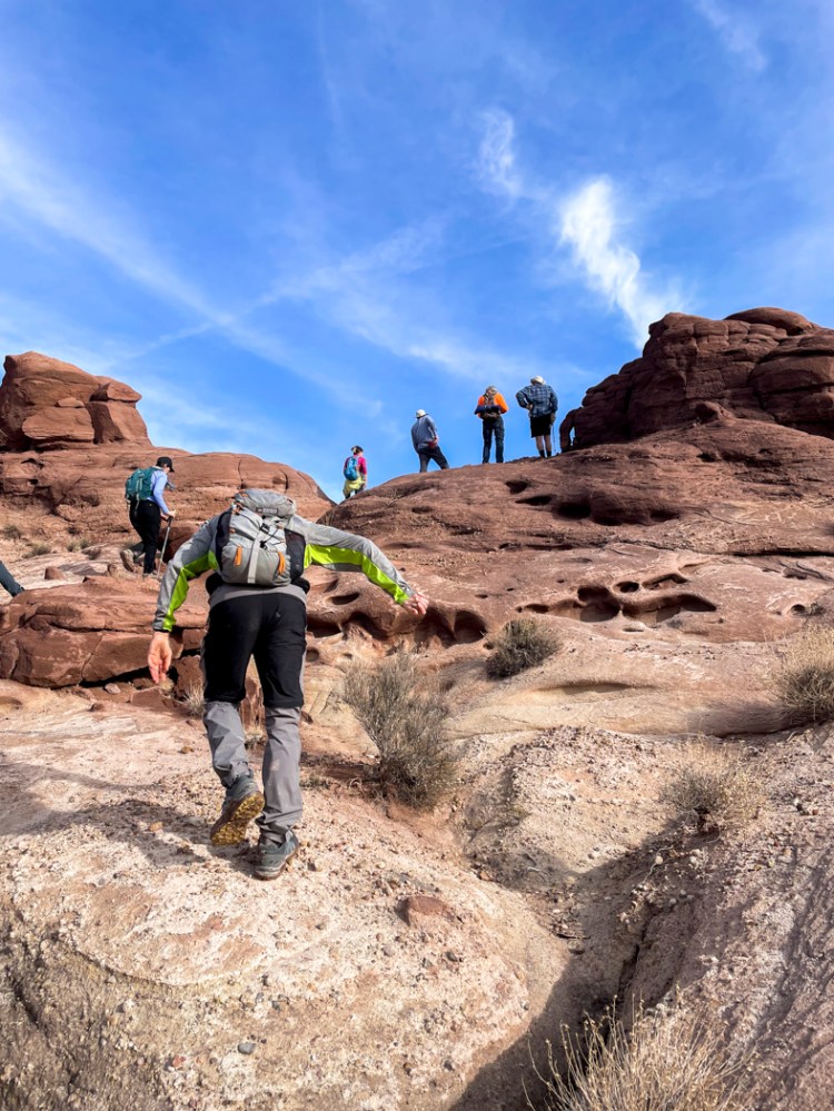
この公園の南端にあるバーティザン アーチを目指して歩き始めました。 We began walking toward the Bartizan Arch at the southern end of this park.
途中から雨が降り出したので引き返そうかと思いましたが、続行してよかったです。 It started raining partway through, so we thought about turning back, but I’m glad we kept going.
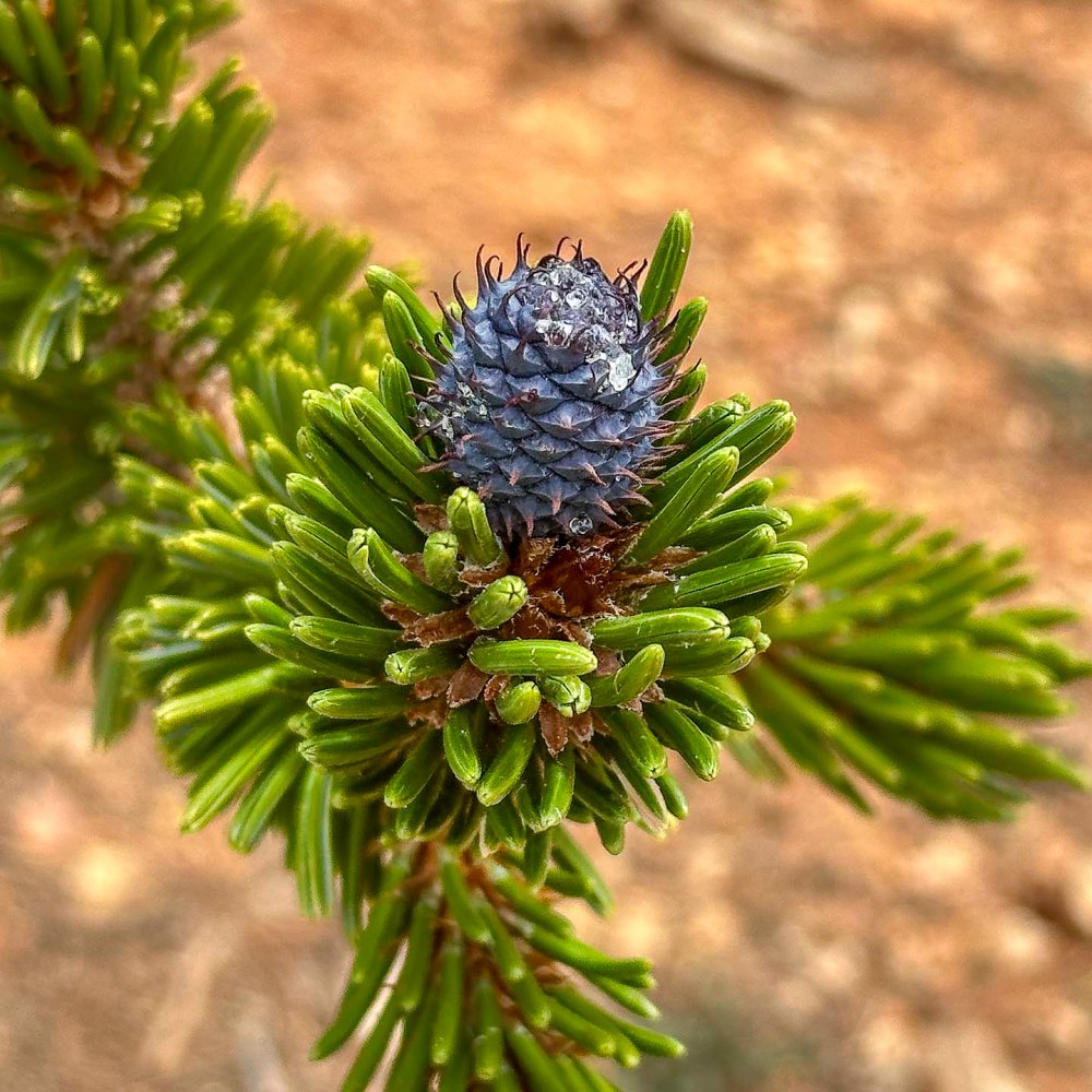
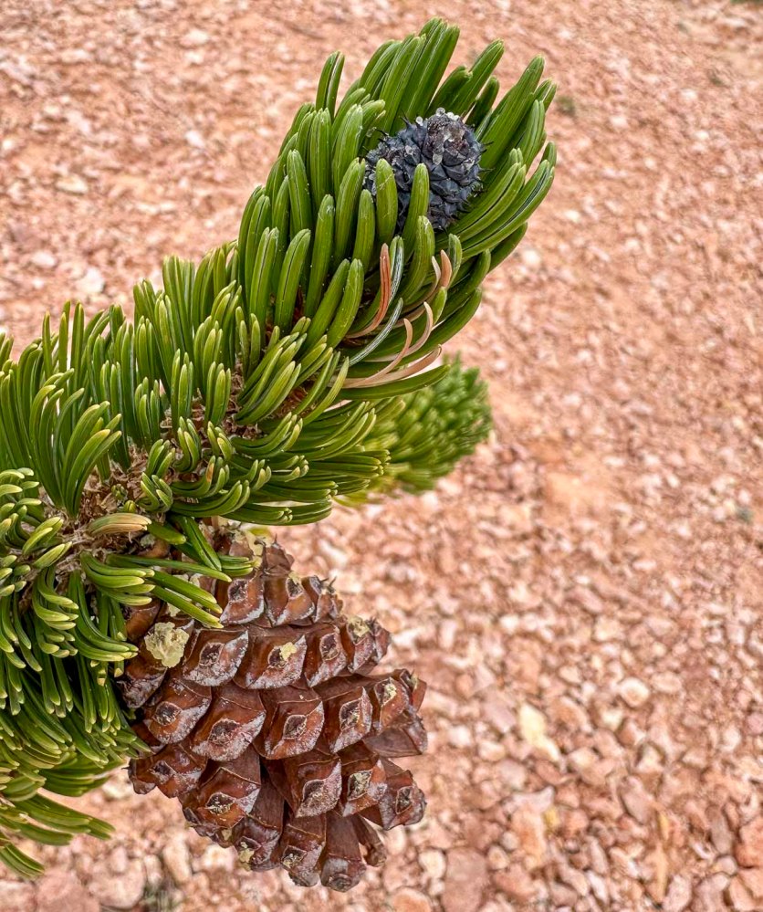
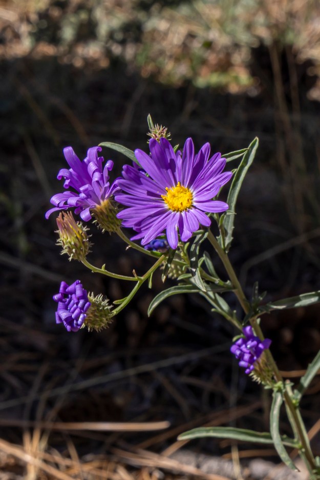
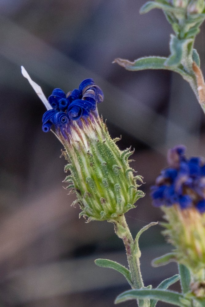
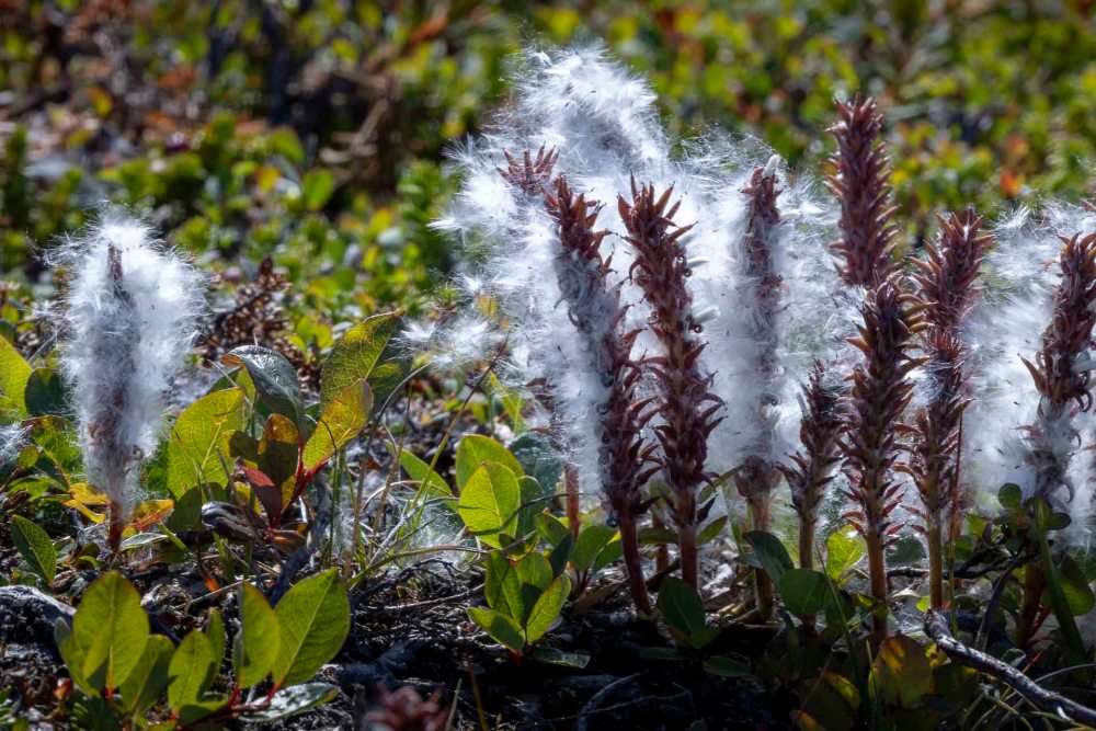
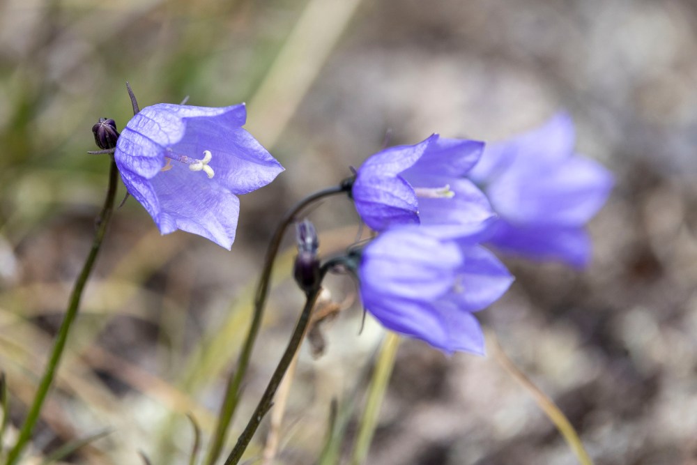
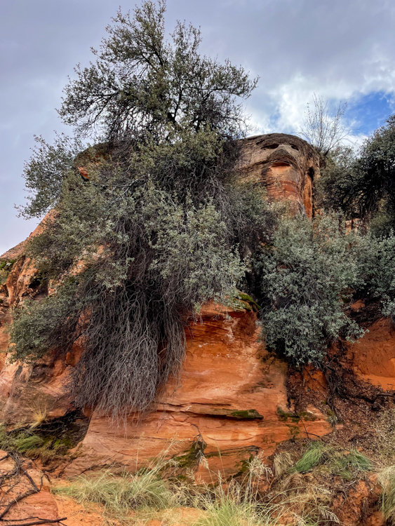
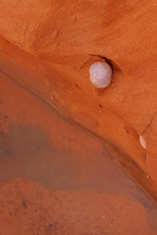
なぜなら、アーチの近くでこの青紫色の松ぼっくりに再会できたからです。ブリスタルコーンパインのコーン。 Because we were able to reunite with this blue-purple pinecone near the arch. The cone of the bristlecone pine tree.
10年前にカリフォルニアのホワイトマウンテン (14,252 ft, 4,344m) 、凍える寒さの中で初めて出会いました。その後、また会えることはないと思っていたので、ここで再開できたことは、とんでもなく意外で嬉しいご褒美でした。 Ten years ago, I first found it in the freezing cold on California’s White Mountain (14,252 ft, 4,344m). I never thought I’d see it again, so it was a completely unexpected delightful reward to see it here once more.
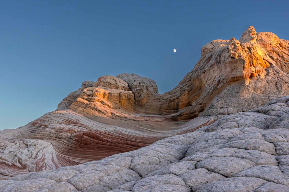
こんなにヒョロヒョロとして頼りない枝の先で頑張って生きていました。ブリスタルコーンという名前は硬い毛でできているボトルブラシのような形からきているようです。 It was struggling to survive on the tip of such a spindly, flimsy branch. The name “Bristlecone” seems to come from its bottlebrush-like shape made of stiff hairs.
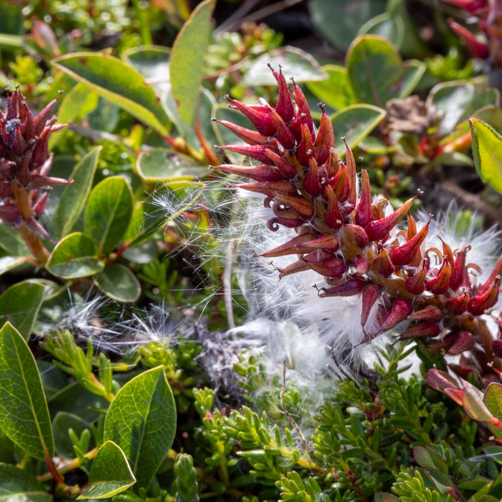
青く硬いコーンは、上の写真のように2年かけて茶色のコーンに成長します。 The snall blue, hard cone grows into the larger brown cone over two years, as shown in the photo above.
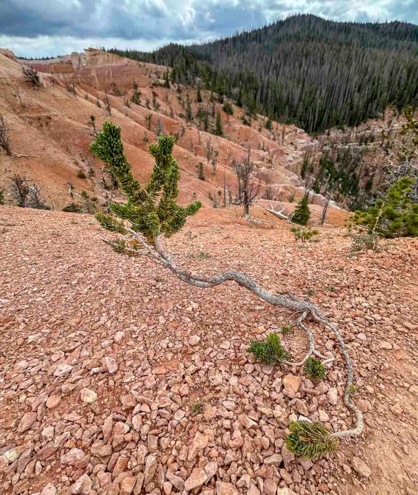
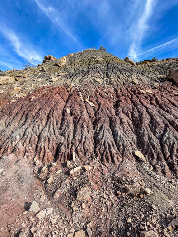
石灰質の粗悪な地質、そして強風と寒さの中を生き抜いてきたブリスタルコーンの丘は、時間が止まったようにゆっくりと流れています。だからでしょうか。4000年以上も生き続けている木もあるということです。 The hills of bristlecone pines, having survived in poor limestone soil and enduring fierce winds and cold, seem to flow as if time has stopped. I wonder, is that why? Some trees have lived for over 4,000 years, like some in the White Mountains.
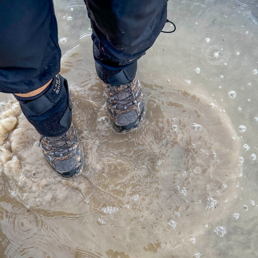
雨の中、一歩足を踏み込むたびに石灰の泥が登山靴にくっ付いて、久しぶりに泥まみれのハイクとなりました。車に乗る前、水たまりで靴を洗っているところ。 In the rain, with every step I took, chalky mud stuck to my hiking boots, making it a muddy hike for the first time in ages. Here I am washing my boots in a puddle before getting in the car.
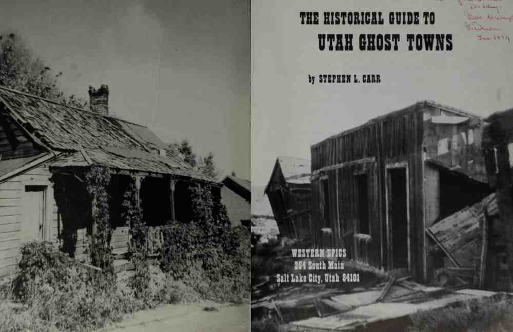
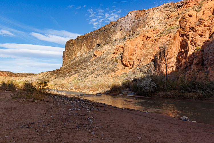
パリアはグランド ステアケース エスカラテ国定公園内にあるゴーストタウンの名前です。 Pahreah, aka Paria, is the name of a ghost town in the Grand Staircase Escalante National Monument.
Screenshot
ユタ州には145ものゴーストタウンがあるそうで、そのリストに載っています。 There are 145 ghost towns in Utah, and this town is on that list.
来るつもりはなかったのに立ち寄ってみました。でも、その景観に驚いてしまいました。ちょっと立ち寄るような場所じゃない。 We dropped by even though we weren’t planning to come. But we were surprised by the view. It’s not the kind of place you would stop by for a minute.
オレゴン州にあるジョンデイ化石層国定公園内にあるペインテッドヒルを思い起こさせます。 It reminds me of the Painted Hills in the John Day Fossil Beds National Monument in Oregon.
じっくりと時間をかけて探索し、ゴールデンアワーに写真を撮りたい場所です。This is a place to take your time to explore and take pictures during the golden hour.
「また絶対来るからね。」と言って、後ろ髪を引かれる思いで立ち去りました。” I’ll definitely be back.” we said, and then left with a sigh of relief in our hearts.
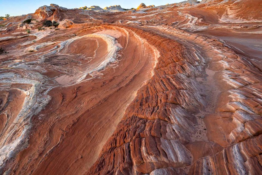
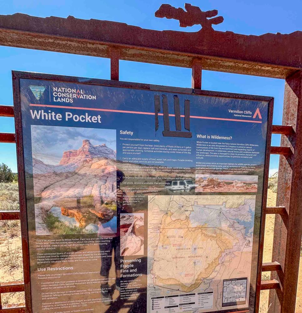
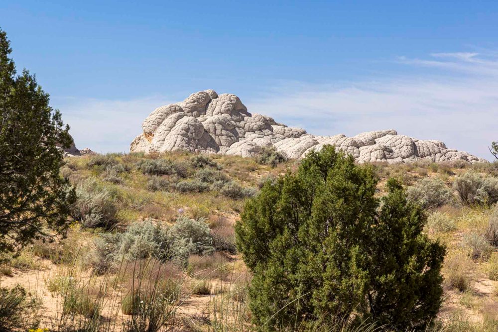
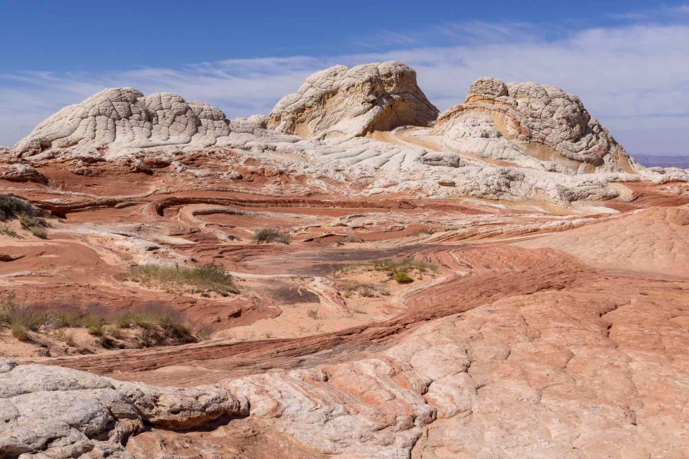
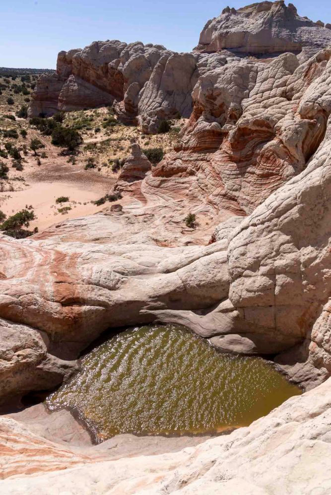
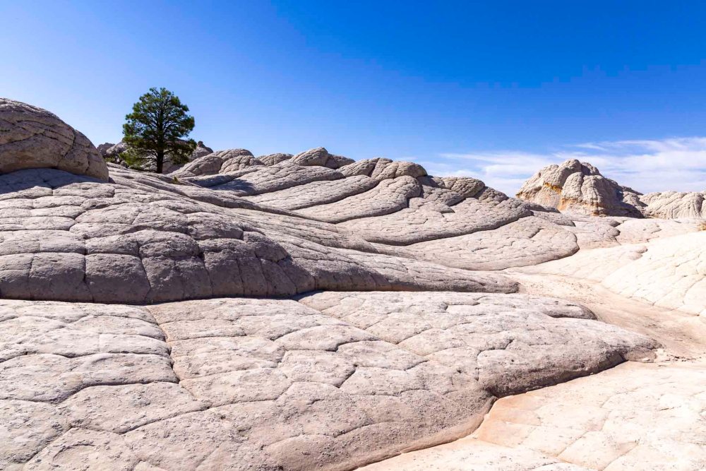
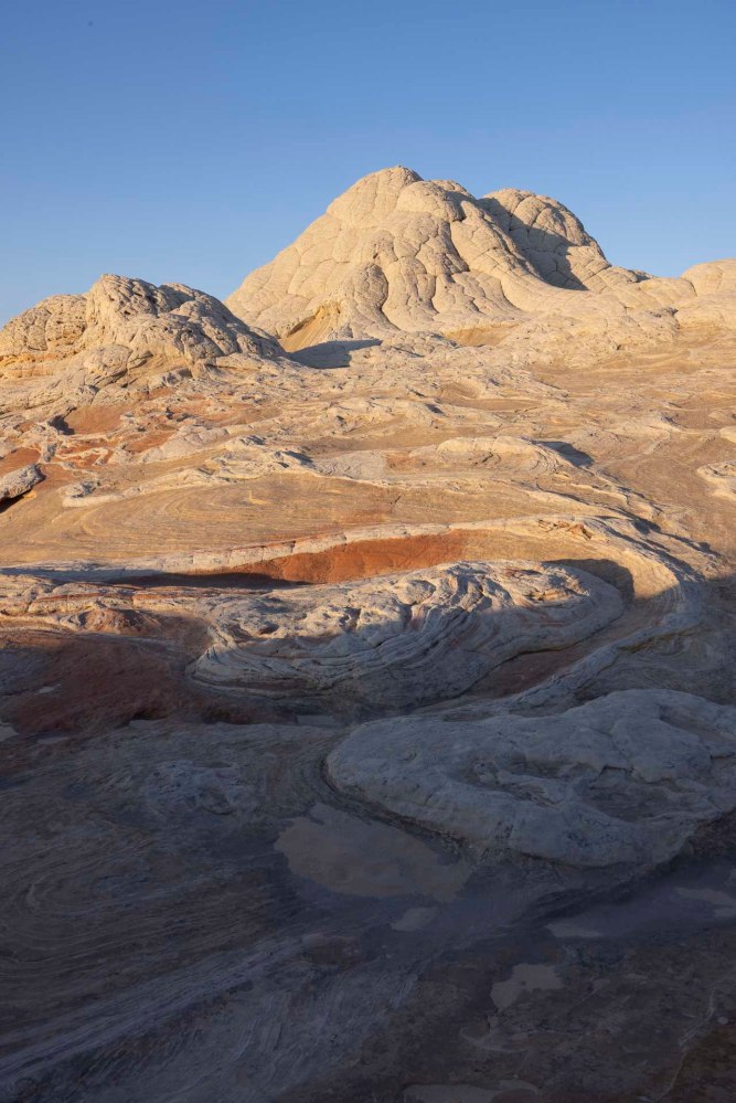
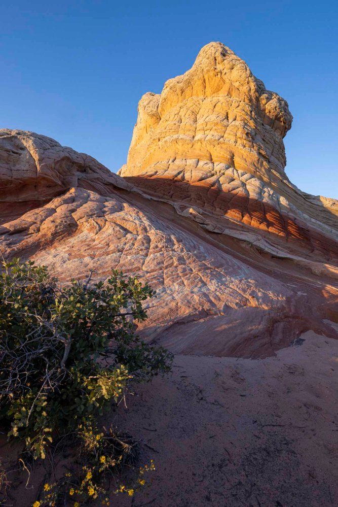
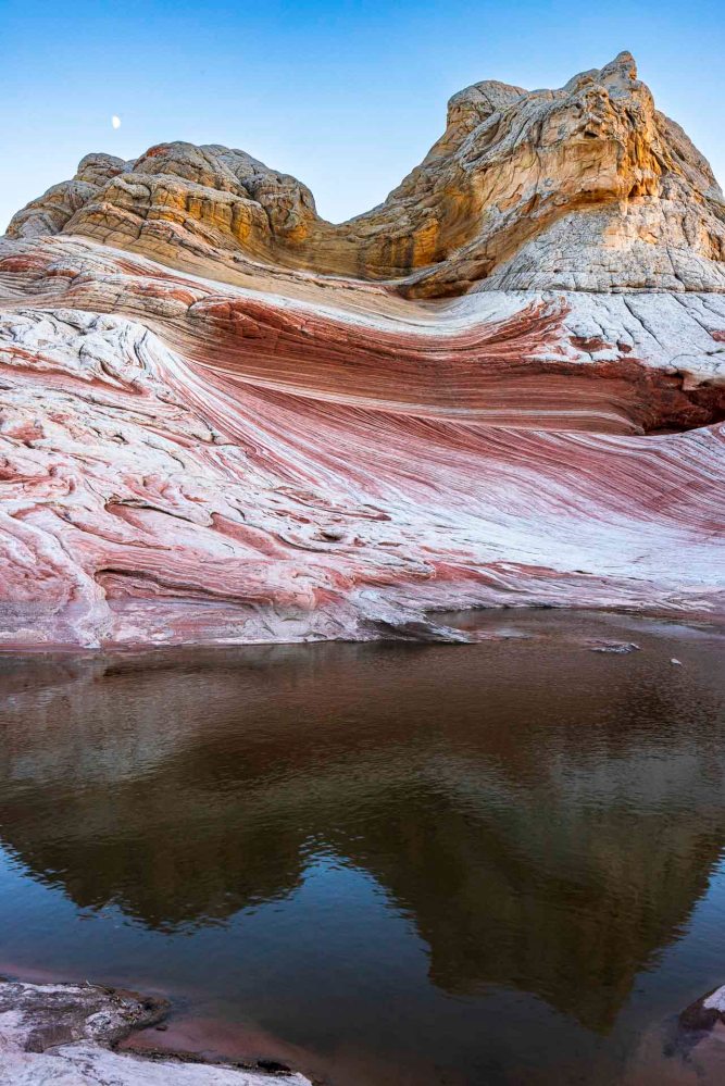
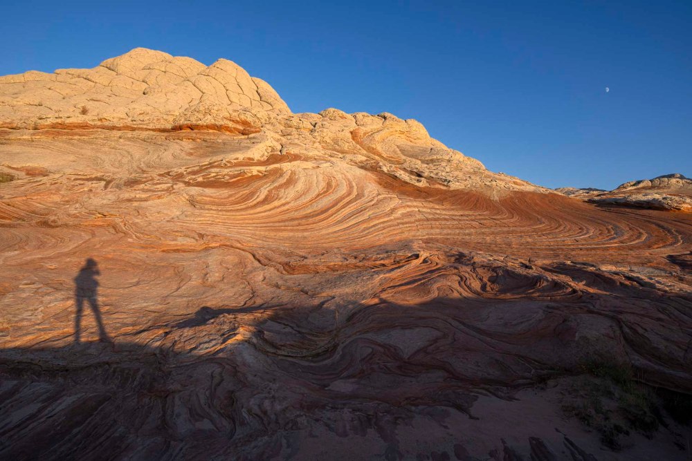
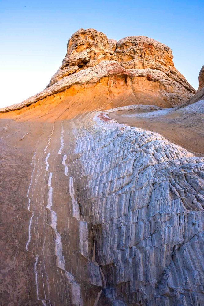
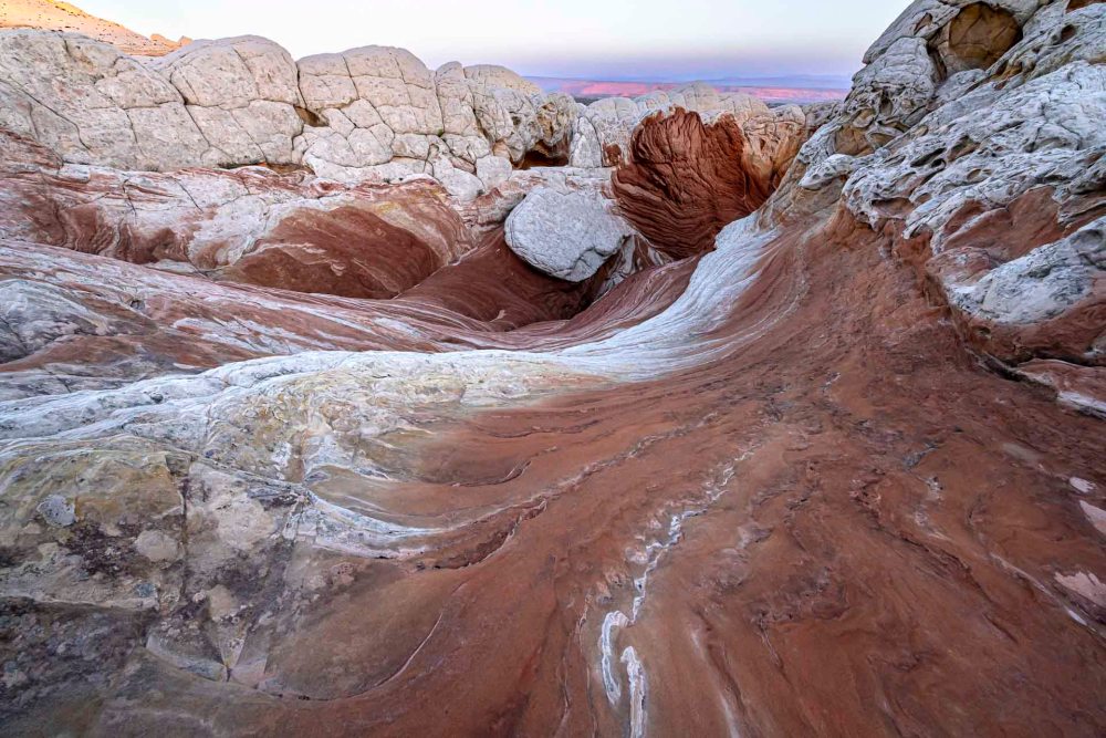
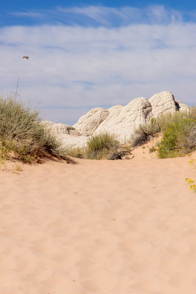
ナバホ砂岩でできているホワイトポケットはまるで大海の荒波でした。 White Pocket, made of Navajo sandstone, has many forms that look like the rough waves of the ocean.
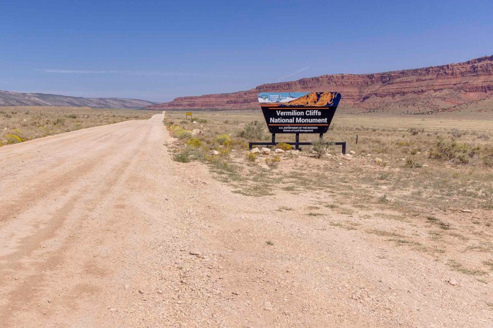
ホワイトポケットはバーミリオンクリフ国定公園内にあります。 White Pocket is located in Vermillion Cliffs National Monument.
ここに行くには、舗装されていない凸凹の道を延々と4輪駆動で行くしかありません。 The only way to get here is by endless high clearance four-wheel drive vehicles on uneven, unpaved roads.
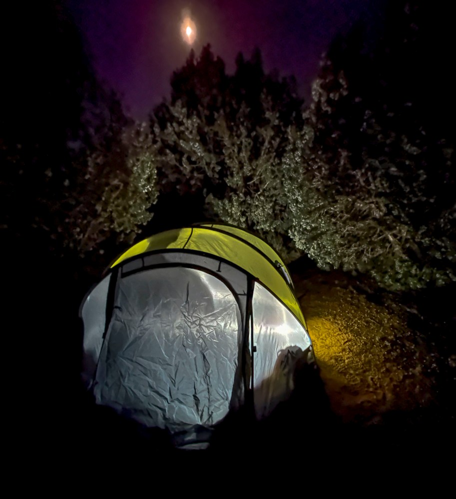
ホワイトポケットが見える場所にテントを張り、キャンプすることになりました。 We decided to pitch our tent and camp where we could see White Pocket.
高校時代の日本でのキャンプ経験を除くと、これで3回目です。でも、テントの中に寝るということ自体は私の最大のチャレンジです。アリや虫の攻撃に遭った経験があるからです。また、日本アルプスの尾根沿いで暴風雨にあい、テント内に停滞していたトラウマもあります。だから、今でもやっぱり好きじゃない。 This is my third camping experience, excluding my high school years in Japan. But sleeping in a tent itself is my biggest challenge. I have experienced attacks by ants and insects. I also had a traumatic experience of being stuck inside a tent after being caught in a storm along a ridge in the Japan Alps. So I still don’t like it.
でも、ホワイトポケットの日の出、日の入り時の写真を撮るためたなら仕方がない。 But I had no choice if I wanted to photograph at sunrise and sunset there.
ジュニパーの木に囲まれた場所を選びました。We chose a spot surrounded by juniper trees.月明かりが眩しすぎるくらいでした。 The moonlight was too bright.
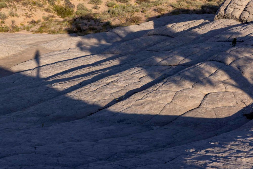
テントの設置もできたので、早速ホワイトポケットを見に行きました。 We finished setting up the tent and immediately went to see White Pocket.
ここには知る人ぞ知る有名なスポットがあります。だからその写真を撮ってみたいと思っていました。バンちゃんは今回で2度目なのでその場所に案内してくれました。 There is a famous spot here that is well known to those in the know. So I wanted to take its picture. Ban-chan guided me to that spot since this was his second time.
見えてきました! Yes, I can see it!
ここでバンちゃんと別れ、一人で夕暮れを待ちました。どのアングルで撮るのが良いのか考えながら、空を見て、鳥の観察もして、影がだんだん長くなっていく様子を観察していました。 Here I parted from Ban-chan and waited for dusk. I watched the sky and observed the birds, thinking about which angle would be best to capture the scene, and observed the shadows getting longer and longer.
iPadを使っていらっしゃる方なら多分わかる。iPadのデフォルトの壁紙の写真です。比べてみてください。撮影の季節が違うからか光と影が違いますね。でも、まあ、良いかな。 If you’re an iPad user, you probably recognize it: it’s a picture of the iPad’s default wallpaper. Compare them. The light and shadows are different because of the different season when the photo was taken. But, well, it’s okay.
その後は光との競争です。 After that, it’s a race against the light.
すでに日は沈んでしまっていたので、わずかな光を探して走り回っていました。 The sun had already set, so I was running around looking for the slightest glimmer of light.
もうISOを2000以上に引き上げても上手く撮れないほど暗くなってきました。 It was getting so dark that I could no longer get a good shot even if I raised the ISO to 2000 or higher.
翌朝、日の出前にテントを出発して、再びホワイトポケットに行きました。 The next morning, we left our tent before sunrise and went back to White Pocket.
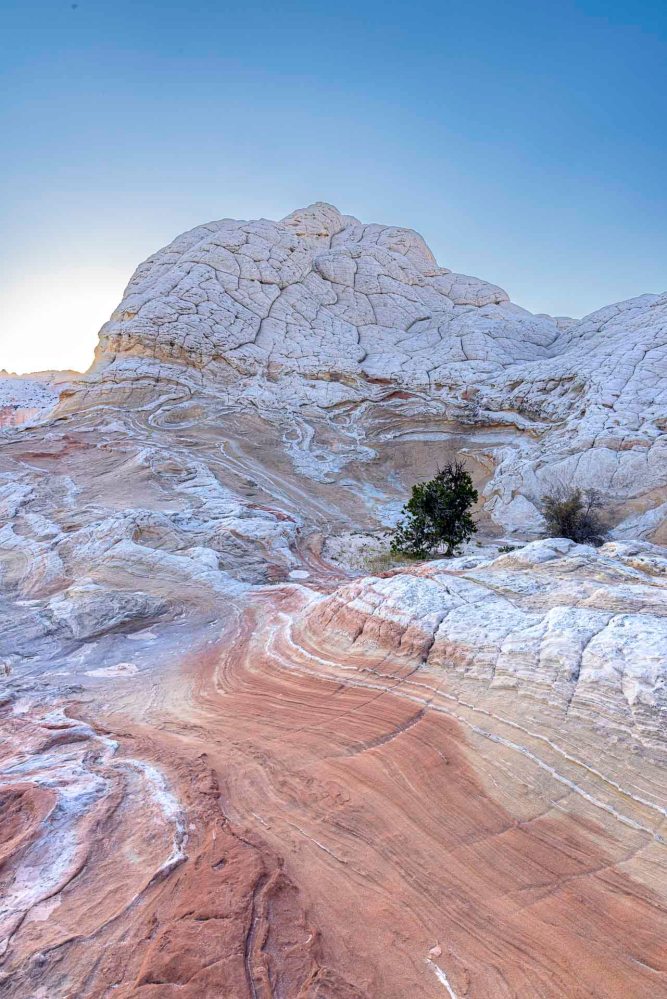
光が差し込んできたころ、自分の立っている場所を眺めてつくづく納得しました。 When the light began to shine, I looked at where I was standing and was truly convinced.
私はまさに陸の上にある荒海の上に立っていた! I was standing on a rough sea above the very land!
もう一度iPadの木に会いに行き、もしかしたらもう2度と会えないかもしれない景色に別れを告げました。 I went to see the iPad tree again and said goodbye to a view I may never see again.
「いつも忙しいアヒルのおばさん」と名付けた石。今日も朝からお出かけですね。 The stone I named “Aunt Duck, always busy.” You are going out in the morning today, too.
私の大好きな場所の一つとなりました。 It became one of my favorite places.
最後に、簡単なホワイトポケットのオーバービュービデオを撮りました。サイズ的には大きくないです。裏側の景色などは入っていないので、多分、このビデオの景色の2-3倍ぐらいの広さと考えて良いと思います。 Finally, I took a quick White Pocket over view video. It is not large in size. It does not include the view of the back side of it, so you can probably consider it to be about 2-3 times larger than the view in this video.
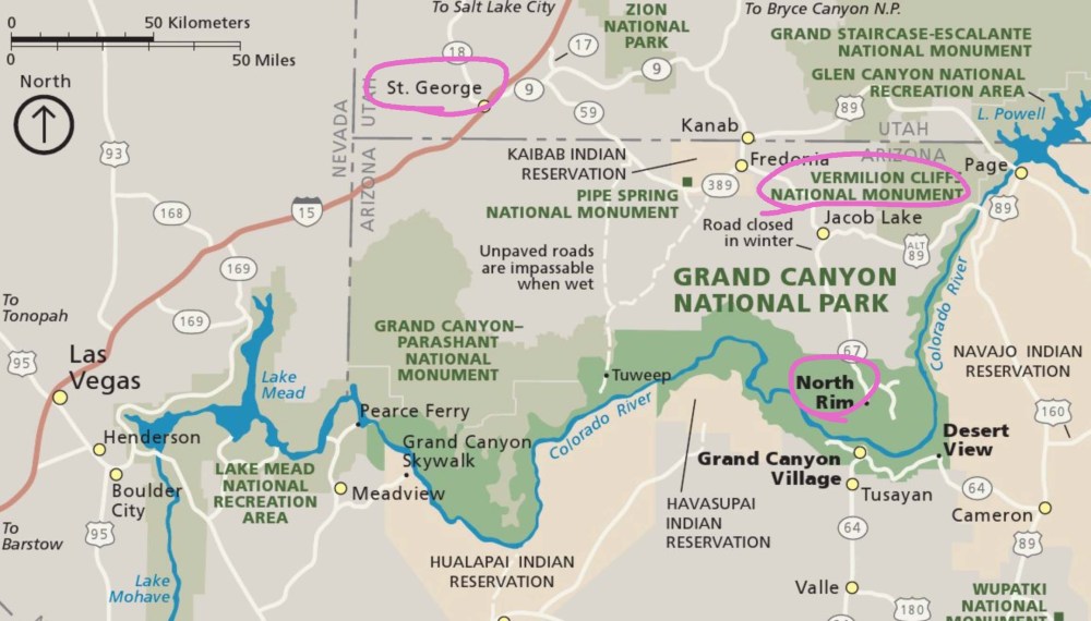
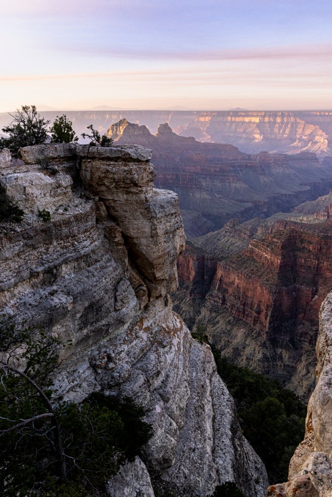
セイントジョージの家を出て、グランドキャニオン国立公園北側で一泊、その後、バーミリオンクリフの中のホワイトポケットでキャンプして帰ってくるという短い旅でした。でも、個人的にはチャレンジングな経験でした。 It was a short trip, leaving my home in Saint George, staying overnight on the north side of Grand Canyon National Park, and then camping in White Pocket in the Vermillion Cliffs before returning home. But it was a personally challenging experience.
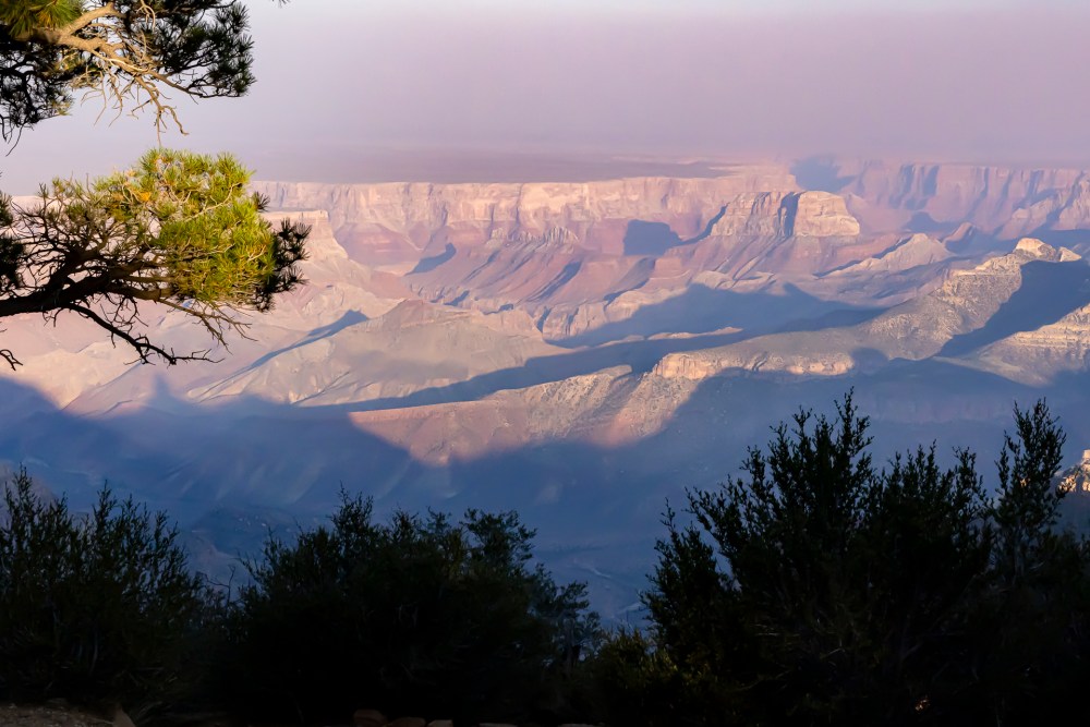
多分、ほとんどの人は人気のある南側から渓谷を見ることになるのではないでしょうか。なぜなら、交通の便が良いことと、太陽の光が南側から当たるので、北側の渓谷斜面が下の方まできれいに見えるからです。 Most people will view the canyon from the popular south side. This is because of the convenience of transportation and the fact that sunlight hits the canyon from the south, so the canyon slopes on the north side can be seen beautifully all the way down to the bottom.
一方、北側から渓谷を見ると、確かに影がたくさんあって、地層の変化が見えにくいです。渓谷までのアプローチがとんでもなく長く、疲れた頃に終点ロッジに到着します。でも、そんな短所が長所で趣があります。森林保護地区に咲くワイルドフラワーはワシントン州のオリンピック国立公園を思い起こさせてくれます。観光客の数が少ない事も落ち着ける要因でもあります。 On the other hand, looking at the canyon from the north, there are indeed many shadows and it is difficult to see the changes in the formations. The approach to the canyon is ridiculously long, and you arrive at the final lodge when you are tired. But such shortcomings are quaint in their advantages. The wildflowers in the forest preserve remind me of Olympic National Park in Washington State. The small number of tourists is also a calming factor.
コロラド川が太鼓の昔から周りの岩を削り取りながら流れた結果に出来た渓谷が公園の中心なので、当然、コロラド川が中心を流れ、公園を北と南に分断しています。北側から南側に車で行きたいとしたら、5時かぐらいかかります。 Since the center of the park is the canyon that was formed as a result of the Colorado River carving away at the surrounding rocks since ancient times, the Colorado River naturally flows through the center of the park, dividing the park into north and south sections. If you wanted to drive from the north to the south rim by car, it would take about five hours.
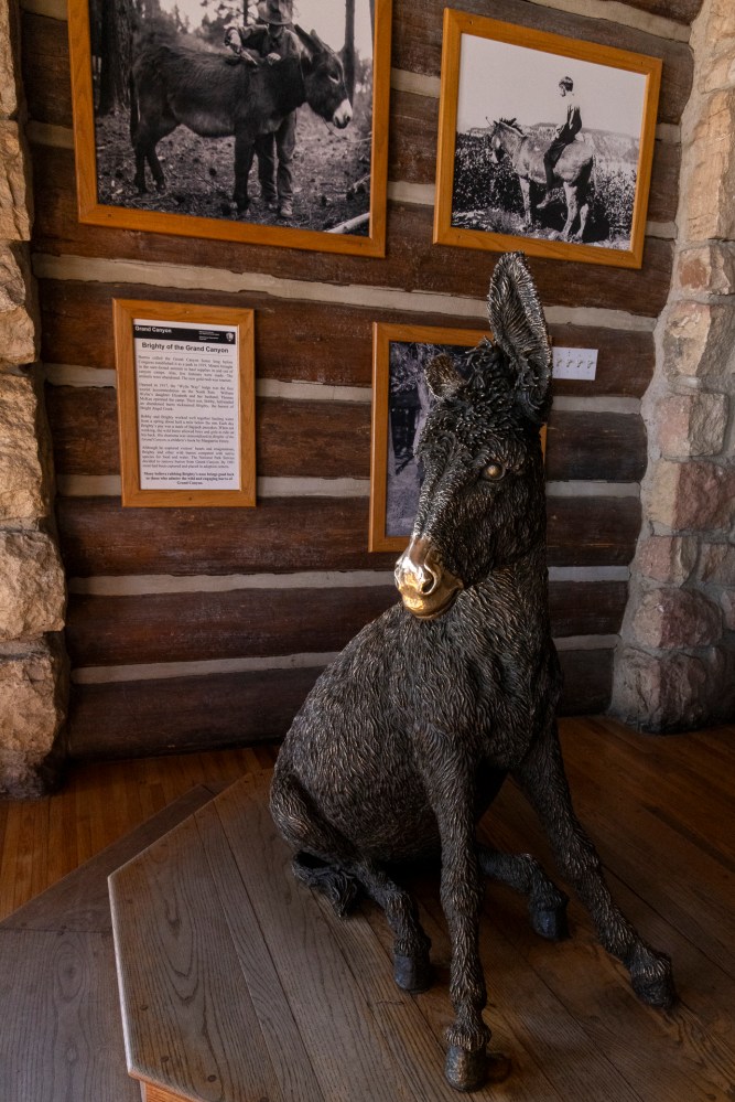
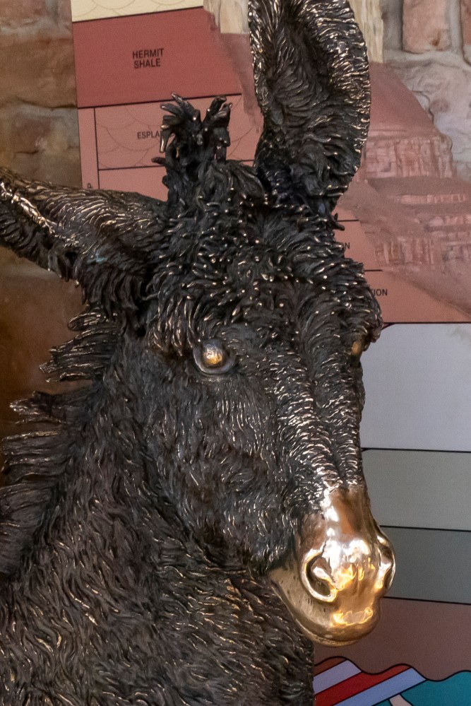
ロバのブライティー。人も含めて運搬作業をしていた人気者のロバでした。 Brighty the donkey. He was a popular donkey who did the carrying work, including people.
渓谷を降りて反対側の渓谷を目指すハイキングは、1日で行ける人たちもいますが、よっぽどな健脚者でないと死に繋がります。99%の人たちには渓谷の下で一泊することをお勧めします。 The hike down the canyon to the other side of the canyon, which some people can do in a day, is deadly unless you are very fit. 99% of people are advised to hike down the canyon and spend the night.
金色の鼻を撫でると幸運を招くと信じられています。 It is believed that stroking the golden nose brings good luck.
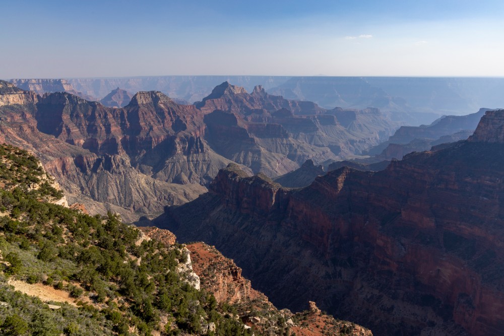
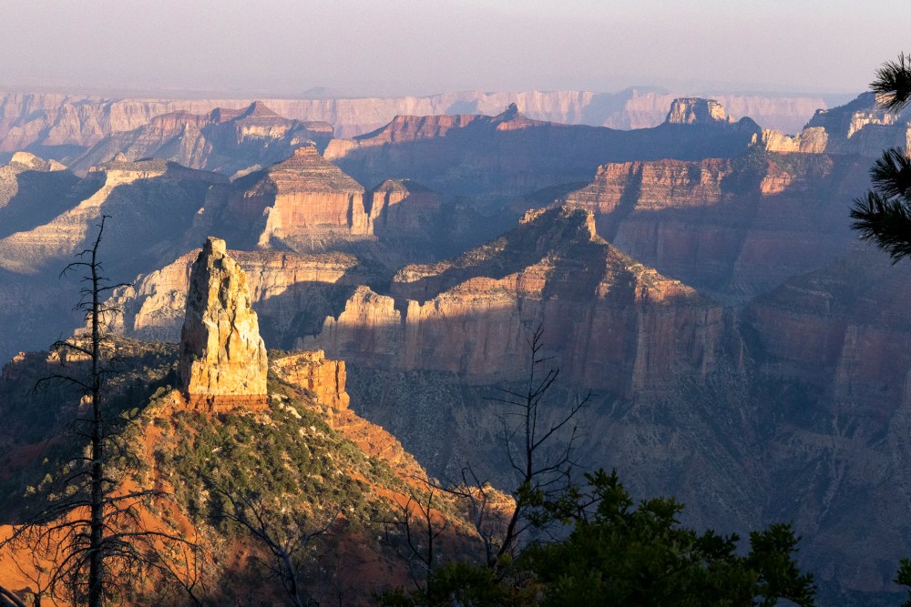
今回は、北側にあるログキャビンの予約ができたので、ゴールデンアワー(日の出と日の入りの前後1時間ぐらいのこと)の写真を期待しました。 This time, I was able to reserve a log cabin on the north rim, so I expected to take pictures during the golden hour (about an hour before and after sunrise and sunset).
ポイント インペリアルから見た夕日の景色。 Sunset view from Point Imperial.
でも、残念なことにLAmの山火事の煙が押し寄せてきていたので、視界は最悪でした。 But unfortunately, the smoke from the LA wildfires was pushing in, so visibility was terrible.
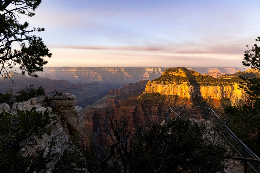
ロッジから見た日の出の景色。 Sunrise view from the lodge.
それでも深く刻まれた渓谷は私たちを魅了させてくれました。 Still, the deeply carved canyon left us spellbound.
次回はこの旅の山場、ホワイトポケットについて、また、私の個人的なチャレンジについて書きます。 In the next post, I will write about White Pocket, the highlight of the trip, and my challenges.
注記:「Oqaatsut」の地名の発音がよくわからないので、記憶にある発音をカタカナ書きにしました。 Note: I am not sure how to pronounce the name “Oqaatsut”, so I have transcribed the pronunciation in Katakana for Japanese based on my memory of the word.
ワークショップ2日目も雨でしたが、元気よく出発しました。 The second day of the workshop was also rainy, but we left in good spirits.
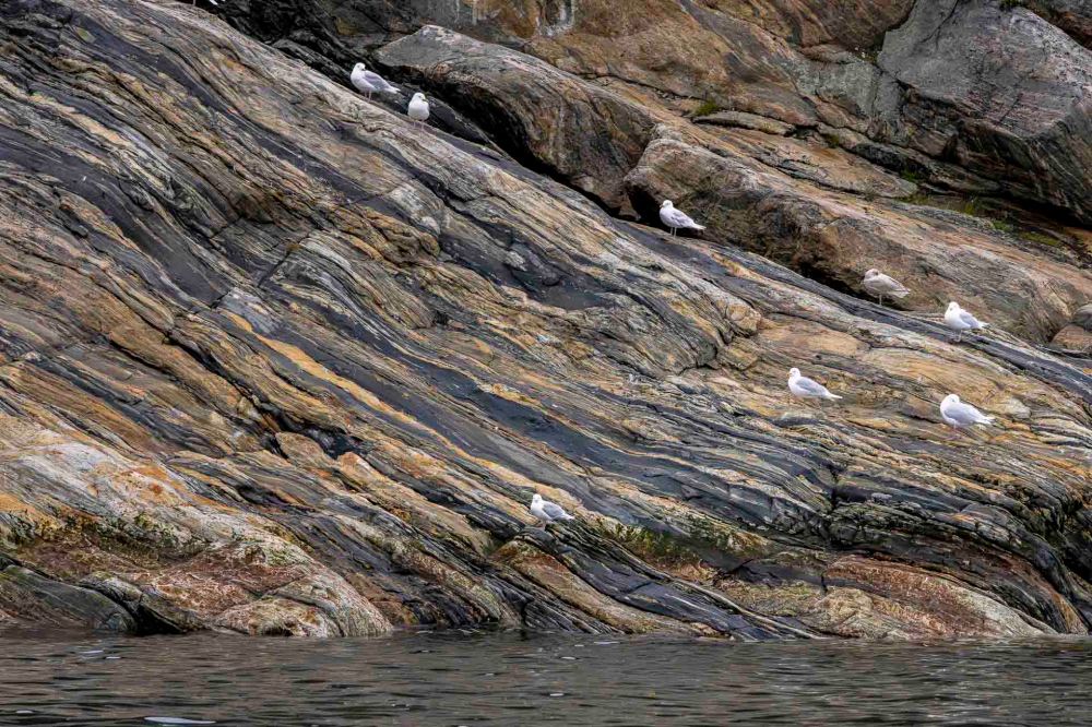
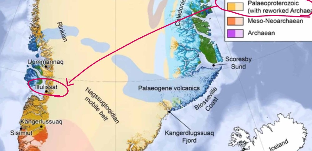
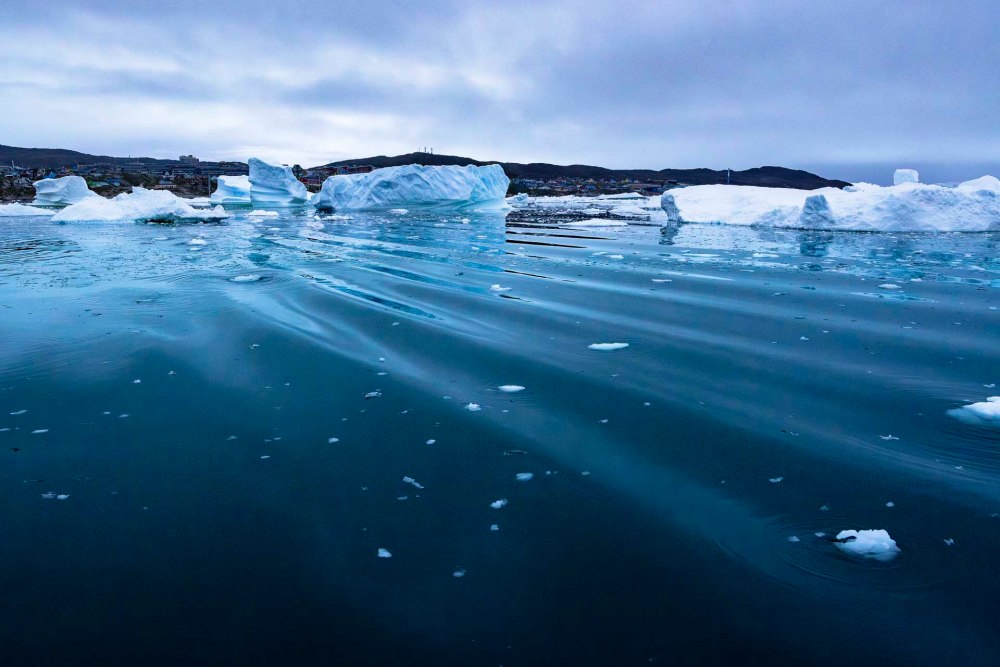
イルリサットの港を出る時に海岸を見ると、美しい地層の線が模様のように流れていました。 When I looked at the coast as we left the port of Ilulissat, I saw beautiful stratigraphic lines flowing like a pattern.
帰ってきてから調べると、この地帯は古原生代のものであることがわかりました。 Upon returning home, I examined the area and found that the zone was Palaeoproterozoic.
古原生代は地球史を半分ぐらい遡った頃をさします。最初の真核生物が生まれたころで、まだ1日が20時間しかなかった頃です。 The Palaeoproterozoic Era is about halfway back in Earth’s history. It was around the time when the first eukaryotes were born and the day was still only 20 hours long.
こんなに想像もつかないことを調査研究されている方々に感謝します。 A big thanks to those who are researching and studying such unimaginable things.
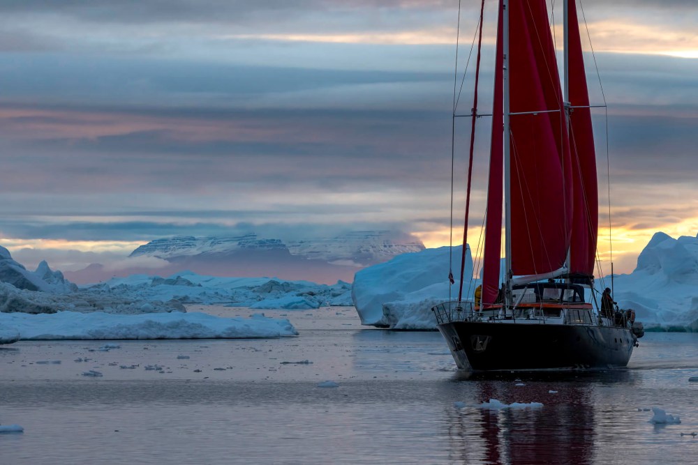
この日はカモメたちが大活躍した日でした。 わたしたちの船を誘導してクジラがいるところに連れて行ってくれたからです。 It was a day of great activity for the seagulls, as they guided our boat to the whales. They guided our boat to where the whales were.
この日私が撮ったクジラの写真の数は500枚ぐらいです。量が多すぎるので、クジラについては後ほど書きます。 The number of photos of whales I took that day is about 500. I will write more about whales later because it would be too much to include here.
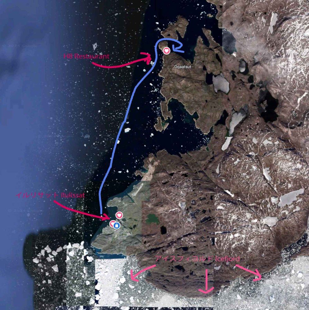
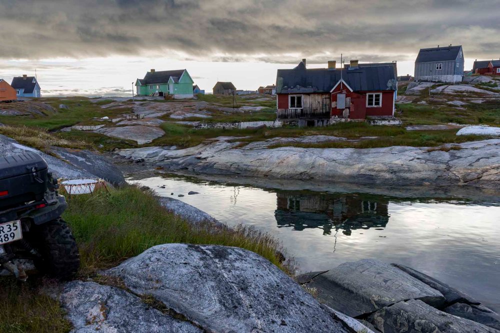
今日はイルリサットからそれほど遠くないですが、私たちのような船だと1時間以上北上したところにあるオカツァットという集落について書きます。 Today I write about the settlement of Oqaatsut, which is not far from Ilulissat, but more than an hour north in a boat like ours.
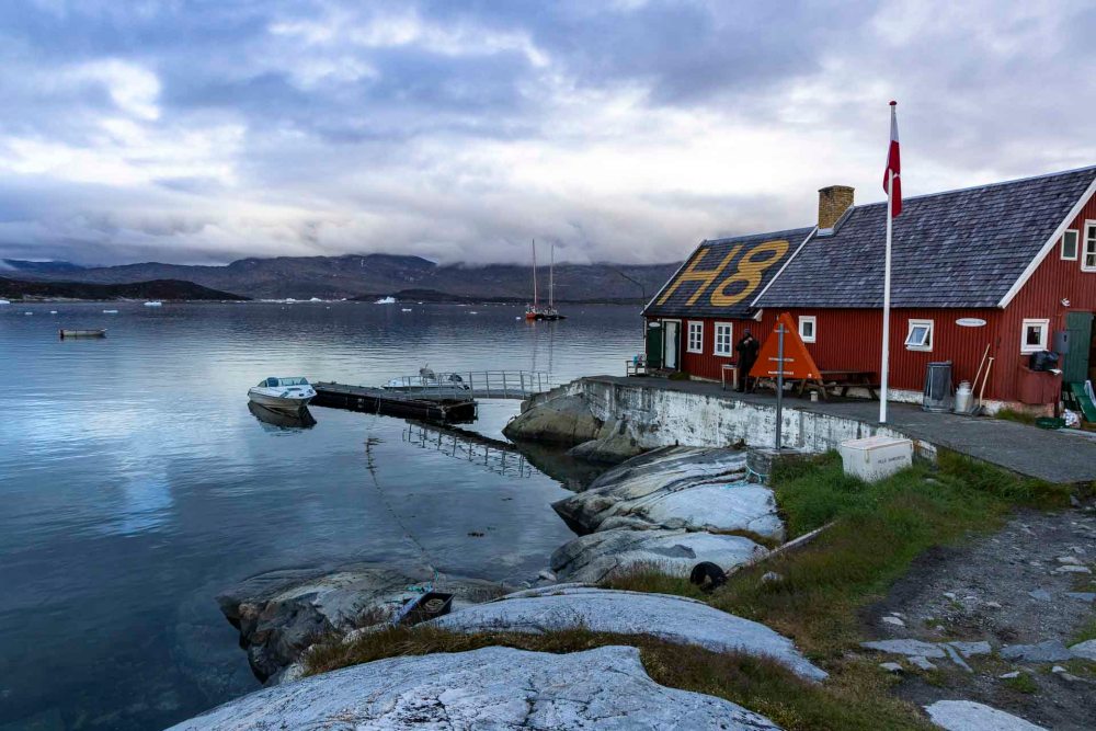
上陸した後すぐにH8というレストランで夕食をとりました。期間限定でオープンしているレストランで、星を5つあげてもいいほど美味しかったです。 Immediately after landing we had dinner at a restaurant called H8. The restaurant is open for a limited time only and was so good that I could have given it 5 stars.
この「H8」という名前は第二次世界大戦まで遡ります。迷子にならないようにアメリカ空軍はグリーンランドのそれぞれの町の家の屋根に「H1」から始まって順番につけて行ったということです。そしてここオカツァットには「H8」がつけられたと言うことです。The name, H8, dates back to World War 2 where the Americans numbered all cities on one roof top, so they could navigate from the sky. In Oqaatsut, it was the building, that today houses our restaurant, that were marked with the letter and number “H8”.
夕食の後、それぞれこの小さな場所の探索をしました。ワークショップ参加者の半数以上の人たちがドローンを持ってきていたので、ここで練習していました。 After dinner, we each explored this little place. Since more than half of the workshop participants had brought their drones with them, they practiced operating them here.
この集落には小さな魚工場があるだけで、ここの人たちのほとんどがそこで働いています。下の写真を見ていただくとわかりますが、中央の大きな建物が魚工場です。 There is only a small fish factory in this village, and most of the people here work there. As you can see in the photo below, the large building in the center is the fish factory.
手前にはボートと自転車が写っています。私の観察では、この自転車はここで使うものではなく、ボートで他の街に行った時に使うものだと思います。そう思う理由は、ここには道がなく、ツルツル滑る石の坂があるだけだからです。また、ここで使うのなら、家の近くに止めてあるはずです。この写真を撮ったのは夜中すぎ、村の人たちはきっと家で寝ていたはずです。 In the foreground you can see a boat and a bicycle. My observation is that this bicycle is not for use here, but for use when you go to other cities by boat. The reason I think so is because there are no roads here, only slippery stone slopes. Also, if it were used here, it would be parked near the house. It was after midnight when I took this picture, and the villagers must have been sleeping in their houses.
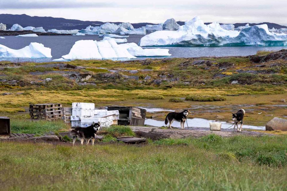
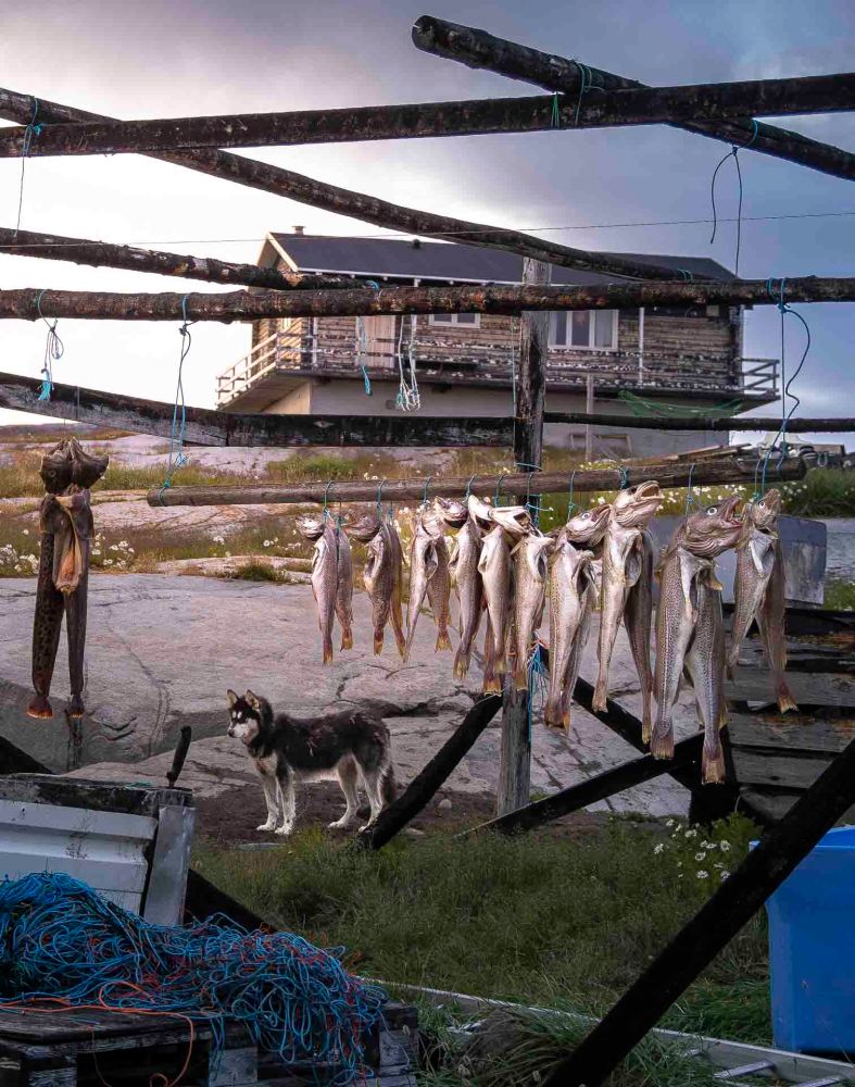
また、自転車の上には箱が見えます。この箱には魚を入れたりするのでしょう。なぜそう思うかというと、村人は彼らの冬の交通手段に餌をあげなければいけないからです。そう、犬ぞりです。 Also, you can see boxes above the bicycle. These boxes are probably used to store fish. The reason I think so is because the villagers have to feed their winter transportation. Yes, it is a dog sled.
私達が上陸した時は夜11時過ぎだったので村人は一人も見かけませんでした。でも、犬は15匹ぐらい見かけました。もう少し奥まで歩いて行ったらもっといたはずです。2020年のこの村の人口は29人なので、犬人口はもっと多いはずです。 When we landed, it was after 11:00 p.m. and we did not see a single villager. However, we did see about 15 dogs. The population of this village in 2020 is 29 people, so the dog population must be much higher.
この集落の最大で唯一の職種は漁業です。だから、こんな風景が見られます。 The largest and only occupation in this village is fishing. That is why you can see this kind of scenery.
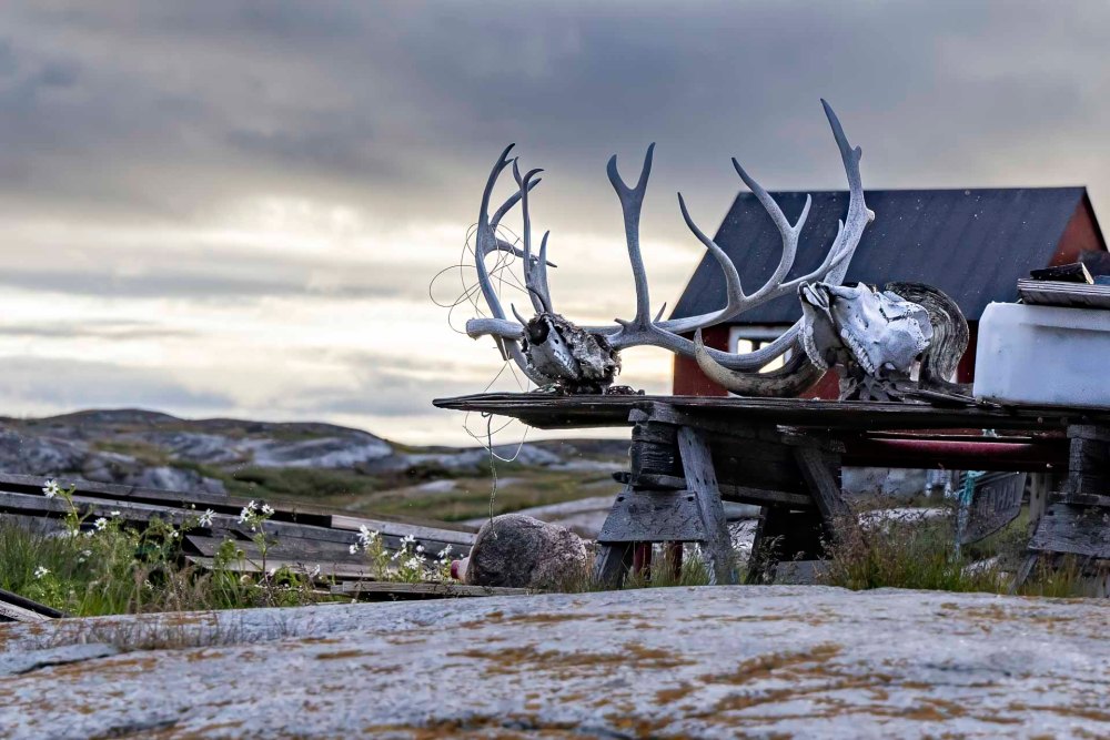
その他、おそらく時折現れる角を持った動物も大切な食糧になっているはずです。 Other animals with horns, which probably appear from time to time, are also important food sources.
歩きながら様々な思いが頭をよぎりました。夜中すぎ、あいにく、雨が降ってきたのでこの集落に別れを告げて再び海へ戻って行きました。 As I walked, my mind was filled with various thoughts. Unfortunately, after midnight, it began to rain, so we said goodbye to the village and headed back to the sea.
太陽が沈んでいくと、薄紅の中、遥か彼方にディスコ島が見えていました。 As the sun set, Disco Island was visible in the distance in a light red.
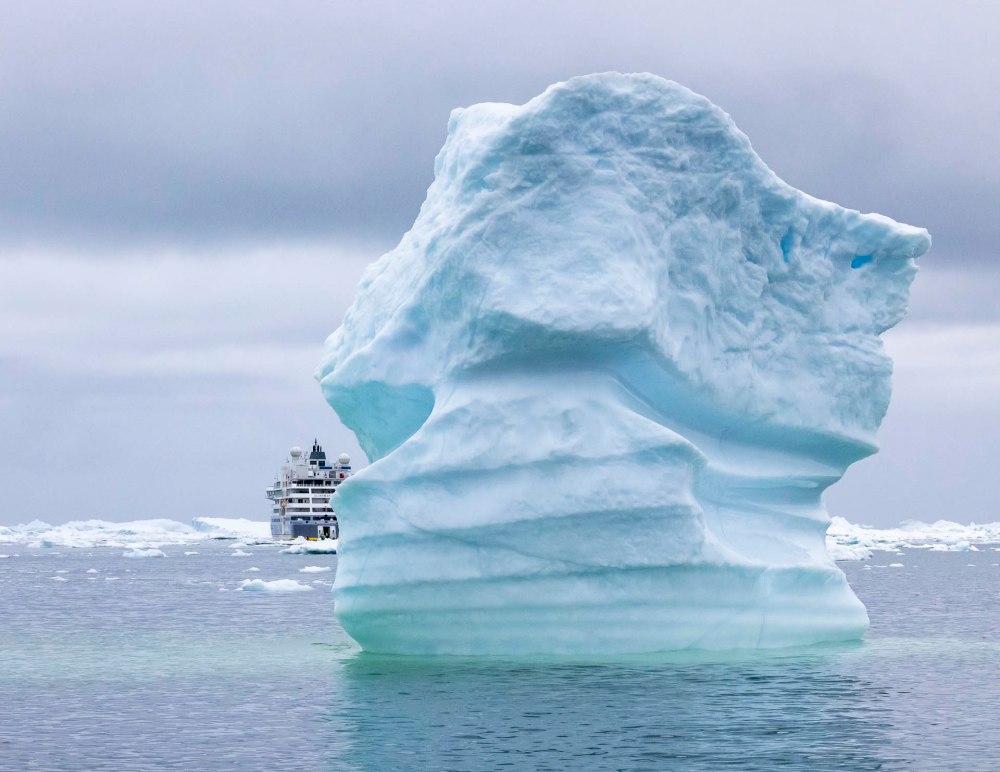
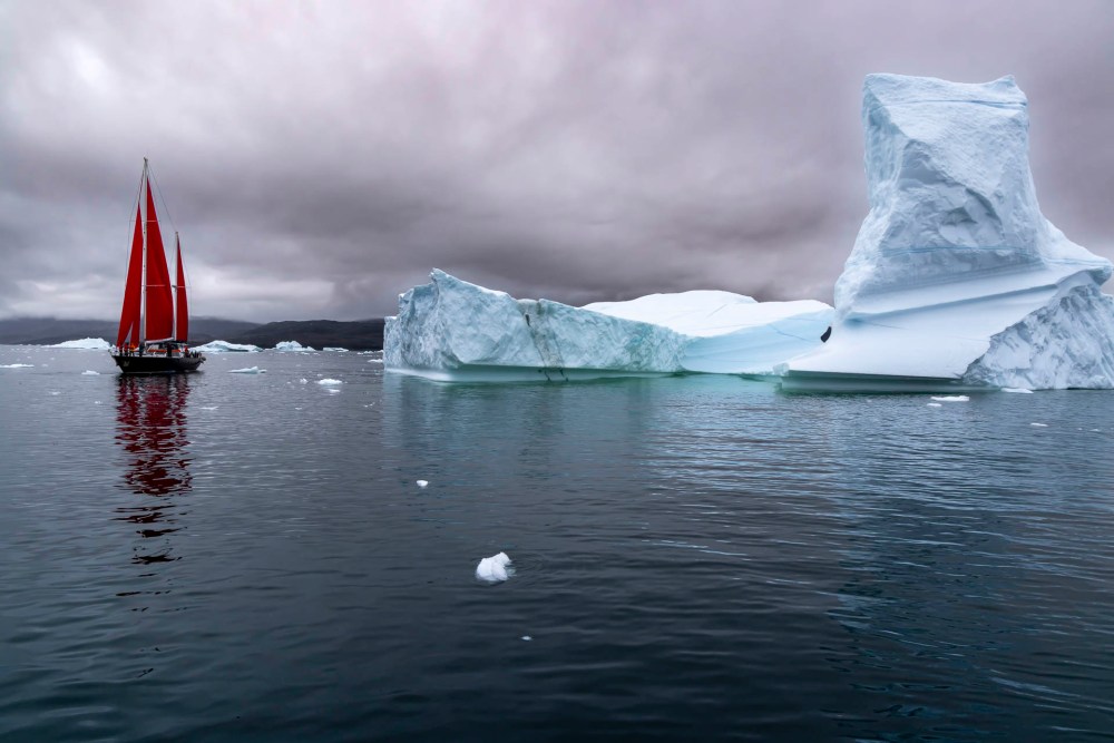
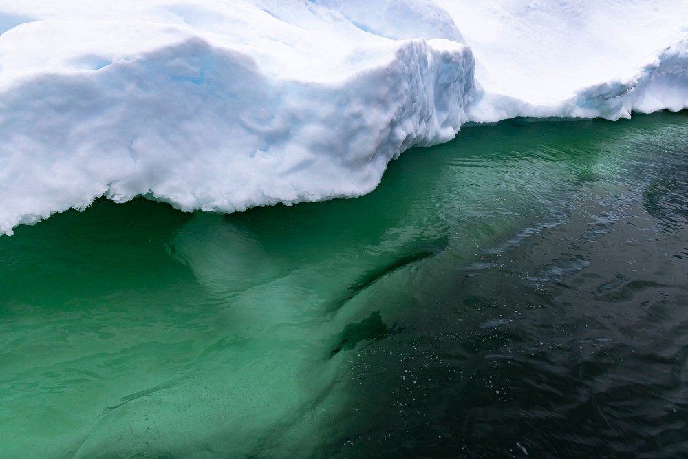
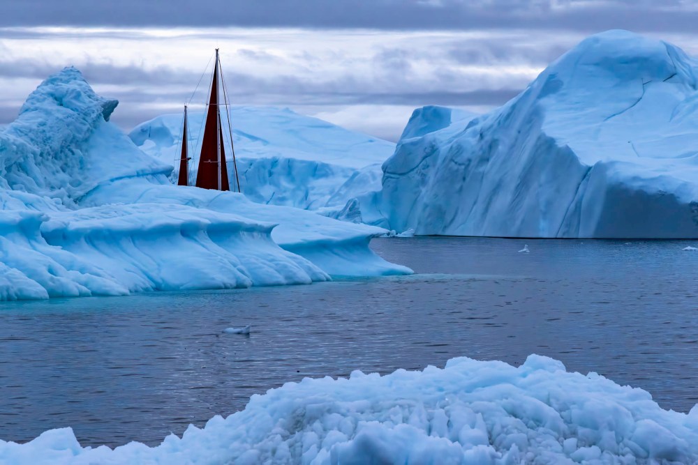
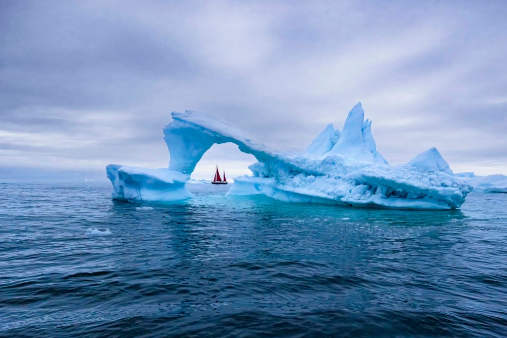
こんな氷山の合間を抜けて、クジラたちにも別れを告げてさらに進みました。 We said goodbye to the whales and continued on, passing between such icebergs.
わずかな光を求め、色々な角度から氷山を観察して、自己ベストのショットを模索しました。 Seeking the slightest light, I observed the iceberg from various angles to find my best shot.
この頃から私の中で「千と千尋の神隠し」と言う映画の中の歌「いつも何度でも」が繰り返し聞こえていました。 Since that time, I have repeatedly heard the song “Always with me” from the movie “Spirited Away” in my mind.
呼んでいる胸のどこか奥でいつも心踊る夢を見たい。 Deep inside my heart that is calling out to me, I want to dream a dream that always dances in my heart.
悲しみは数え切れないけれどその向こうできっとあなたに会える。 The sadness is uncountable, but I am sure I will see you on the other side of it.
繰り返す過ちのその度、人はただ青い空の青さを知る。 Whenever I repeat a mistake, I only know the blue of the blue sky.
果てしなく道は続いて見えるけれどこの両手は光を抱ける。 Although the road appears to be endless, I know these two hands can embrace the light.
(Note: The English translation is mine not the official lyrics.)
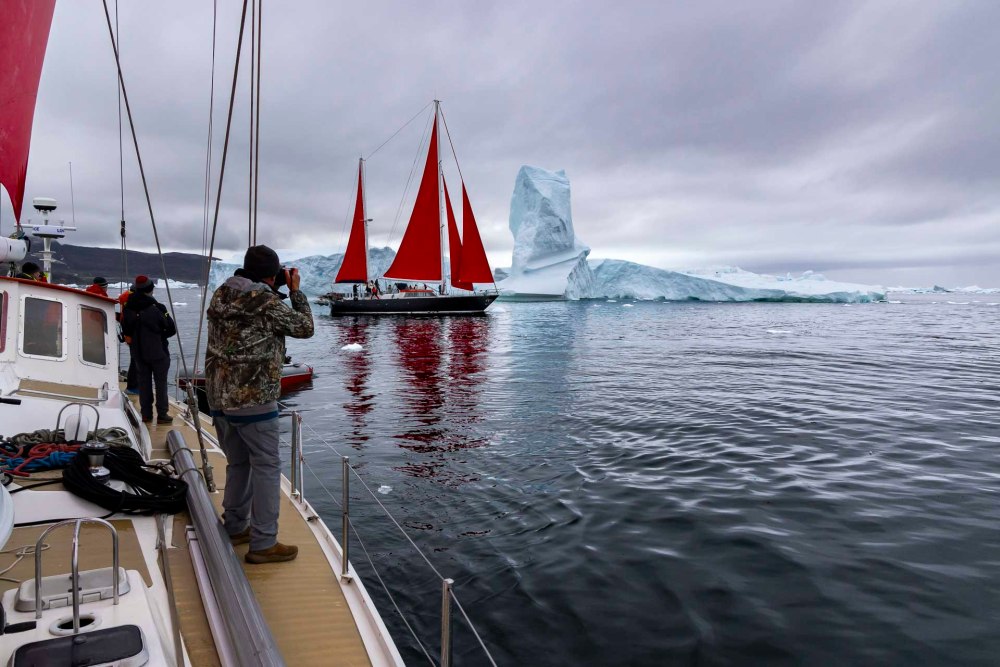
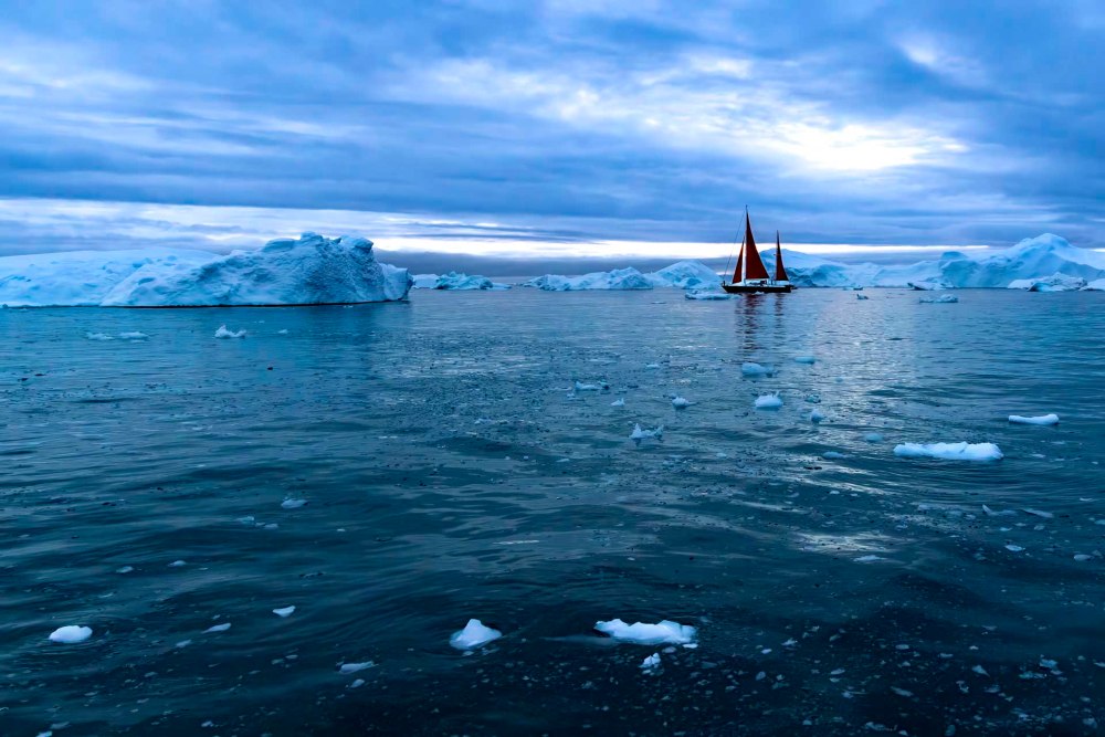
そして、何回も何回も氷山のアーチの向こうに船を配置して、ベストタイミングを待ちました。 And many, many, many times, we positioned the ship behind the arch of icebergs and waited for the best timing.
午前4時過ぎ、もうみんな疲れ切っていました。イルリサットの港が見えてきた時には懐かしさと安堵に満たされました。 It was past 4:00 a.m. and everyone was already exhausted. When the port of Ilulissat came into view, we were filled with nostalgia and relief.
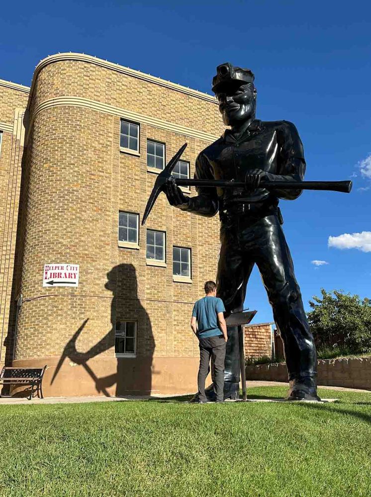
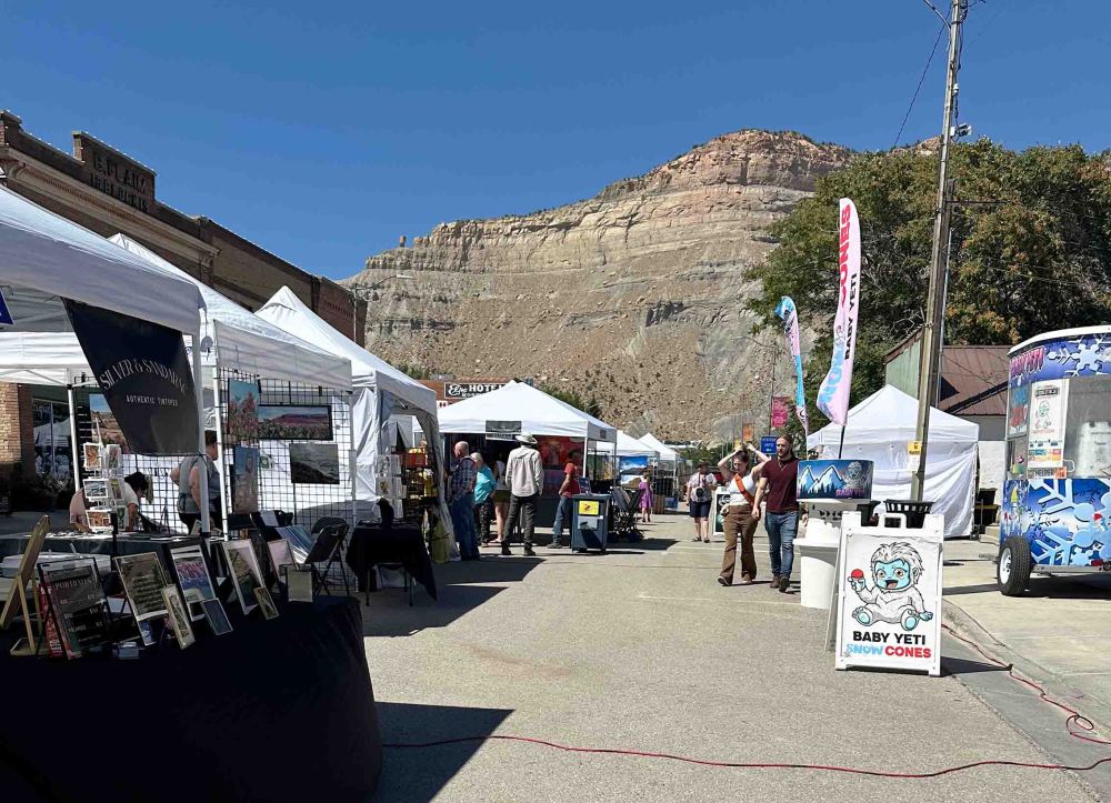
先週末から5日間、わたしたちの街、セイントジョージから300マイル (483 km) 北東にある小さな町、ヘルパーに行ってきました。この地で3日間のフェスティバルがあったからです。 For 5 days last week up until the weekend, we went to Helper, a small town 300 miles (483 km) northeast of our town, Saint George. This is because there was a 3-day art and music festival there.
ヘルパーはかつて炭鉱の街でした。 Helper was once a coal mining town.
バンちゃんも写真で参加したので、そのお手伝いで行ったわけです。 Banchan participated in the event with his photos, so I was there also to help him.
お手伝いの内訳は、荷物の運搬と展示用のブースのセットアップが主なことです。(私の小さな車にも荷物を詰め込んで、2台でいきました。)ただ、一度セットアップが完了すると、何もすることがないので退屈ですが、他の人たちのブースを見て回ったり、買い物をしたりすると1日目は終わります。 The major help needed is setting up his booth for the exhibit. (We also packed up my little car because not everything could fit in his only.) However, once setup is complete, it can be tedious as there is nothing to do but look around at other people’s booths and do some shopping until the first day was over.
2日目からは他の展示をしている人たちと会話を楽しみました。 On the second day, I enjoyed conversing with other exhibitors.
フェスティバルの参加者は様々です。一年中、アメリカ全土のフェスティバルを渡り歩いているアーティストもいれば、私たちのように定年退職後、全く違った職種の製品やサービスを提供する人たちも意外に多くいます。また、現在進行中で、医者や弁護士などをしつつも、週末の趣味としてこだわりの製品を売る人たちもいます。 Festival attendees vary widely. Some artists travel to festivals all over the U.S. throughout the year, while a surprising number of people like us are retired and offer products and services in completely different professions. There are also ongoing people who are doctors, lawyers, etc., but sell their particular products as a weekend hobby.
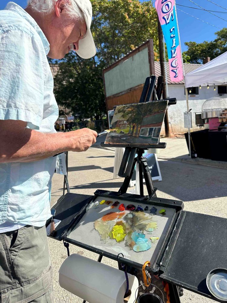
バンちゃんのテントの横でアーティストが2時間のタイムリミットで絵を描いていました。 An artist was painting next to Banchan’s canopy with a two-hour time limit.
そういった様々な過去や生活を持った人たちが集まるフェスティバルは面白くないわけありません。私の場合は製品を売る必要もないので、なおさら気ままに会話を楽しむことができました。 It is not uninteresting to have a festival that brings together people with such diverse pasts and lifestyles. In my case, I didn’t have to sell any products, so I was able to enjoy the conversation even more freely.
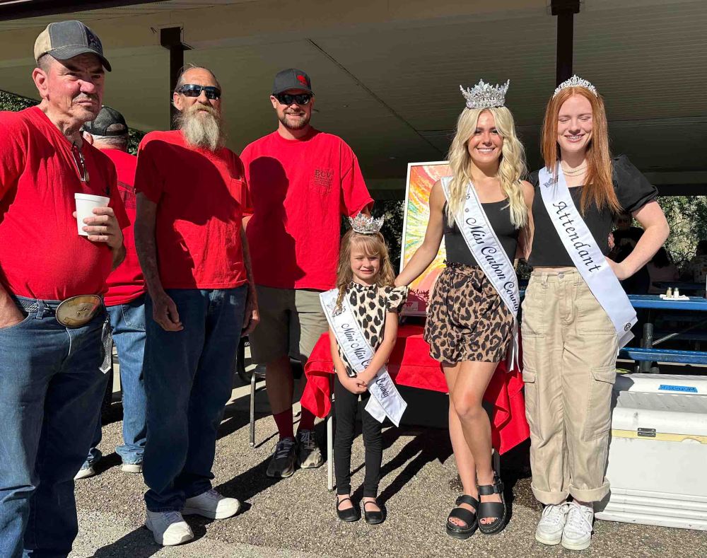
朝食の時に出会ったミスコンテストクイーンの3人。残念ながらまだドレスは着ていませんでした。 Three Miss Beauty Contest Queens met at breakfast. Unfortunately, they were not wearing dresses yet.
お客様と話すのも面白く、今日のこのトピックはまさに地元のお客様から聞き出した話に基づきます。 It is interesting to talk with customers, and this very topic today is based on a story I heard from a local customer.
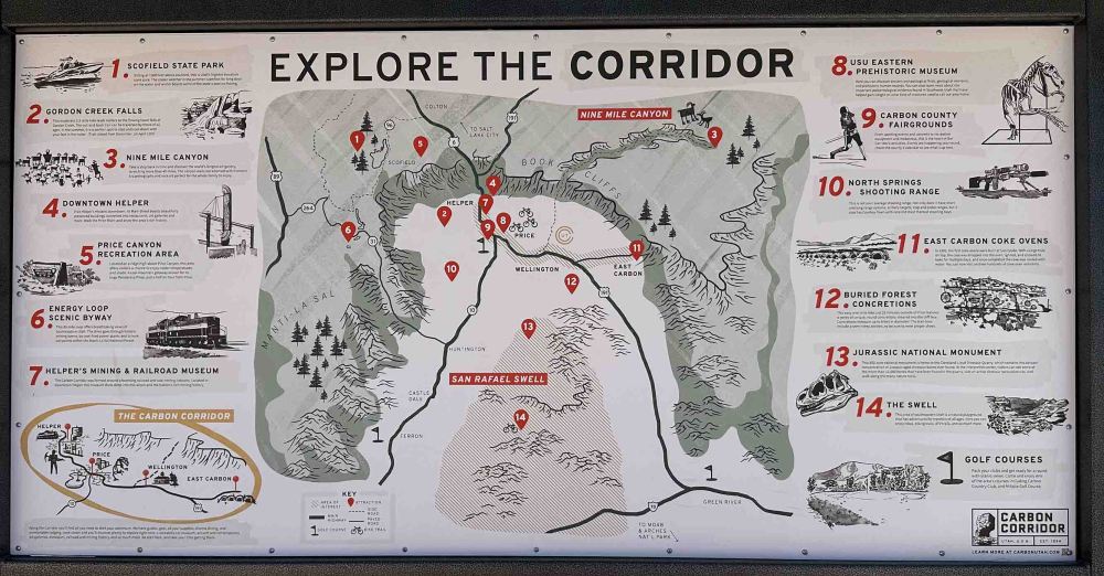
ヘルパーという町とその周辺は、先史時代の遺跡がたくさんある場所です。ペトログリフや恐竜の骨など、多く発掘されています。 The town of Helper and the surrounding area are home to many prehistoric ruins. Many petroglyphs and dinosaur bones have been excavated.
ヘルパー近郊の地図。 Map of the Helper suburbs.
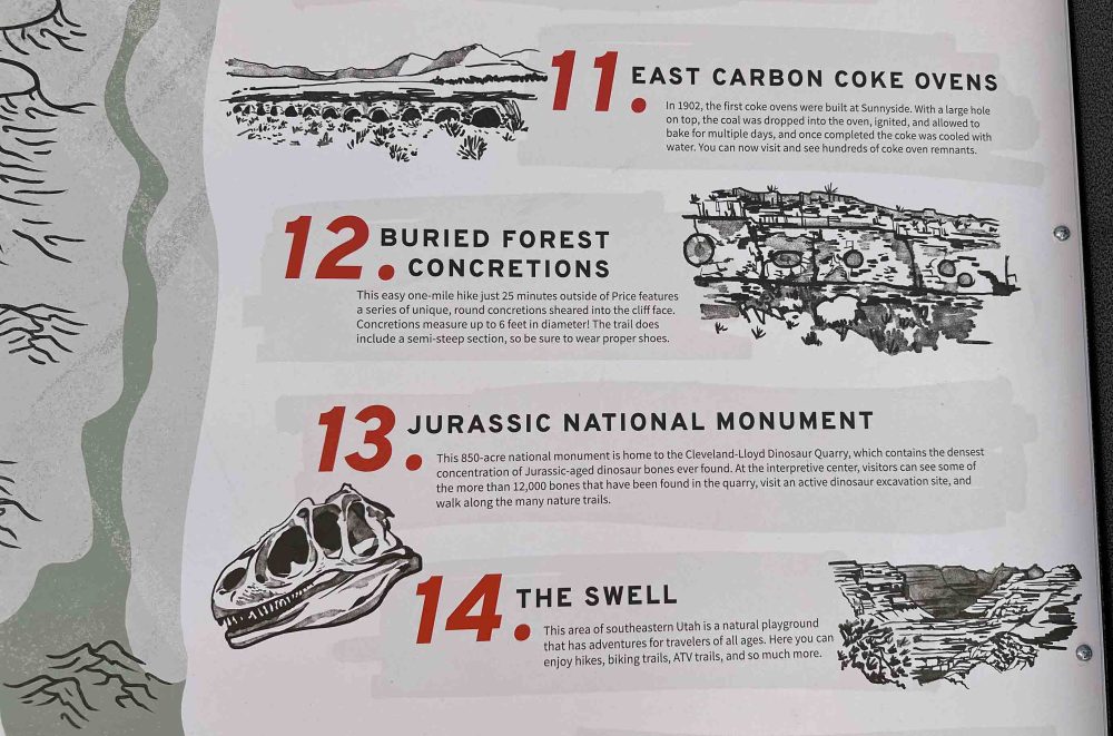
中でも私の興味を引いたのは、6フィートもあるキャノンボールというコンクリーションがあることでした。地図上、12番のBuried Forest Concretions です。お客様の一人はご主人がコンクリーションの隣に立って写っている写真を見せてくれました。 Of particular interest to me was a type of concretion called a “Cannonball”, which are about six feet long. On the map, these are at Buried Forest Concretions, #12. One of the guests showed me a picture of her husband standing next to one of these concretions.
12番、キャノンボールのコンクリーションがある、Buried Forest Concretions。 Number 12, Buried Forest Concretions, with cannonball concretions.
私が見たことのあるコンクリーションはモキボールと言われ、たかだか1インチから5インチほどの丸いボールです。 昔、家の近くを歩いていた時に見つけたものは、1インチぐらい。半分に割れたボールを観察すると、中心は砂岩が固まったもので、その周りに鉄分で覆われているのがわかります。 The concretions I have seen are called Moqui Balls, which are round balls that are a mere 1“ to 5” in diameter. The one I found while walking near my house a long time ago was about 1 inch. If you observe the ball broken in half, you can see that the center is made of hardened sandstone and is covered with iron around it.
家の近くで拾ってきたモキボール。 Moqui balls I picked up near my house.
さらに興味を引いたのが「恐竜ダイアモンド」と呼ばれる巨大な地帯です。名前の由来は大きくダイヤモンドの形を描くようにハイウェーがこの地帯を囲んでいるところから来たらしいです。そしてこのヘルパーもそのダイヤモンドの西側に位置しています。 Of further interest is a huge zone called the “Dinosaur Diamond”. The name is said to come from the fact that a highway surrounds this zone in the shape of a large diamond. And Helper is also located on the west side of the diamond.
ユタ州道、10号線からの眺め。 View from Utah State Highway, Route 10.
私たちは、このダイヤモンドの北に位置する恐竜国定公園を一度訪れています。その時は、恐竜ダイヤモンドの存在を意識しませんでした。何しろ巨大な地域を指していますからね。 We visited Dinosaur National Monument once, which is located north of this diamond. At that time, we were not aware of the Dinosaur Diamond. After all, we are referring to a huge area.
このキャノンボールができた頃は白亜紀の後期、9,000万年前とされています。この頃のアメリカ北大陸は白亜紀海路 (西部内陸海路とも呼ばれる) が入り込んでいて、この恐竜ダイアモンド地帯は浅い海になっていたそうです。 It is believed these Cannonball concretions were formed in the late Cretaceous Period, 90 million years ago. At this time, the Cretaceous seaway (aka Western Interior Seaway) was entering the northern continent of the United States, and this dinosaur diamond zone was a shallow sea.
10号線沿いにあるハンティングトン州立公園からの眺め。 View from Huntington State Park on Route 10.
恐竜が絶滅し始めたのが白亜紀末期で時代の転換期でした。古生物学や地質学にとってとても興味深い時代ですよね。ここは、白亜紀をそのまま地中に閉じ込めた貴重な場所ともいえます。 It was a turning point in time at the end of the Cretaceous when the dinosaurs began to become extinct. It is a very interesting period for paleontology and geology. This is a precious place where the Cretaceous Period was trapped underground as it was.
今度来る時は、キャノンボールも含めて、この地帯一帯にフォーカスして探索したいねと言って、家路を急ぎました。 We hurried home, saying that the next time we come back, we would like to focus our exploration on this whole area, including the Cannonball area.
さて、次回から再びイルリサット旅行記に戻ります。 Now, I will return to the Ilulissat travelogue again in the next posting.
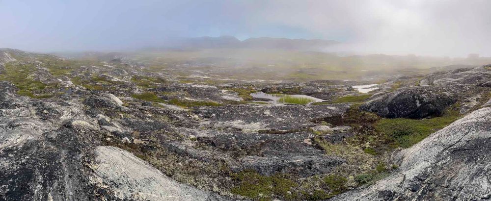
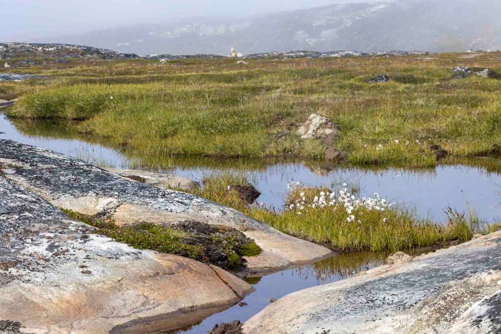
ツンドラ地帯は、地下に永久凍土が広がる草木が生えない地帯を指します。(高山ツンドラは少し違うようですね。) Tundra is the area where there is no grass or trees with permafrost beneath. (Alpine tundra is a little different.)
夏には地表の氷が溶けてコケや地衣類が生えてきます。 In summer, the ice on the ground surface melts and mosses and lichens grow.
氷河にもフィヨルドにも興味がありましたが、実は絶対に時間を見つけてツンドラの荒野を歩いてみたいと思っていました。I was interested in both the glaciers and the fjords, but in fact I definitely wanted to find time to walk the tundra wilderness.
なぜなら、友人に勧めらて『極限大地』という地質学者が書いた本を読んだからです。初めは英語版を読んでいましたが、あまりにも難解な専門用語が出てきたので、日本語訳で読み終えていました。 This is because a friend recommended a book written by a geologist called “A Wilder Time“. At first, I read the English version of the book, but I found the terminology too difficult to understand, so I finished reading the Japanese translation version.
バンちゃんは興味がないので、私一人でゆっくりと歩きました。 Banchan was not interested, so I walked slowly on my own.
ここで確かめてみたいことがいくつかありました。 There were a few things I wanted to check here.
一つめ:極限大地の本の中で作者は次のように記述しています。 First: In the book ”A Wilder Time”, the author describes;
With each step I took, I felt like I was trespassing. It seemed as if I was violently attacking the earth, which had been undisturbed for thousands of years, and contaminating it with my feet of dirt. (Omitted.) As soon as my boots left the ground, the details would hide again and the moss would return to its original form. (Note: The English quote is not the real quote from the book. It’s my translation from the Japanese edition.)
作者はその発見に「彼の存在は午後に吹くそよ風と同様、撮るに足らない存在」だと思い至ります。 The author comes to the realization that “his existence is as insignificant as the breeze in the afternoon.”
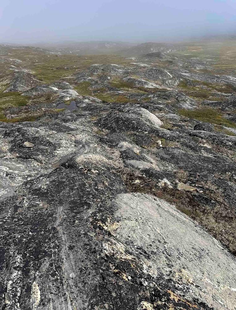
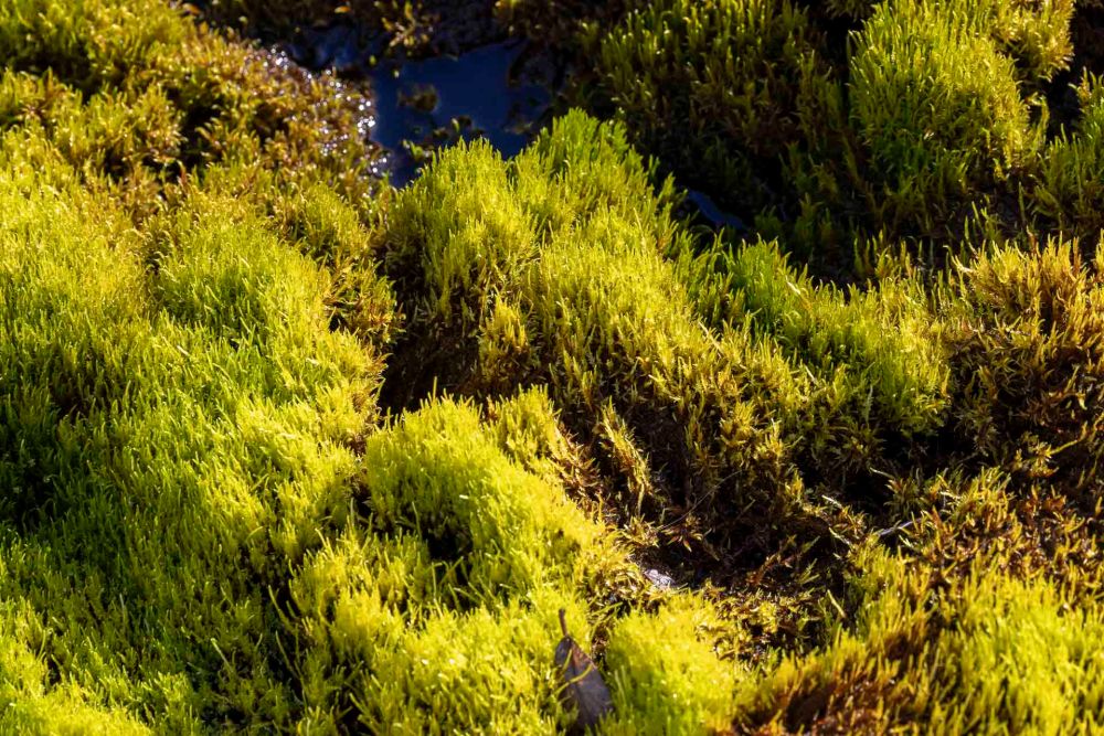
道がない場所だったので、私も彼と同じようにフカフカした厚い絨毯のようなコケの上を歩いていました。振り返ってみると、本当に、私の足跡など、どこにもない!彼の経験は本当だった事に感動しました。 There was no path, so I was walking on the same thick, fluffy carpet of moss as he was. When I looked back, there really were no footprints of mine, or any other footprints, anywhere! I was impressed that his experience was real.
もう一つは、見渡す限り誰もいないツンドラ荒野で、大声を上げて叫んでみたかった。 The other thing I wanted to do was to scream out loud in the tundra wilderness, where there was no one as far as the eye could see.
作者は、そんな事をしても荒野に吸い込まれてしまうだけだと記述します。「大昔の音のない世界と同じように無言で語りかけてくる。すべてをありのまま受け入れるようにと誘いかけてくる。」 The author describes how such a thing would only suck you into the wilderness. He says, “Like the soundless world of long ago, it speaks to us silently. It invites us to accept everything as it is.”
フヤー!(Yahooの逆さま)
HoYaa! (Reverse Yahoo)
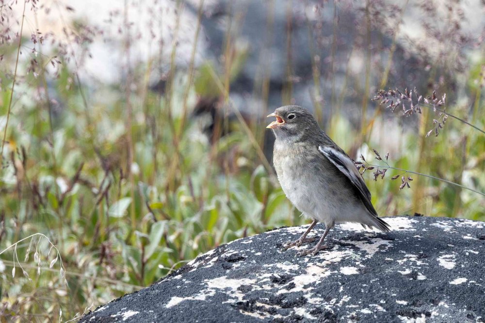
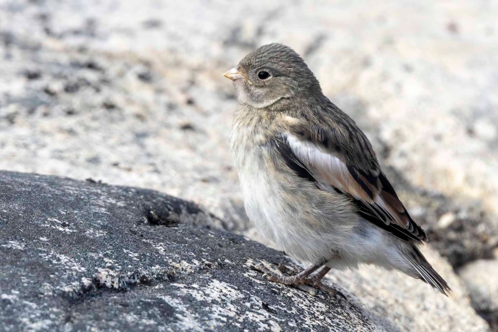
確かに、何の返信もなく、風の音だけが聞こえていました。私の近くでユキホオジロが行ったり来たりしていただけでした。 Indeed, there was no reply, only the sound of the wind. All I heard was a Snow Bunting coming and going near me.
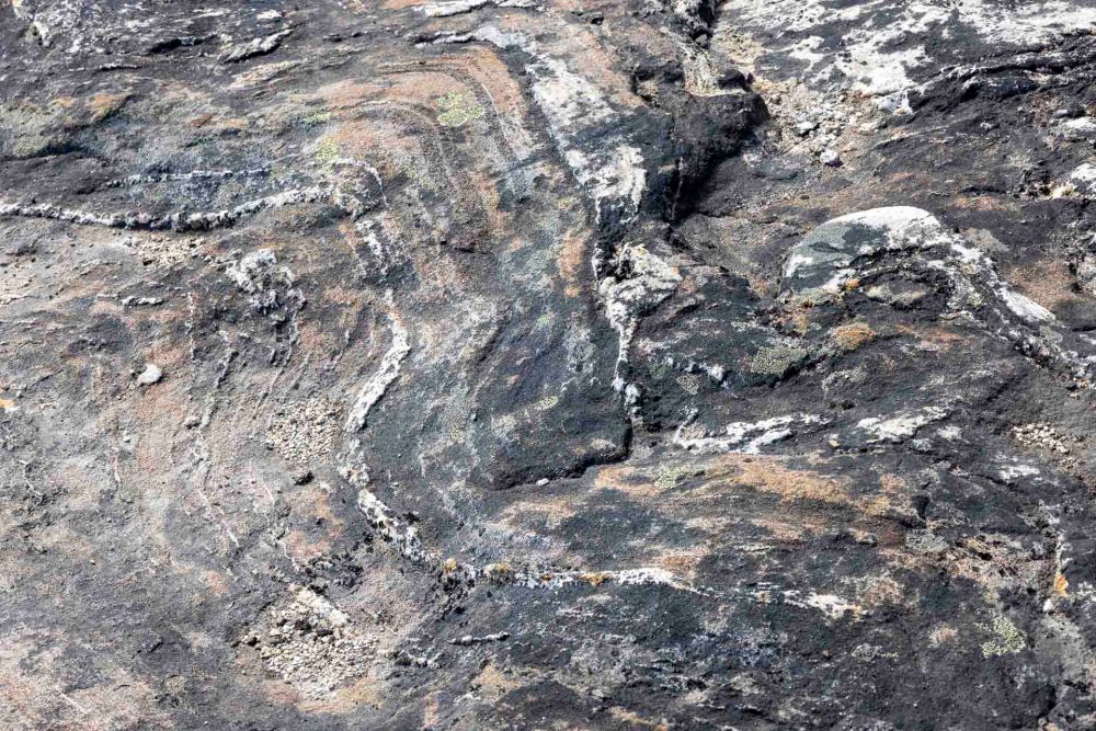
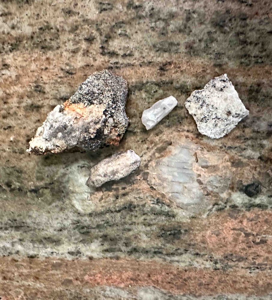
帰り道、作者が発見したように片麻岩を探しました。もちろん、深い知識がないので岩石を見てどんな石か区別ができるわけではありません。そこで、家のキッチンのカウンタートップと似たような模様なら、少なくとも花崗岩らしくなるので、そんな小さいかけらを拾ってホテルに戻りました。 On the way home, I looked for gneiss as the author discovered. Of course, not having in-depth knowledge, I could not distinguish what kind of stone it was by looking at the rock. So I picked up small pieces of gneiss that looked like granite, at least it had a similar pattern to the kitchen counter top at home.
補註:片麻岩は地下深くまで潜り込んで再結晶化した岩石です。二つの大陸がぶつかり、縫合された場所ではよく発見される岩石だそうです。後、作者達はそれを証明する証拠をさらに発見していきます。そして、まさにここは、18億年前、二つの大陸が衝突して縫合した場所 なんですね。すごい! Sidenote: Gneiss is a rock that has recrystallized after burrowing deep underground. It is a rock often found in places where two continents collide and are sutured together. Later, the author and fellow geologists discovered more evidence to prove it. And this was exactly where the two continents collided and stitched together 1.8 billion years ago. Amazing!
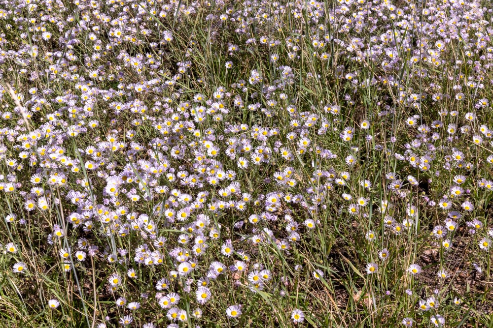
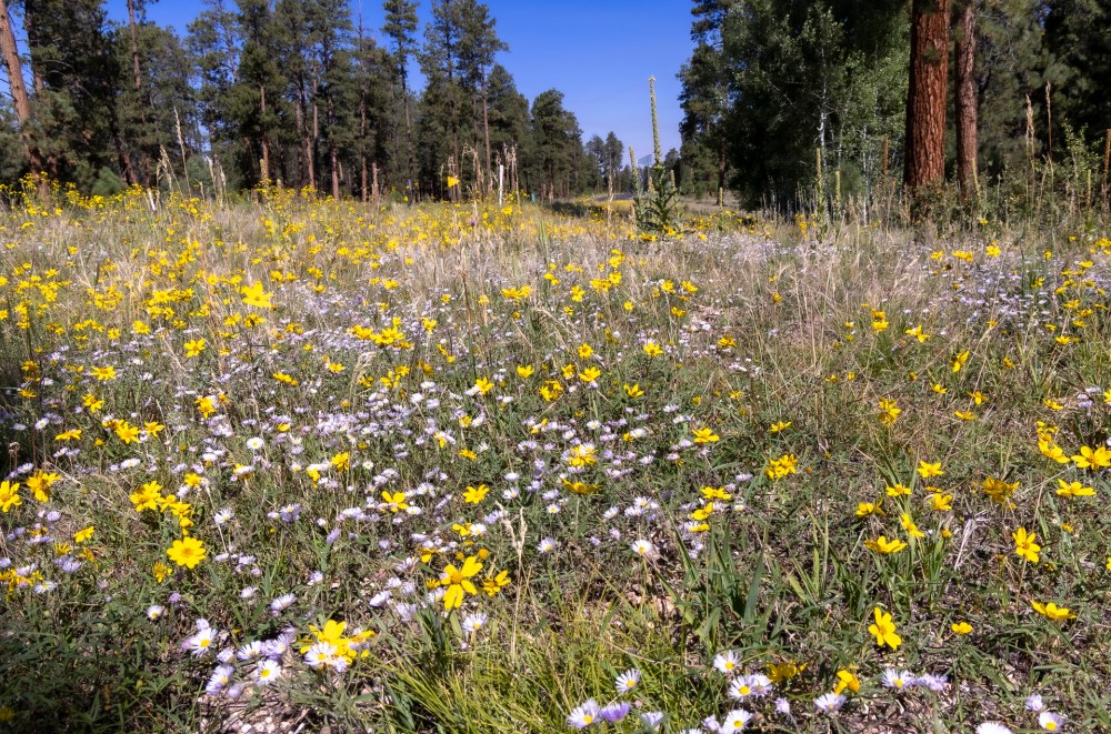
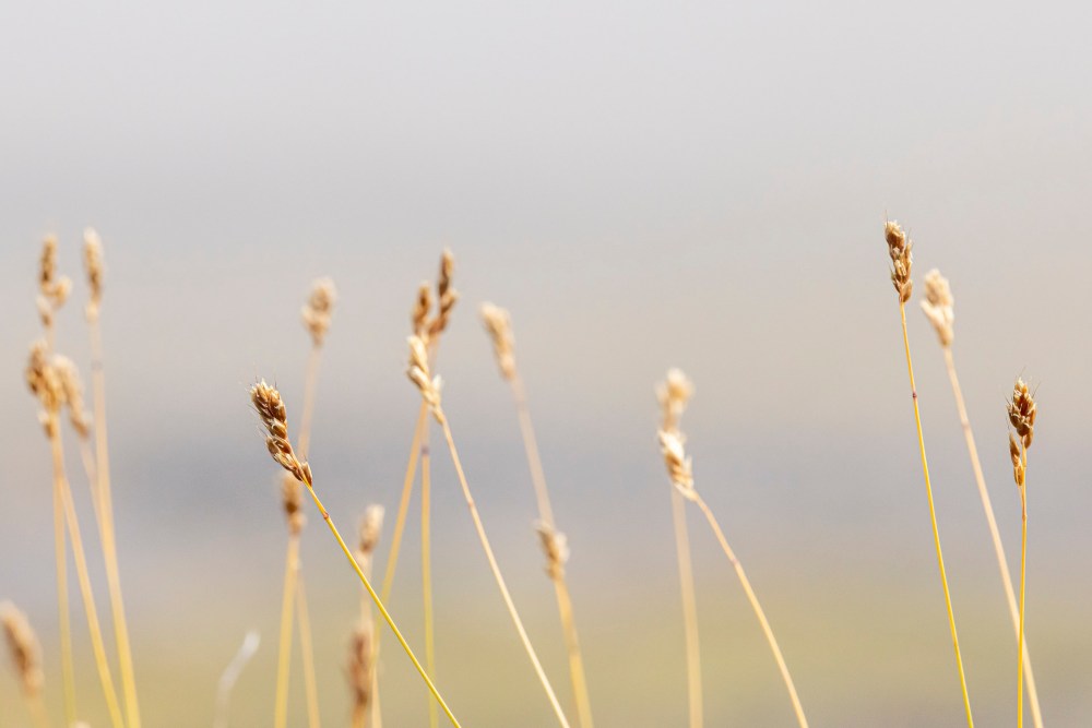
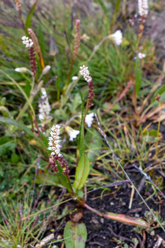
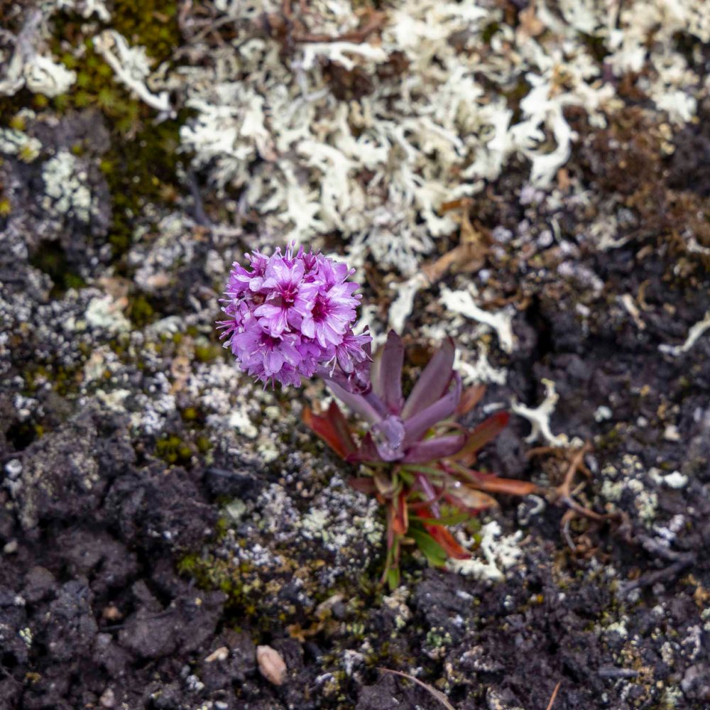
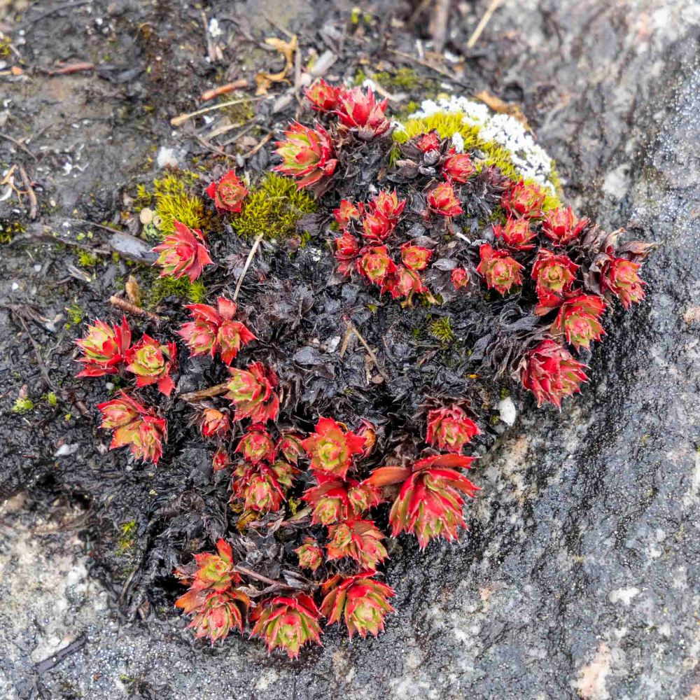
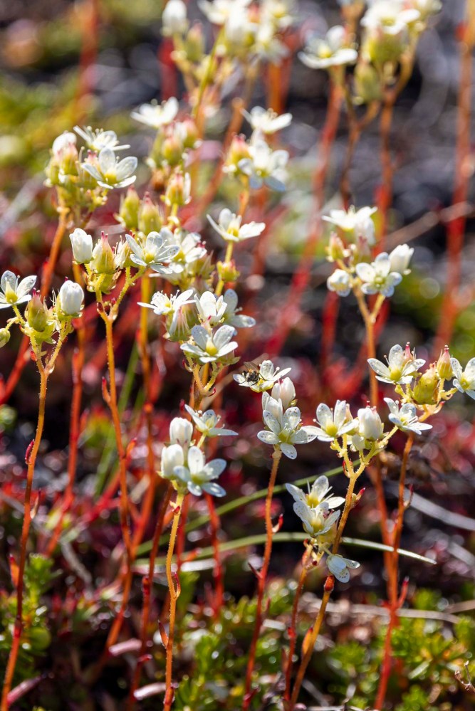
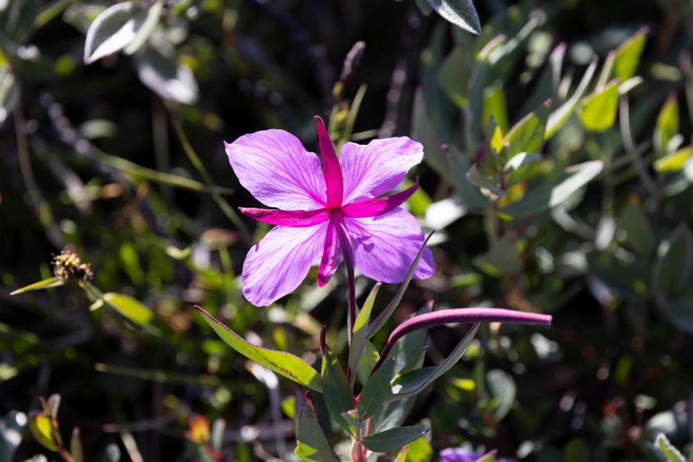
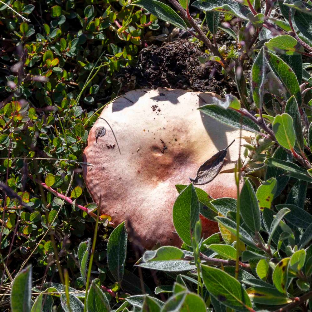
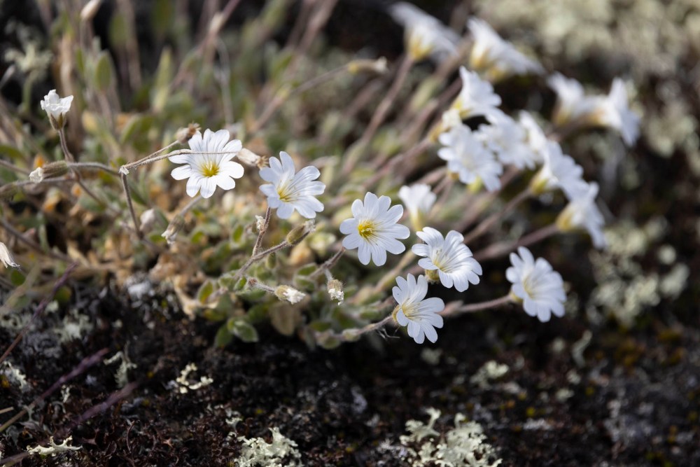
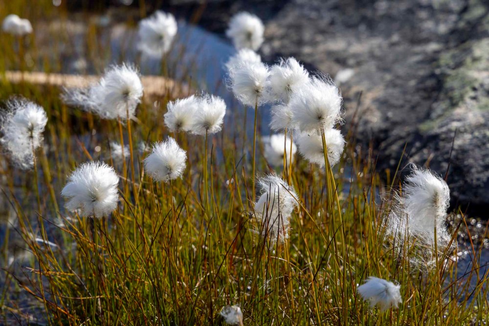
最後に、ツンドラで見かけた花や植物を紹介します。 Finally, here are some of the flowers and plants I saw on the tundra.
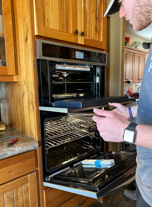
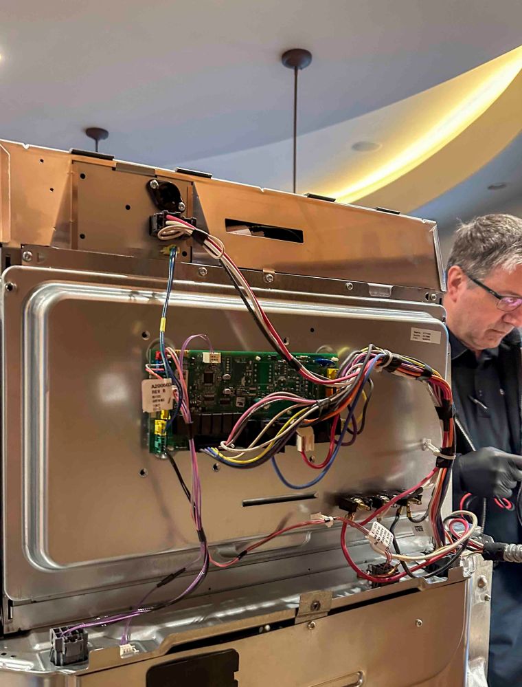
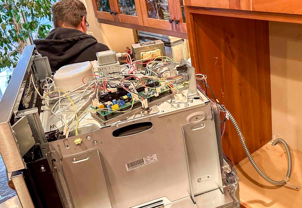
2月2日、オーブンと電子レンジを使って料理している最中にパタリと電音が止まり、両方とも動かなくなってしまいました。今日で15日目、電子レンジなしの生活を続けています。去年の暮れに新製品に取り替えたばかりなんですけどね。 On February 2nd, while cooking with the oven and microwave, their usual electrical noises stopped. Both just stopped working. Today is the 15th day of our lives without those appliances. What went wrong? We just replaced our old oven/microwave combo with a new one at the end of last year.
修理屋さんは来てくれたんですが、パーツがいくつか必要で、その一つがまだ届いていないという状況なんです。 The repairman came, and he identified that we need a few parts but one of them is on back order and has not arrived yet.
オーブンと電子レンジがくっついている物なので、両方とも使えない状態です。オーブンは無くてもなんとか生活できますが、私たちにとって電子レンジは致命的です。 Since it is an oven/microwave combo, we are unable to use either. We can manage to live without the oven, but for us the microwave is critical.
毎日5-6回使いますが、その内訳はこちら。 I use it 5-6 times a day. Here is the breakdown of daily usage.
朝イチのコップ一杯のお白湯を沸かす。 Boil a cup of lukewarm water first thing in the morning.
料理中にちょこちょこと使う。 Heat small things while cooking.
1週間に3-4回大量に料理し、残りを小分けして「残り物」ランチとディナーを作るので、それらを温める。 Heat up leftovers for lunches and/or dinners. I cook a large amount of food 3-4 times a week, and make lunch and dinner boxes out of the left overs.
午後と夕食時のお茶用にお湯を沸かす。 Boil water for tea in the afternoon and for dinner.
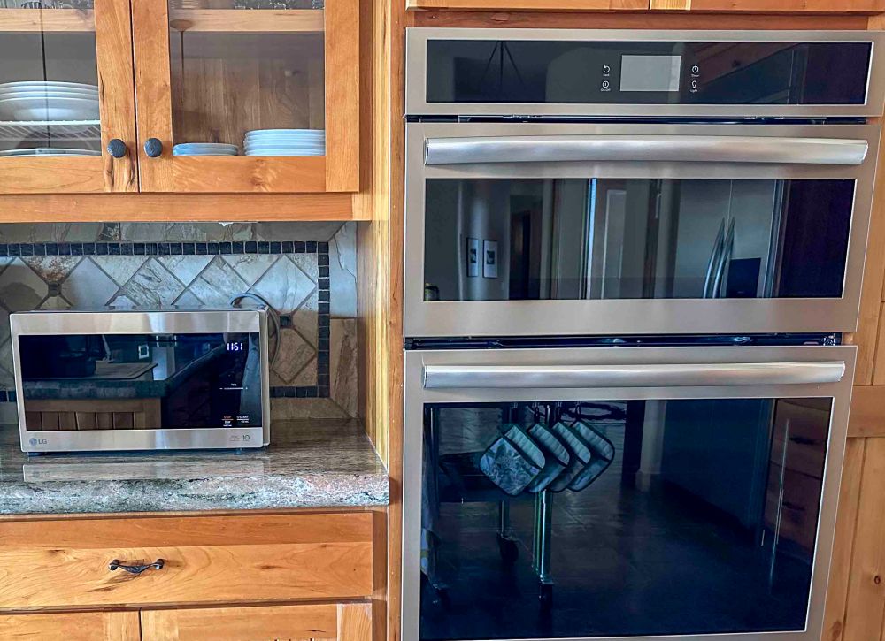
いつまで待たされるのか全く不明なので、ついに一番安そうなレンジを買ってしまいました。便利な物は、私たちに自由な時間を提供してくれるけど、いざ使えなくなると危険です。 We finally bought an inexpensive microwave because we have no idea how long we will have to wait. Modern conveniences provide us with free time, but it is very inconvenient when they are no longer available.
巨大な置物と化したオーブンとレンジ。その横にある、新しく買った小さなレンジ。活躍してくれています。 An oven and microwave that have become huge ornaments. Next to them is a newly bought small microwave. It is working well.
忘れた頃に修理してもらえるようになるのでしょう。ま、これも忍耐力の訓練と受け止めて気長に待ちましょうかね。 The repairman will probably be able to get it repaired when we forget about them. Well, I guess I should take this as another exercise in patience and calmly wait.
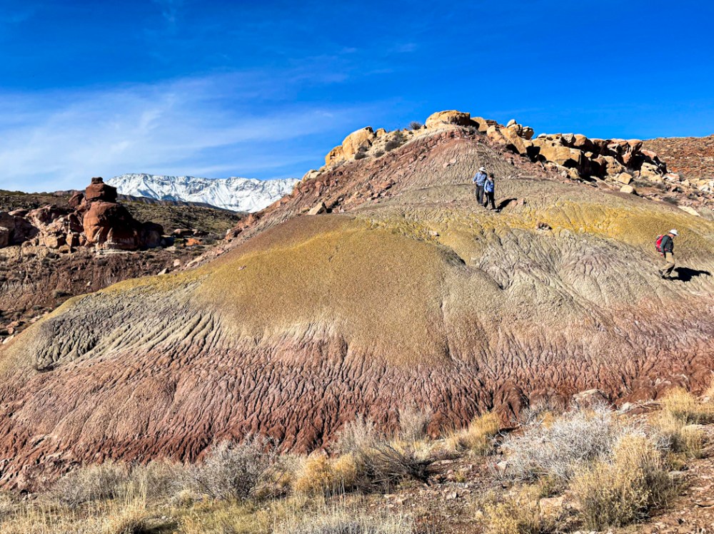
5 km の距離と 183 m の高度差のハイキング。 It was a 3.1 mile hike with 600 feet of elevation change.
距離的には短いんですが、雨が続いたため、滑りやすい10cmぐらいの泥地を歩くハイキングとなりました。 The distance was short, but it became a challenging hike because we needed to walk through thick, slippery, muddy clay as deep as 5 inches. The wet clay stuck to our boots when we picked up our feet. The many days of rain we have had this winter caused the muddy sections.
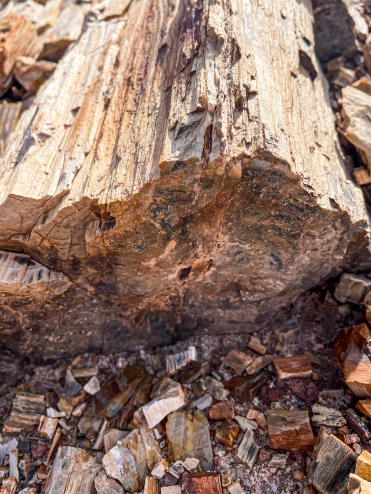
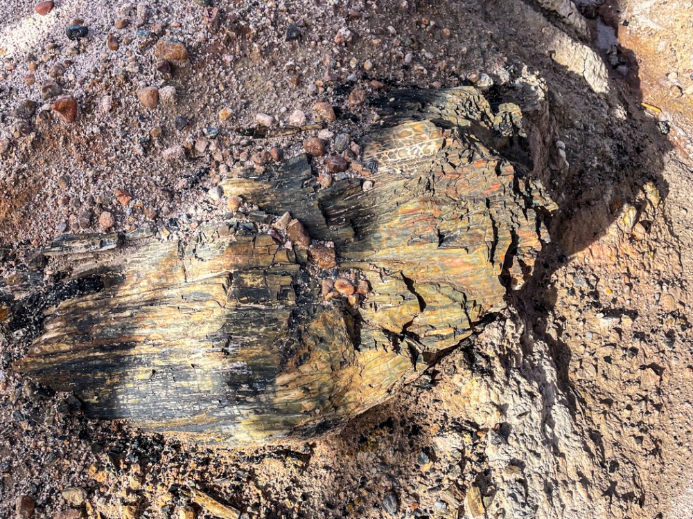
私たちの目的は化石化した木を発見する事でした。 One of the purposes of the hike was to find petrified wood.
木が化石化するということは、木の中にミネラルが浸透し、それが1億年以上経って石になるということです。だから、小さな木片のように見えるものでも、拾ってみるとずっしり重い。 The petrification of a piece of wood means that minerals went in the wood and replaced the wood over 100 million years, so the wood became rock. Therefore, even a small wood chip is quit heavy when you pick it up.
一億年の経過が、その重みになって感じられるようでした。 When I felt the weight of the piece of wood/rock, I had the sensation of holding 100 million years of history right there.
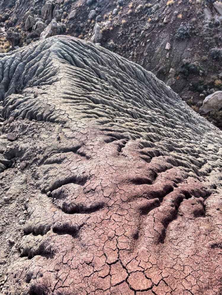
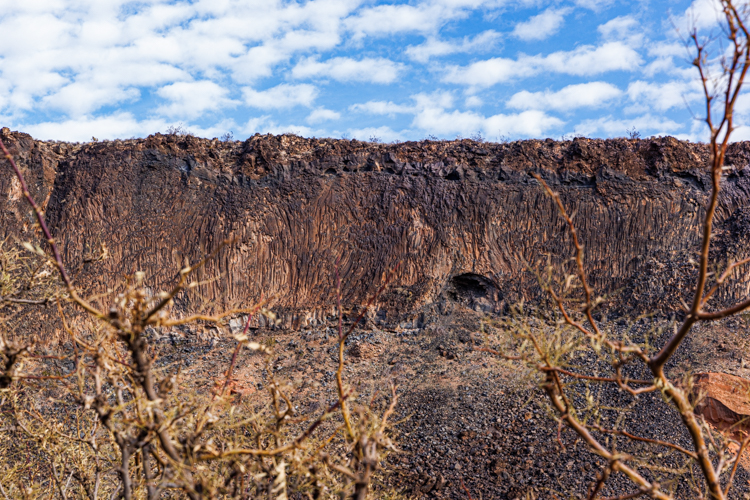
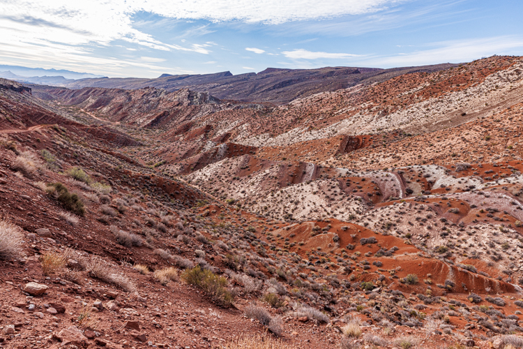
この地帯はかつては海の中であったため、石膏がたくさん地表を覆っていて、光っているました。 The area was under the sea once upon a time. So many gypsum pieces were there on the surface, sparkling in the sunlight.
また、大陸移動が繰り返し起こっていたため、地形は複雑です。 The ground formation of this area is quite complicated because the plates have moved many times.
そんな中を登ったり降りたりしながらの、楽しいハイキングでした。 We walked up and down in this unique place, and thoroughly enjoyed it.
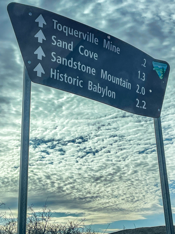
ここがバビロン史跡と言われる理由は、1870年の始めに鉱山があった事から来ています。 It is called “historic” because there was a mine and a mining town named Babylon here at the beginning of 1870.
でも、鉱山跡と言えるものほとんど残っていません。私たちは鉱山があったと思われる場所のすぐ近くを流れるバージン川まで降りてみました。 We didn’t see much of the ruins here, but instead we went down to the Virgin river.
この川はザイオン国立公園内を貫き、渓谷を削りとってきた川として有名です。今は水量がそれほどありませんが、雨の後には水位がぐんと上がるはずです。下の写真、中腹にある棚に砂利が溜まっている事からも水位の変化がわかります。 The Virgin river is known because it carved a deep canyon for millions of years. This canyon was designated Zion National Park.
また、ジュラ紀にはこんな河原の沼地を恐竜達が歩き回っていたに違いありません。 I imagine that dinosaurs roamed this area by the riverside during the Jurassic era.
なぜそんなことが言えるのかって?なぜなら、恐竜の足跡がちゃんと残っているからです。 You may ask me why I can say such thing? I say because the actual dinosaur footprints exist near it.
歩幅は約1メートル。 The stride length is about three feet.
この地層には無数の足跡が残っています。斜めに傾斜した壁に残っている足跡は、その後の大陸移動が激しく何回もあっただろうとも推測させてくれます。 This stratum preserved many footprints very well. And the slanted strata in this area made me guess that many continental movements happened since then.
その後、白亜紀にはこの辺一帯は水面下となります。そんな大きな地球の変化を乗り越えて、今でもしっかりと恐竜の足跡が残っていることに感謝します。 After that, the entire area was under the sea during the Cretaceous era. I am awed by the fact that the footprints still keep their shapes well through all the Earth’s changes.
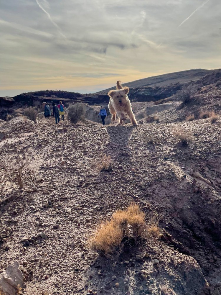
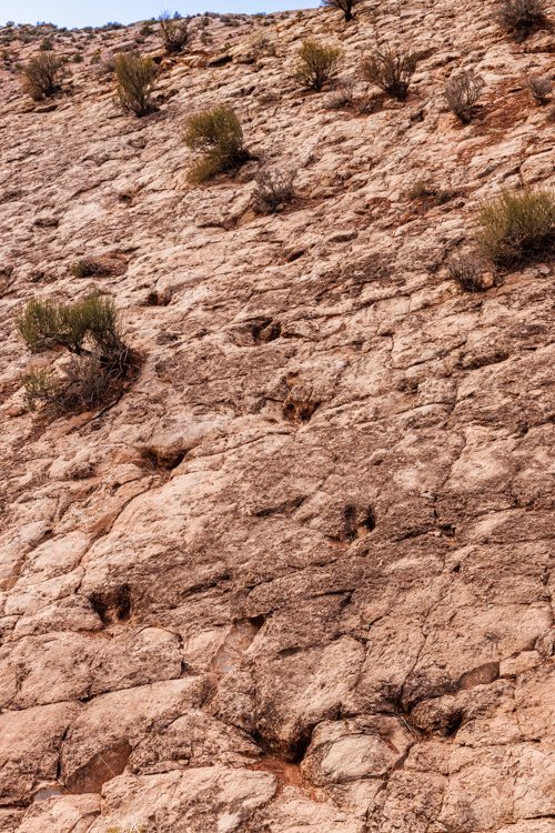
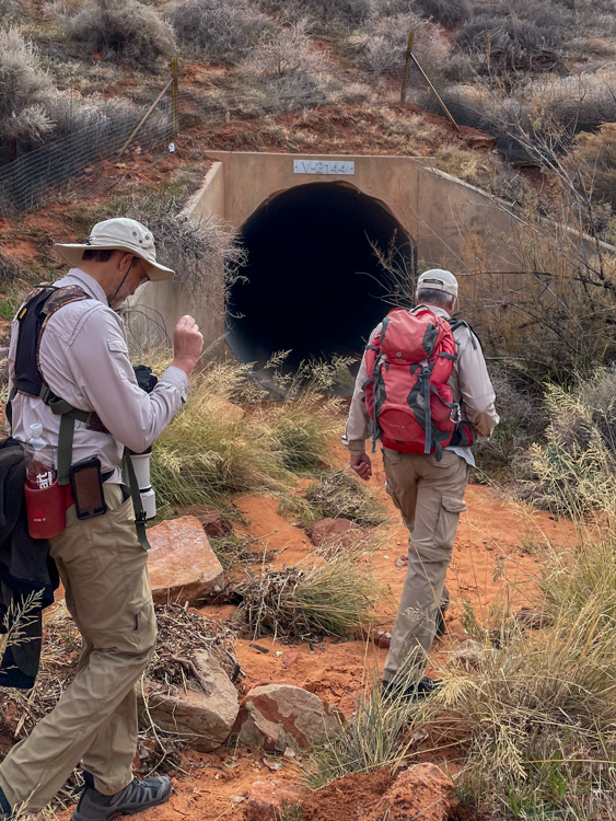
この日は Red Cliff Desert 保護区内で「ニシアメリカフクロウ」が見られと聞いたので行ってきました。ウロウロしたので正確な距離は分かりませんが、7.5kmを主にスパニッシュ ウォッシュに沿って歩きました。We went to Spanish wash in Red Cliff Desert Reserve because we heard that an owl had been seen there. We are not quite sure of the exact distance, but it was about 4.5 miles out and back along the Spanish wash.
まず、長いトンネルを通り抜けます。 We went through the long dark tunnel first.
そして、こんな所をズンズン歩いて行きます。 Then, we went through places like this to get to deeper sections.
フクロウが最初に発見された場所がここです。 This was the place where the owl had first been spotted.
でも、残念ながら、全く姿が見えませんでした。 But we didn’t see any sign of owls there, unfortunately.
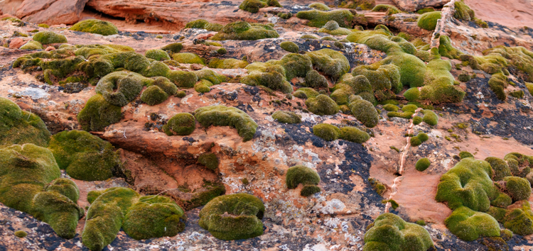
そこで、再びズンズン進んでいくと、周りの丘が夏に比べて緑色になっているのに気がつきました。苔が最近の雨で青々とし始めたんですね。 So we marched on. Then I realized that the hills were greener than before because the moss was greener.
フカフカしています。 It looks so cushiony.
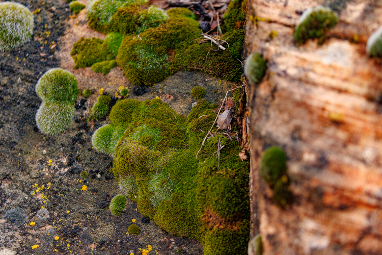
これの写真にも苔が生えているんですが、よく見ると岩の中を突き抜けて伸びているのが見えます。すごい生命力です。きっとこんな根っこがあと100万年もしたら木の化石になっているのかもしれません。 The picture below also shows the moss, but if you look at it closer, you can see a root stretched through the rock. How awesome to see such vitality. I imagine that it will become petrified wood in a million years.
それから更にズンズン進みましたが、フクロウの姿はついに見つけられませんでした。きっと、年末休暇をとっているのでしょう。 We went on a little further in the wash, but couldn’t find any owls. They must have gone on vacation for the end of the year.
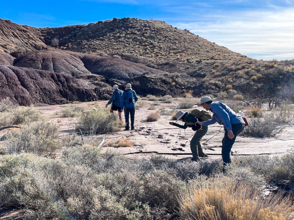
諦めた私たちは、帰途、矢じり探しに集中しました。 So we decided to go back along the same path we came in on, but this time, we focused on looking for arrowheads on the ground.
かつてアメリカ先住民が狩猟のためにたくさん作っていたのでしょう。いくつか発見できました。先端は破れてますが、左端の根元が矢じりであったことを証明してくれます。 I imagine that American indigenous people made many arrowheads for hunting. We found a few. The left side of the sample above indicates that it was an arrowhead, although the tip on the right side was broken off.
ところで、これはなんだと思いますか? By the way, what do you think these are?
美味しそうでしょ? Aren’t they delicious looking?
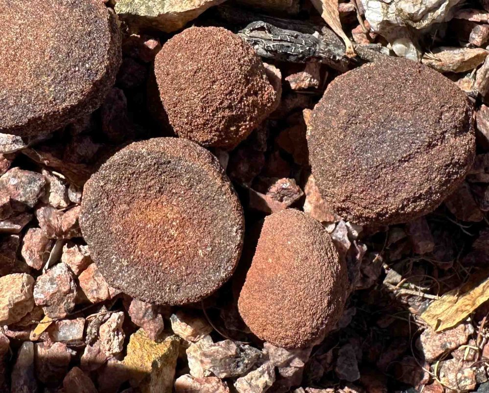
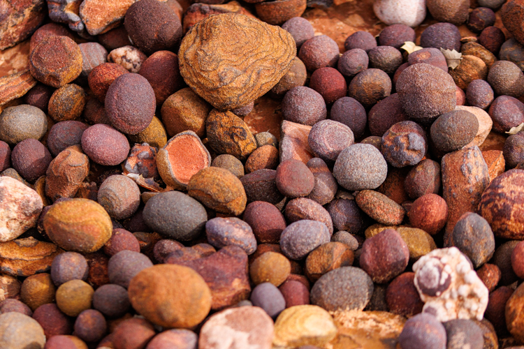
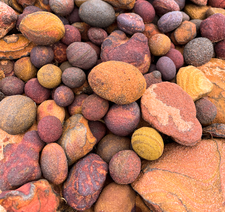
モキマーブルと名付けられているボール状の酸化鉄です。長い年月の後、ナバホ砂岩から鉄分が分離して、鉄が参加することによって赤みを帯び、ボール状になったものです。コンクリーションとも呼ばれています。 They are called “Moqui marbles” or “Moqui balls”. After millions of years, the iron separated from the Navajo sandstone, oxidized, and became a ball. It’s also called a “concretion.”
こちらの写真はモキマーブルがまだ完全に分離されていない段階です。雨が降って水にさらされることにより砂岩の侵食が進むと、ポロリと分離するんですね。面白いです。 The picture below shows a moqui ball that is still attached to the sandstone wall. I can see that rain water eroded some of the sand around it. I wonder how long it will take for this particular ball to come out from the wall as the erosion continues. Isn’t it interesting?
いやいや、こんなことありえないよね?岩壁に見つけたモキマーブルのアパート? At one point, we found a moqui ball apartment. I am sure this was not formed naturally.
水曜日の夜のダンスは必ずしも満足のいくものではありませんでした。 Our dance performance on Wednesday night was far from what we could say “good”.
間違いだらけで、私の大好きなステップも踊ることなく終えてしまったので、少々落ち込みました。 We made many mistakes, and we ended without doing my favorite step. So I was a little depressed afterwards.
でも、ディケンズ フェスティバルの会場でこのゴールドラベルのバルサミコ酢の試食をして、大感激。一気に立ち直りました。食べ物の力は偉大です。 But we found this Balsamic vinegar at the Dickens festival. I tasted a sample of it. OMG, I recovered from the depression immediately. It’s the power of this food.
さすがイタリアから輸入された25年ものです。コクのある味にイチコロです。早く友人を招待してカプレーゼにトロトロとかけてワインと共にじっくり味わいたい。 It’s balsamic aged for 25 years from Italy. I loved the mature and deep flavor. I am looking forward to inviting friends over to enjoy it on top of Caprese salad with wine.