Monthly Archives: February 2023

Hike 10: ピナクルズループ Pinnacles Loop


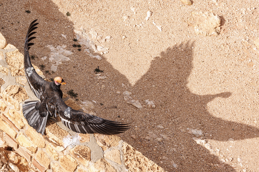
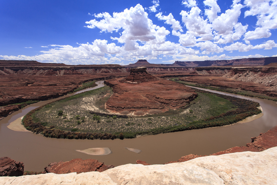
距離は10km、325mの標高差、アリゾナ州のバレーオブファイヤー州立公園内のピナクルズループは今回で2度目ですが、雨が降ったばかりのためか、景色がとても違って見えました。6.2 miles with 1,066 feet total climbing. We have been here once before, but Pinnacles loop at Valley of Fire in Arizona looked different. The rain the day before might be why.

歩き始めて程なく見えてくる景色。 This is the sight you could see after a short hike of half an hour or so.

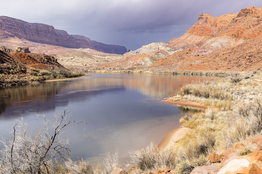
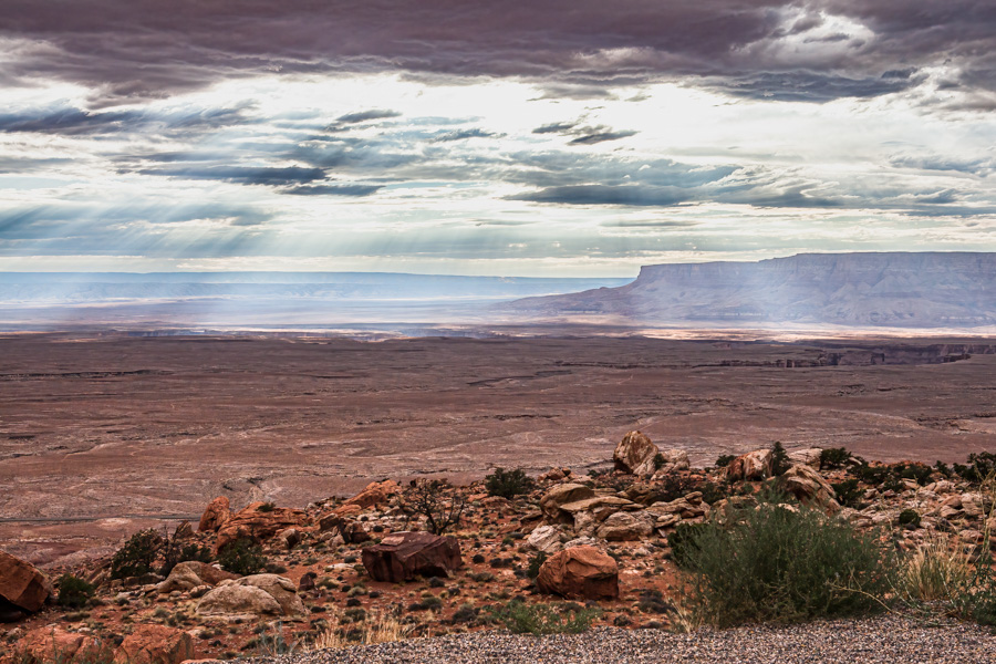
もう、っこの日の目的は終わり、帰っても良いと思えるほどの絶景。 It was such a stunning view that I could have just gone home after seeing that.

実際、ほとんどの人たちが、この先に足を踏み入れません。 In fact, most visitors to the park stop right there and don’t go any farther.

なぜなら、その先はトレイルもないし、荒野があるだけだからです。 It’s because there is only wilderness beyond there without any trail.

私たちは、本当にラッキーです。なぜなら、私たちのハイクリーダーのジョンは私たちだけでは絶対行けない所まで連れて行ってくれるからです。 We are really lucky to have our hike leader. He could take us places where we could never get to on our own.

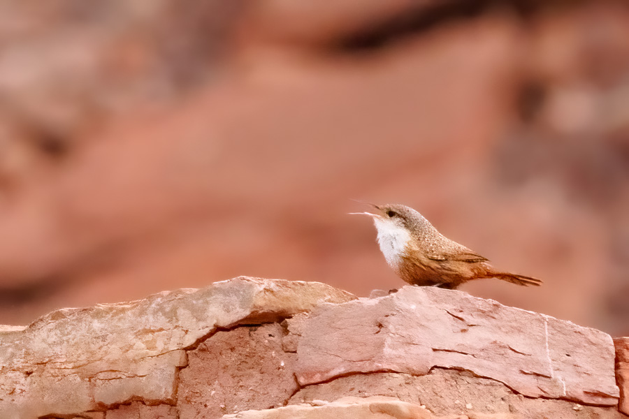
ハイクリーダーのジョンはチェスターという犬をよく連れてきます。Our hike leader, John, takes Chester out often on our hikes.

彼の大家さんの犬ですが、彼の犬のように懐いています。私たちも彼のリードに従って歩くので、チェスターのようにジョンに懐いていると言えないこともありません。 Chester is John’s landlord’s dog, but he is attached to John and follows him everywhere. Come to think of it, we also trust John and follow John’s instruction. Are we attached to John like dogs?

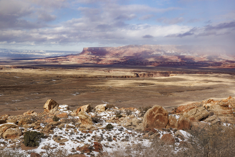
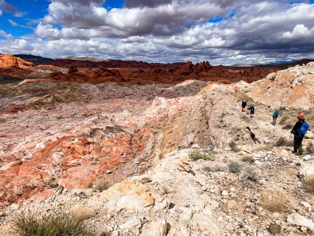
目指すは、ピナクルズと名付けられた場所。ギザギザの岩山が中央、奥に見えます。 Our destination was the Pinnacles where the pointy peaks are in the picture below.

迫ってきました。 It’s getting closer.

雨上がりなので、水たまりがたくさんあり、避けながら進むので、さすがのジョンも四つ這いになって崖の横を進みました。 Even John needed to get down on all fours. The recent rain created many ponds and we had to work our way around them.

ピナクルの真っ只中、景色は最高で、どのショットを見直しても捨て難いものばかりです。 All my shots from the Pinnacles are so good that it was very difficult to choose which to include in this blog.

こんな所まで来られたのが嘘のようです。 It’s hard to believe that we made it there.

ピナクルを通り抜け切る前にランチ休憩。 We had a short lunch break before leaving the Pinnacles.

ピナクルの向こう側の景色は再び変わり、赤い岩肌が見えてきます。 The other side of the Pinnacles had different views. It changed to red rocks.

雄大な自然、これこそがアメリカのアセットです。 Majestic great nature, it’s one of the greatest assets of America.

満足のハイク、ハイクリーダーに感謝、自然に感謝、私達の健康にも感謝です。 I was quite satisfied with the hike, and thankful for our hike leader, nature, and our health.

寒い! It’s So Cold!


春が近いと思っていたら、寒い日が続きます。  I thought Spring is so close, but it went back to cold winter days.

窓ガラスにまで氷が張り付いて、びっくり。でも、なんだか良い感じ。 I was shocked to see that ice was on the window glass. but it’s kind of nice.

アラレのような雪と風で、外に出られません。 We couldn’t go out because it was icy, snowy, and windy.

翌朝、外を見たらMVロックの前の丘に雪が積もっていました。 When I saw outside our bedroom the next morning, there was snow at the hill leading up to MV Rock.

わーい、球形の飾りの上にも雪が積もって、帽子をかぶっているみたい。 How cute it is to see snow on top of the sphere ornament in the backyard. It’s like it has a snow cap on it.

もう溶け始めていますが、バレルサボテンの上にも雪が残ってました。 It mostly melted away already, but a small amount of snow was still on top of the barrel cactus.

こんな天候なのでピックルボールの練習も中止となっています。こういう時はフィットネスセンターに行けば良いのですが、なぜかゲームにハマっています。 Because of this weather, our pickleball practice was cancelled. I could go to our fitness center, but for some reason, I am quite addicted to a video game now and stay inside all day.

明日はハイキングの予定です。明日天気になーれ! We have a hike scheduled tomorrow. Let’s hope it will be a nice day tomorrow!

レッドクリフ ギャラリー Red Cliff Gallery


先日、レッドクリフ ギャラリー(ユタ州南部のアート協会)でコンテストの発表会がありました。 We went to a reception and award ceremony held by Southern Utah Art Guild at Red Cliff Gallery the other day.

テーマは「光を捉える」でした。 The theme was “Capturing the Light”.

なぜ私たちがその会場にいたかというと、バンちゃんもコンテストに参加していたからです。We were there because Banchan entered his pictures for the photography category.

発表の前、作品を見て回りながら、特に目を引くものが何点かありました。We walked through the gallery to see other artists’ pieces before the announcement. A few pieces caught my eyes especially.

この方の作品はテキスタイル部門で優勝しています。キルトですが、全体的に完成していて、ダントツに素晴らしく、優勝してもおかしくない作品でした。 This piece was awarded the 1st place in the textile category. I must say it is fully integrated as an art work, and no room for any question, it was the winner.

また、賞は貰わなかったものの、私が気に入った水彩画が以下です。 同じような構図で写真を撮っている私としては、彼女の光を扱う水彩画技術に感心しました。 The water color painting below didn’t receive any prize, but I liked it. It was because I took a picture with similar composition. I was quite moved by the light handling in the picture with water color.

こちらは、写真部門で優勝した方の写真です。私が唯一バンちゃんの競争相手になる作品だと思った写真、2枚です。分かりにくいですが、優勝したのは右の写真、冬のイエローストーン、バッファローに光が差している所。 I thought the only competitor to Banchan was the person who took the pictures below. The top two pieces were one notch up from other photographic prints. And indeed, the picture on the top-right was awarded 1st place in photography. It’s at Yellowstone National Park in winter. Light came through the clouds and striking the bison on a stormy day (my imagination).

その他の写真はそれほど目を引くものではなく、上の写真には勝てなくても、きっとバンちゃんは入賞できると思っていました。 Other photographic prints weren’t as good. So I thought Banchan had a good chance to win either 2nd or 3rd.

そして、初参加、写真部門で3位に入賞しました。パチパチパチ! And he did. His picture was awarded 3rd place in photography for the first time entry. Yeah!!!

Hike 9: ゾウのアーチへ To Elephant Arch


14.5kmと距離もあり、標高差915m、しかも山道もない場所、難易度の高いハイキングでしたが、景色は最高でした。 The total hiking distance was 9 miles, 3000 feet altitude changes, and mostly off-trail. The difficulty level of the hike was was hard, but the view was incredible.

ヤントフラットからスタートから1時間後の景色です。 After walking from the Yant flat trailhead for one hour, the view opened before us like this.

これから先の場所を確認しています。 The hike leader explained to us the rough direction where we were heading.

ここから岩壁を降り、登り、そしてまた登りと繰り返しました。 We then went up and down, and up and down the rocky wall.

蜘蛛のように四つ這いになってよじ登り、ズルズルとお尻で降りてくるような場所でした。 We crawled up on the rock literally like spiders, and slid down with our butts.

日陰で見た鮮やかでビロードのような苔。真夏は茶色っぽいのに、水をもらうと復活するレザレクションモスです。 I saw vivid and gorgeous velvety moss at shady rocks. It’s resurrection moss. Although they look brownish when dry, they become like this once they get water.

日向ではすでに1cmしかない野草が咲いていました。真夏の暑い時には冬眠ならぬ、夏眠をするのでしょうか。 I saw these tiny flowers already blooming under the sun. I wonder if they hibernate during the hot summer?

超えてきた場所を振り返ります。あの巨岩群を超えてきたのかと思うと、感無量です。 This is the view of the rocky mountains where we walked through. An intense feeling of fulfillment came to me while looking back at them.

さて、ここからです。半分以上歩いたものの、ここからが難所でした。溶岩石の間を降りていくのは、このハイクの中で一番苦しく、また危険な場所でした。Now, the toughest part of the hike started from here at the last one third of the entire walk. It was the most dangerous part of the hike going through the lava rocks especially since we were quite tired already.

そして、7時間後、ようやく見えたゾウのアーチです。そこから駐車場までは40分ぐらい。 Here is Elephant Arch that we wanted to see. After 7 hours of hiking, we could see it, but it took only 40 minutes to get to the parking lot from there.

ドライブ時間も含めると、朝7時半から夜7時半までかかったハイキング。さすがに疲れてしまい、その夜はぐっすり眠ることができました。 We left home at 7:30 am and got back home at 7:30pm. What a hike it was. As expected, we were so tired and slept very well that night.

Hike 8: 仮想ハイク Virtual Hike


フィットネスセンターのトレッドミルは優れものです。 The treadmill at our fitness center is a wise machine.

自分でワークアウトを作ることが出来ます。そこで、さっそく作ってみました。 One of the features allows you to make your own workout. So I tried it.

コロブキャニオンズでハイキングができなかったので、そこを歩きたい。スタート地点と終了地点を地図上に入力すると、私のワークアウトが本当にできちゃいました。 My workout was in Kolob Canyons because we couldn’t hike there the other day. By entering the starting point and ending point on the map I could make my own workout that simulates this hiking course. Wow!

写真も可能な限り映し出してくれて、傾斜もコースに沿って作ってくれる。 It gave me images along the course. Not everywhere, but at some points along the route.

そうそう、去年このキャンプ場まで歩いて、引き返したんです。 My memory came back. We hiked up to the campground at the bend on the map below last year.

ここから先は未知の世界。ルンルンと歩いていら、55分を切った時点でクールダウンになってしまいました。 I don’t know beyond that point, it is an unknown world. I was so happy with this cool feature of the treadmill, but it suddenly switched to cooldown mode when it reached 55 minutes.

「優れ物」を撤回、かなり残念です。 I was so disappointed. I will take back my word, “wise machine”.

仕方がないので、もう一度やり直しました。 I tried to continue the course, but couldn’t. So I started it again reluctantly.

今度はテレビを見ながら走ったり、歩いたりのインターバルをしました。This time, I did walking and running intervals while watching TV.

コロブアーチまで7マイルm、11.25kmです。それを往復するので14マイル。この日のトレッドミルを4回繰り返すと完了する事になります。でも、実際は6-10時間だと言われています。標高2000メートル以上の場所ですから、それを考慮すると、走れませんよね。 It’s 7 miles to get to Kolob Arch, which is our goal. And the round trip is 14 miles. If I repeat the same workout 4 times, I could get to the arch and come back based on my calculation. But it’s been said it takes 6 -10 hours. The real trail is above 7000 feet. I guess we can’t run there like I do here at 3000 feet.

仮想ハイクは、行きたくてもいけない場所でハイキングの擬似体験をさせてくれます。1時間以内で歩ける距離なら、楽しいでしょう。 It’s fun exercising with a virtual hike if you can make a course finishing in less than one hour, especially at the places where you want to go, but you can’t.

Hike 7: 氷の橋 Ice Bridges


週末、今年7番目のハイキングをするためにザイオン国立公園のコロブキャニオンズ地区に行きました。  We went to Kolob Canyons district of Zion National Park last weekend to do the 7th hike of this year.

雪と氷を全く予想していなかったので、トレイル入口で断念しました。標高2000m以上はまだ冬。アイゼンやストックを持って行けば、さぞかし楽しいハイクができたことでしょう。 We didn’t even think about ice and snow, but there it was. So we gave up at the trail entrance as we didn’t bring crampons and hiking sticks. The elevation, over 7,000 ft, was still very much in winter.

車で65kmも走ってきたので諦めきれず、近くの町のスプリングクリークというトレイルに向かいました。 We felt we had to do some hike since we drove 40 miles to get there. So went to near-by Spring Creek trail.

比較的平らなので、多少の登りや下りはあっても、気をつけて歩けば雪道も怖くないと思ったからです。 We thought the snow covered trail wasn’t that bad as long as we walked carefully because the trail was rather flat.

しばら歩いていくと、一歩踏み込んだ時の靴音が違うのに気づきました。 We noticed that the sound from under our boots was different after a while.

これは、もしかして、いや、まさに、小川の上を歩いていた!!! We were possibly… let me rephrase it, we were absolutely walking on a river!!!

橋の上を歩くと聞こえる太鼓を叩くような音。気がついたら、小川のせせらぎが聞こえていました。氷の橋だ! The sound I heard was very similar to the sound that we could hear when we walk on a bridge. Then, I noticed the sound of the creek. It was an ice bridge!

さらにいつくかの小さな氷の橋を渡り、気分も爽やかでしたが、1.5kmぐらい歩いた所でガリー(深い谷)に遭遇し、断念しました。 I felt so good walking on the snow and crossing a few more ice bridges. But then, we needed to give up at 1 mile because a deep gully full of thick mud was ahead of us.

10kmぐらい歩きたいと思っていたのに、3kmしか歩けませんでした。でも、初めて氷の橋を渡ることができたから、ラッキー。 We wanted to hike longer than 6 miles, but it was only less than 2 miles. But that’s all right. We could walk over ice bridges which I have never done before!

最近の技術 Tech These Days


私だけが浦島太郎なんでしょうか。最近驚いた技術の発達を2点ご紹介します。 I don’t know if I am the only one who didn’t know this, but I was so excited when I found out about these technological developments recently.

一つ目は、クラブハウスのトレッドミルです。今年からマシンが一斉に更新され、まだ2回しか行ってないんですが、驚きの発見をしました。 The first item is a new treadmill I found at our clubhouse. Our club brought in entirely new machines at the beginning of this year, and one of the machines I use the most is the treadmill. I used the new one only twice, so I may discover more features later, but my finding was revolutionary to me.

今までのトレッドミルは「フラット」から、「登り坂」の動きはありましたが、ひとつ欠けていたことがありました。それは「下り坂」です。-3度から+30までの上下をコントロールできるんです。 All treadmills I used in the past had only from “flat” to “uphill”. That’s fine, but the new machine includes a new feature, “downhill”. The tilt range is from -3 to +30.

しかも、自分専用の扇風機まで付いていて、そのコントロールまでできちゃう。 On top of that, it has a fan built in which you can control.

他のマシンも最新テク満載なようで、ぜひ試してみたい。 New features and technology comes with other machines, too. I will be so busy trying them out.

2番目は、昨日、歯医者さんに行った時に発見した事です。 The second discovery was at my dentist’s office.

虫歯に新しいクラウンを乗せる作業の為に行きました。 I went there to get a new crown to replace one that broke.

昔はインプレッションを作るために巨大ガムみたいな物を詰め込まれて型を取る作業が入っていたんですが、最近の技術は違います。 I had a similar procedure five years ago at a different dentist. At that time, he still used a gigantic gum to get an impression from my tooth. But my new dentist I visited yesterday used a totally different technology.

レーザーです。アシスタントが細長い棒のようもので歯の表面を捉え、それがディジタル化されて、3D映像としてモニターに映し出されます。 It was a laser technology. His assistant used a device to record my tooth and surrounding surfaces, and the result came out on a monitor simultaneously in 3D.

話はまだ終わりません。口を開けていたので、うまくコミュニケーションが取れませんでしたが、ディジタル化されたものが、そのままクラウンを作る会社に送られるそうです。 The story didn’t end there. I couldn’t communicate well with my dentist because I needed to keep my mouth open, but he said that the digitized image would be sent out to the crown making company, and they will make my crown accordingly.

更に、歯医者さんのオフィスにも3Dプリンターもすでにあり、30分でクラウンができてしまうという事です。使えないこともないけど、まだテストしている段階だそうです。 And even more, he told me that he already has a 3D printer which can handle making crowns. He also said that it takes 30 minutes to make it, but he doesn’t use it yet because he wants to test it more before he applies it for real use.

こんな医療技術の進歩は、とても嬉しい。 I love this kind of improvement in the medical field.

動く石 Moving Rocks


石が動いてもいい。 It’s OK for a rock to move.

石が競争してもいい。 It’s OK for rocks to race.

ここはデスバレー国立公園内のレーストラックプラヤです。(プラヤとは一時的に水が溜まる広い平野のこと) This is Racetrack playa in Death Valley National Park.

たどり着くまで大変な労力がかかるので、あまり観光客は訪れません。私たちが訪れたのは4月でしたがすでに猛暑で、平野内は、石と、バンちゃんと私だけでした。 It’s rare to see many people there because it takes a long time and a lot of effort to get there. It was April when we visited, but it was already very hot. And there were only Banchan, myself, and the rocks at the playa.

去年から続いているハードディスク内の写真の整理は、まだ続いています。 I started organizing Hard Disks, mainly the pictures in them, from the end of last year, and I am still working on it.

目下2012年を整理しているところですが、忘れ去られていた石の写真を見つけたので、ご紹介します。 I am reviewing pictures from 2012 now, and found the forgotten rock pictures.

当然ですが、石は自分の意思では動きませんが、それでも動く。長い間の謎でしたが、最近、研究者の努力の結果、原因が解明されました。 No doubt that rocks won’t move by their own will, but they still move. It was one puzzle we haven’t solved for a long time, but it was recently solved by a researcher.

リサーチャーがついに突き止めた方法と結果が以下のYouTubeビデオで理解できます。(英語版ですが、よかったらどうぞ。) The YouTube video linked below explains it well.

How Rocks Move @ YouTube

リーズ フェリー Lee’s Ferry


ナバホ橋を過ぎると、すぐ、リーズフェリーへの道があります。 Once you cross the Navajo bridge, you will find a sign pointing to Lee’s Ferry road on the right.

ジョン ドイル リーさんが始めたコロラド川を渡る唯一のフェリーサービスがあった場所なので、リーさんの名前がついてる場所です。19世紀半ばから20世紀初めまで賑わっていたようです。 It was the one and only ferry boat ride service station to cross the Colorado river once upon a time and operated from the mid 19th century to the beginning of the 20th century. It’s called “Lee’s Ferry” because Mr. John Doyle Lee started it.

今では、シーズン中に川下りをしたり、魚釣りをしたりする観光客で賑わっているようです。私たちはシーズンオフに訪れたので、人はせいぜい2-3人歩いていたくらいで、静かでした。Now, it’s a popular place as a starting point for rafting and fishing on the Colorado river. It was off-season when we visited there, so we saw only 2-3 other people. It was very quiet.

川の水がとても綺麗なのに驚きます。 We were amazed at how clean and transparent the water was.

そして、とにかく美しい。 And it was so pretty.

私たちは川縁を往復3kmほど歩きました。時間があったらもっと、もっと歩いていたい場所でした。 We hiked 2 miles round trip along a trail by the river. But I can assure you that you want to keep walking, or sit somewhere to gaze at the river for a long, long time.

生憎、雨がポツリポツリと降ってきていました。 Unfortunately, rain drops started falling.

駐車場に戻ってきた時のことです。そんなに遠くない場所から、鳥の鳴き声が聞こえてきました。しかも、私がずーっと撮りたかった鳥の鳴き声です。その名をムナジロミソサザイと言います。 Then, it happened. I heard a bird was calling. and it was not just any bird, but the bird I always wanted to capture in my camera for a long time yet hadn’t succeeded. It was a Canyon Wren.

帰りの雪道を心配しているバンちゃんに「10分だけ待って!」と頼んで、鳴き声を頼りに追いかけました。 Banchan was anxious to drive out of there quickly because it should be snowing on the road ahead of us at the high elevations. I told him, “give me 10 minutes!” and started chasing the calling sound.

10gぐらいしかない小さな鳥で、すばしっこい。しかも曇り空。 苦戦しました。Canyon Wrens are so tiny, only weighing about 0.5 oz, and agile. Thick clouds covered the sky. It was very difficult to get a good picture.

でも、なんとか撮れました。初めてカメラに収められて大満足です。 But in the end, I could capture three decent shots, for the first time, of this bird. I am happy with them, for now.

ホクホクと温かい気持ちで寒い雪の降る道を走り、家に帰りました。 The Canyon Wren made my heart so warm, and we drove through the cold snowy road back home.

マーブルキャニオン Marble Canyon


アリゾナ州のマーブルキャニオンはかの有名な公園、グランドキャニオン国立公園の東にあります。コロラド川が中心を流れ両地域を繋いでいます。Marble canyon in Arizona is east of the famous park, Grand Canyon National Park.

以下の写真はペイジの町から渓谷に降りていく途中で撮りました。 The image below is from a place on the way down to Marble canyon.

10年前の7月、同じような場所から撮った一枚。何も変わってない事に安堵します。 The image below is from the same place but I took it 10 years ago, in July, 2012. I am so happy to see that nothing has changed since then.

マーブルキャニオンに行くには国道89号線から国道89A号線に入ります。89A号線の歴史を読むと、89A号線は、もともと89号線だったようです。でも、1960年に新しく走りやすい新ルートの89号線ができてたので、旧道は名前を変更して、89A号線になったという事です。 To get to Marble Canyon, you take US 89A from US 89. The summarized history says that 89A was the original 89 until a new route was built in 1960. Since then, the old route was renamed to US 89A.

89A号線は147km と距離的には短いですが、グランドキャニオン国立公園の北口へ入る道やバーミリオンクリフ、マーブルキャニオンも含めて、魅力的な所が満載の道です。 US 89A is short, it runs only 91.7 miles, but it is quite an attractive road including the entrance to get to the north rim of Grand Canyon National Park, Vermilion Cliff, Marble Canyon, etc.

渓谷に降り切るとコロラド川にかかるナバホ橋があります。橋自体は大したことはないのですが、有名な訪問者が出入りする事で有名です。 When you get down to the canyon, you will find the Navajo bridge over the Colorado river. The bridge itself is not so special, but it is known because a famous character often visits there.

私たちが訪れた時も、「おや?あれは・・・?」 “Oh? What is that?” We saw them when we visited there, too.

老人夫婦かと思ったら、カリフォルニア コンドルでした。コンドルが好んでくる場所なので、コンドルを見るために観光客が集まります。 They were California condors, although I thought it was an old couple at first. They like the bridge and often stay there for a long time, so it attracts tourists.

エメラルド色の川を眺めて何を話しているのでしょうか。I wonder what they are talking about as they look down at the emerald colored river.

寒そうです。 It looked so cold.

コンドル スポッターのページによると、これはR8。まだ7歳のオスです。 According to the Condor spotter website, this is R8, a 7 year old male.

こちらはL3。11歳のメスです。 This is L3, an 11 year old female.

そして、もう一羽、58。18歳のオスです。 And one more condor, the name is 58, is an 18 year old male.

コンドルの頭の色は、黒か灰色からスタートして、7年ぐらいで成長し切ると58のようにピンク色の禿頭になります。 The color of the condor head is black when it is young. When it grows fully in about 7 years, it changes to pink like the head of 58.

R8の頭と比べると、歳の差がわかります。R8はちょうど成長し切ろうとしている時なんですね。それにしても禿頭とは対照的に暖かそうな襟巻きですね。 We can see some differences compare to 58 and R8. R8 is just about the age to be a fully grown condor. I see a few black spots on R8’s head. In any case, their scarves look so warm compared to their bald heads.

60年ぐらい生きるということなので、昔の人間の寿命と同じぐらいです。ということは、彼らの鳥生はまだ始まったばかりです。 Condors live about 60 years, about the same as a human life span once upon a time. It means that these birds’ lives have just begun.

マーブルキャニオンにはもう一つの見どころがあります。それは、明日書きます。 There is one more interesting thing in Marble Canyon to see. I will write about that tomorrow.

Hike 6: エヌーペテス トレイル Enepitsi trail


注:「エヌーペテス」は南パイユート族の言語で、「幽霊」という意味だそうです。かつてパイユート族はこの地域に住んでいて、この場所に深く関わっていたとされています。

Note: “Enepitsi” (pronounced e’noo petes) means “ghost” in the Southern Paiute language. Ancestral Puebloans and Southern Paiutes lived in this area and are closely connected to the land.

サンタクララ川沿いを歩く、6.5km ほどの短いハイクでした。 It was a short hike of 4 miles walking along the Santa Clara river.

ハイクリーダーが寝坊してしまったので、リーダーなしで出発しました。 We started the hike without our hike leader because he overslept.

道がわからず歩いていくと、川にぶつかり、先に進めません。 At one point, the trail split and we weren’t quite sure which path to take. So we went left, but ended up hitting the river and couldn’t go any farther.

引き返して別ルートを歩いていくと、石に刻まれたペトログリフを発見した時には安堵しました。 ペトログリフを発見するのが目的でしたから。So we went back to the split and took the path to the right instead. When we found petroglyphs on rocks, I was so relieved because one of the purposes of the hike was to see some petroglyphs.

このトレイルの名前が「幽霊」なので、それにまつわる絵が刻まれているのでしょうか。 I wonder if any images related to “ghosts” were there because of the name of the trail.

やはりコースを知っているリーダーの存在は偉大だと思いました。 I thought the presence of the hike leader who knows the trail is indeed important.

ホースシューベンド Horseshoe Bend


ペイジから少し南下した所に、コロラド川の馬蹄形をした場所が見下ろせる展望所があります。 The viewpoint of the Colorado river’s Horseshoe Bend was about 5 minutes south of Page.

24mmレンズで撮りました。16mmがあったらもっと余裕を持って撮れたことでしょう。 I used a 24mm lens. If I had 16mm, it would be a little easier to capture it.

流石に有名な観光スポットなので、寒い中でも10-20人ぐらいの観光客がきていました。全員がいなくなったと思ったら、なんと、T-レックスが写真家の指示に従って、ポーズをとっていました。 It’s a well known tourist spot. Even though it was a cold day, I saw 10-20 people walking on the path to the viewpoint. I wanted to take pictures after all the people left, so I waited a little. Then I found a T-Rex posing at the edge of a rock following a photographer’s request.

もちろん、着ぐるみを着ているだけですが、面白い発想です。 Of course, it was only a person wearing a T-Rex suit. But I thought the idea was interesting.

バンちゃんも色々な角度から撮っていました。 Banchan was also taking pictures from many different angles.

私は、高所は苦手なので、崖の淵に寝そべって撮りました。(写真はばんちゃん提供) I did, too, but lying down on the ground at the edge of the cliff because I am afraid of the height. (Below photo was taken by Banchan.)

小雨が降る曇り日でしたが、朝日が雲間から顔を出し、岩壁の上部に光を刺してきました。川面に反射して、綺麗でした。 It was a cloudy day with light sprinkles, but the morning light came down through the tiny break of the clouds, and lit the top of the rocks. It reflected very well on the surface of the water.

ところで、私たちは、10年前、キャニオンランド国立公園のホワイトリム巡りをしました。ここはコロラド川とグリーン川が南端で合流する場所です。7月の暑さが厳しい時、4日間かけてオフロードの道を走りました。グリーン川サイドにある馬蹄形のある場所に歩いていきましたが、そんな季節に訪れるの狂気の沙汰なので、当然、私たち以外、誰もいませんでした。 By the way, we visited White-rim road in Canyonlands national park 10 years ago. The south end was the place where the Colorado river and the Green river meet. We spent 4 days off-road to go around the White rim. It was mid July, the ridiculously hot season, but we walked to the edge of Green river’s horseshoe bend. We were the only people crazy enough to be there and didn’t see anyone else, needless to say.

こちらは16mmレンズでも収まりきらない程大きなものでした。 I used a 16mm lens for the picture below, but still couldn’t completely capture it.