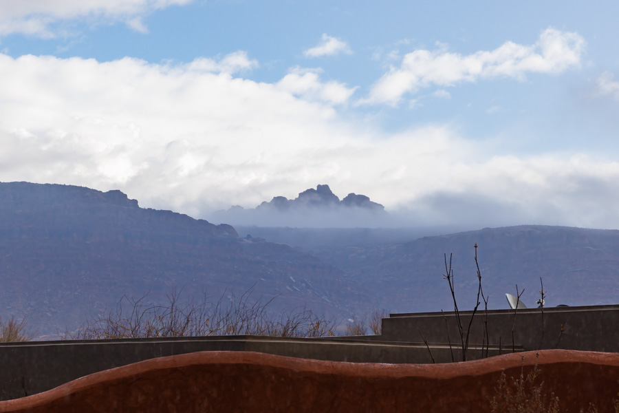
ヘアカットの帰り道、久しぶりに見た、晴れの景色。 This is a view I saw on the way back home from a haircut. It’s been a long time since seeing such a nice view as the rainy days continued.
この地域では、雨が3月の終わりまで降り続いていることは、とても珍しいことらしい。 Many people said that it’s very unusual in this region for the rains to continue until the end of March.
パインバレーマウンテンを後ろに、MVロックが嬉しそうだ。 MV Rock looks happy with the Pine Valley Mountains behind him.
今日の午後は何をしようかな。 Let me see… what shall I do this afternoon?
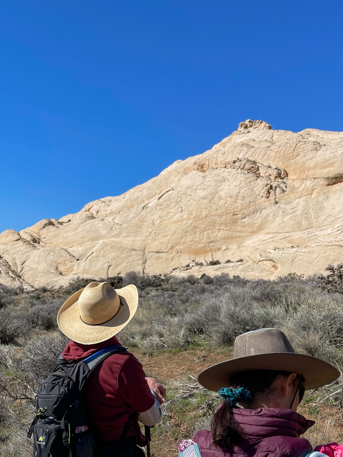
スノーキャニオン州立公園は、私の大好きな場所です。この日はその中にあるホワイトロックの一番高い場所、トップオブザワールドロックに登りました。 Snow Canyon State Park is one of my favorite places. We climbed the highest point of the White Rocks called which we called “Top of the World” on the day of the hike.
雨が降り続いていたので至る所に水溜りができていました。 It had been raining so hard the past few days that there were puddles of water everywhere.
巨大な亀の甲羅のようなナバホ砂岩の上を、慎重に慎重に歩いてドンドン高度を上げました。 We walked carefully and cautiously over Navajo sandstone that looked like the shell of a giant turtle, and gained altitude rather quickly.
目指す頂上が見えてきました。 The summit we were aiming for was now in sight.
最後の登りの前、眺めはすでに最高です。 Before the final climb, the view was already great.
ハイーダーのジムの写真。私も一番手前に入ってます。 Photo credit: Jim, the hike leader. I am at the very right.
でも、この岩場はとりわけ慎重に歩きました。 We were especially careful on the final rocky area.
これが頂上からの眺めです。 This is the view from the top.
狭いので、立つのもちょっと怖いほどでしたが、ハイクリーダーのジムはロッククライマーなのでマウンテンゴートのように軽やかに歩いてました。 It was so narrow at the top that it was scary to stand on for me, but Jim, the hike leader, is a rock climber, so he walked like a mountain goat.
平地に戻ってからトップオブザワールドロックを見上げ、「よくやったね!」と、自分を褒めてあげました。 When we got back to level ground, I looked up at the Top of the World Rock. I said, “You did great!” praising myself.
距離は6kmぐらいしかありませんでしたが、一歩一歩慎重に歩いたので、時間がかかりました。 The distance was only about 3.7 miles, but it took a long time because we walked carefully step by step.
雨あがりの後のハイキング、気持ちよかったです。 It was a nice hike after the rain.
トレッドミルを使った仮想登山です。テヘッ! This is a virtual hike with a treadmill. Why not?!
私の使っているトレッドミルのプログラムは、富士宮ルートを歩きます。4.3kmを7回に分け、1回分を20分から25分ぐらいにしています。 The treadmill program I use lets me walk the Fujinomiya route, which is 4.3 km divided into 7 parts, each part lasting about 20 to 25 minutes.
私は、2日間に分けて登頂完了しました。
パート1のスタート画面の写真を撮り損ったので、その代わりにこ結果画面です。 I forgot to take a picture of the start screen of part 1, so here is the result screen instead.
歩きはじめということもあり、上りがなだらかで、ちょっと気抜けしてしまいました。だからスピードをアップして歩きました。 Since it was the beginning of the walk, the uphill was gentle and I was a bit disappointed. So I changed to a faster speed.
パート2のスタートの画面。 Screen shot of the start of part 2.
パート2になると、突然勾配が30%と急上昇し、トレッドミルの上を歩くのもちょっと危ない程になりました。ここがバーチャルのいいところで、自分で勾配を変えられます。20%から10%、最後の方では8%ぐらいで歩いてました。 In part 2, the gradient suddenly spiked to 30%, making it a bit dangerous to walk on the treadmill. This is the nice thing about virtual, you can change the gradient yourself, from 20% to 10%, and towards the end I was walking at about 8%.
パート3。 Part 3.
パート3でも高度をたくさん稼いだことになります。 I gained a lot of virtual altitude in part 3. This is actually the case for parts 2 to the end.
わかったことは、時間が一定なので、スピードを上げても早く着く訳ではなく、距離を稼ぐだけだということです。だからスピードも勾配もプログラム通りにしておく方がいいです。 What I found out is that since the time is constant, increasing the speed will not get you there faster, it will only increase the distance. So it is better to keep both speed and gradient as programmed.
多くの人たちは、富士宮ルートの5合目から頂上までの4.3kmを4-5時間ぐらいで登るらしいです。標高が 2,400m から 3,776m まであるので早く歩くわけにはいかないんですね。 Most people climb the Fujinomiya route from the fifth station to the top, a distance of 4.3 km, in about 4-5 hours. The altitude ranges from 2,400 to 3,776 meters, so it is not possible for a normal person to walk fast.
もう20年以上前のことですが、私も富士山頂まで息子と二人で登りました。このルートではなかったと思いますが、二人とも高山病になってしまい、下山するまで苦しみました。 More than 20 years ago, my son and I hiked to the top. I don’t think it was this route, but we both got altitude sickness and suffered until we descended.
—
二日目。残りのパート4から7までを歩き、無事、頂上に立つ事ができました。へへッ! Second day. I walked the remaining parts 4 to 7 and successfully made it to the top. Grin.
パート4。Part 4.
このパートでも高度を稼ぎましたが、トレッドミルの勾配数を変えずに歩いてみました。 I gained altitude again in this part, but walked without changing the default gradient on the treadmill this day.
パート5のスタート。 Part 5.
勾配が30%もあると、それだけで汗ダラダラになります。 With a slope of 30%, it is enough to make you sweat a lot.
結構疲れてきていたためか、パート6のスタート画面を撮り忘れました。 Perhaps because I was getting quite tired, I forgot to take a picture of the start screen for part 6.
パート7のスタート。 Part 7.
頂上の火口近くなので、ここまでくると登りはそれほどなくなりました。 Since I was near the crater at the summit, there was not much more climbing to do up here.
30%の急勾配を歩いている最中に、「エベレストでも目指してるの?」なんて言われました。 As I was walking up the steep 30% grade, someone asked me, “Are you aiming for Mount Everest?”
アイディアいただきです。次回はエベレストに挑戦もできる! Thank you for the idea. Next time I can try for Everest!
雨が降る日には、仮想登山、楽しいです。 On rainy days, it’s fun to do a virtual hike.
日暮れを待って、近くの丘、私たちのMVロックのある丘からタートルウォールをぐるりと回って帰ってくる、6.5kmの道をご近所さん達と歩きました。 We waited for nightfall and walked with our neighbors on a 4 mile loop trail heading up to our MV rock, around the Turtle Wall and back.
暗くなってから月が出るまでの15分程度の時間は、ご近所さん達との情報交換をしました。 After dark and before moonrise, we spent about 15 minutes getting to know our neighbors.
この写真は友人提供です。This photo is courtesy of a friend.
近所を歩き回る事があまりないので、すぐ近くなのに知らなかった隣人とも話す事ができました。 Since I don’t often walk around the neighborhood, I was able to talk to neighbors I didn’t know even though they were right around the corner.
月を撮るのは難しい。 It is difficult to photograph the moon.
暗い山道をヘッドランプで歩くのは初めてです。楽しい思い出になりました。 This is the first time for me to walk on a dark mountain trail with a headlamp. It was a fun memory.
ネバダ州のゴールドビュート国定公園には、面白い場所がぎっしり満載です。You can find so many interesting places to visit at Nevada’s Gold Butte National Monument.
12kmほどのハイキング。巨岩群の中にはペトログリフがびっしりと隠されていました。It was a 7.5 mile round trip hike. So many petroglyphs were hidden in the giant rocks.
巨岩を登ったり降りたりすると、次から次へとペトログリフが見つかります。 As we climbed up and down the huge rocks, we found one petroglyph after another.
ほとんどの物は意味不明ですが、逆さまに描かれている物は、死んでいることを意味しているそうです。 Most of the meanings are still unknown, but an object drawn upside down is said to mean that it is dead.
ほとんどの物は線画ですが、2点だけ、塗りつぶすように描かれていました。足のように見えます。 Most of the objects were line drawings, but I found only two drawings that were filled in like in the picture below. It looks like a foot to me.
ペトログリフは勿論見る価値ありですが、その周りの景色も最高です。 The petroglyphs are no doubt worth seeing, but the surrounding scenery is also excellent.
ここはリトルフィンランドと呼ばれています。 This place is called Little finland.
いつものことですが、自然の創造物は不思議で、その美しさにはかなわないと思い知らされます。 As always, I am reminded that nature’s creations are wondrous, and that there is no substitute for their beauty.