Monthly Archives: March 2022

Hike 13: Snow Canyon Overlook


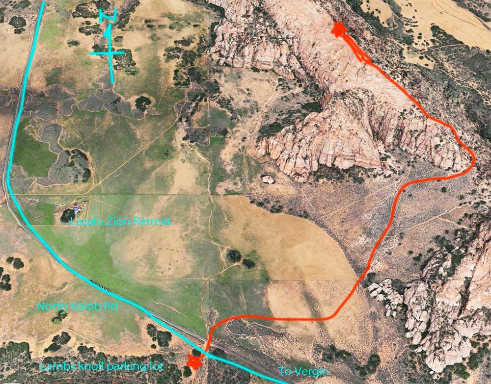
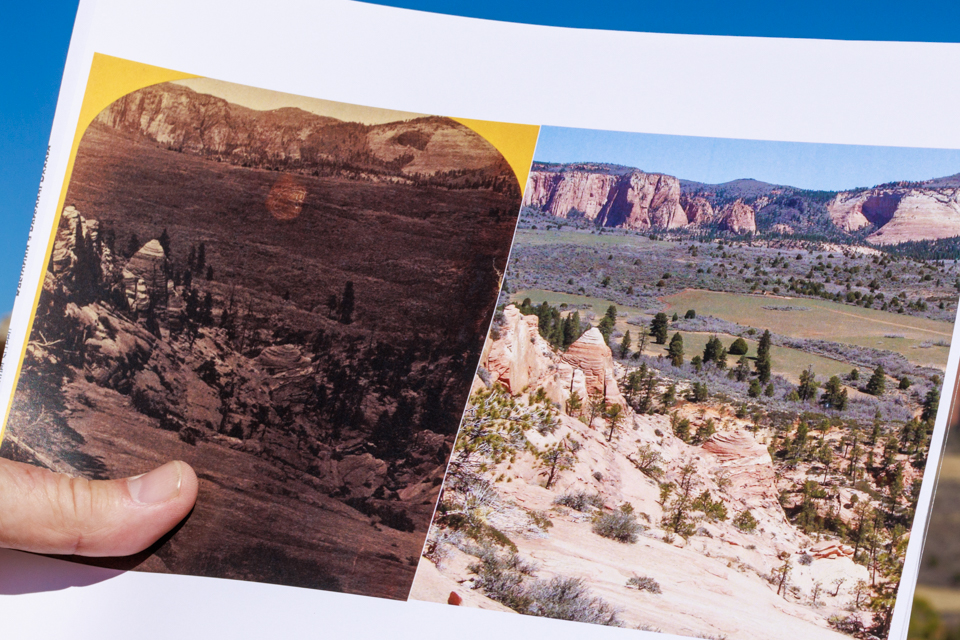
久しぶりにスノーキャニオンを見渡せる場所に行きました。往復8.5kmのハイキングです。It is 5.3 miles round trip to Snow Canyon Overlook.

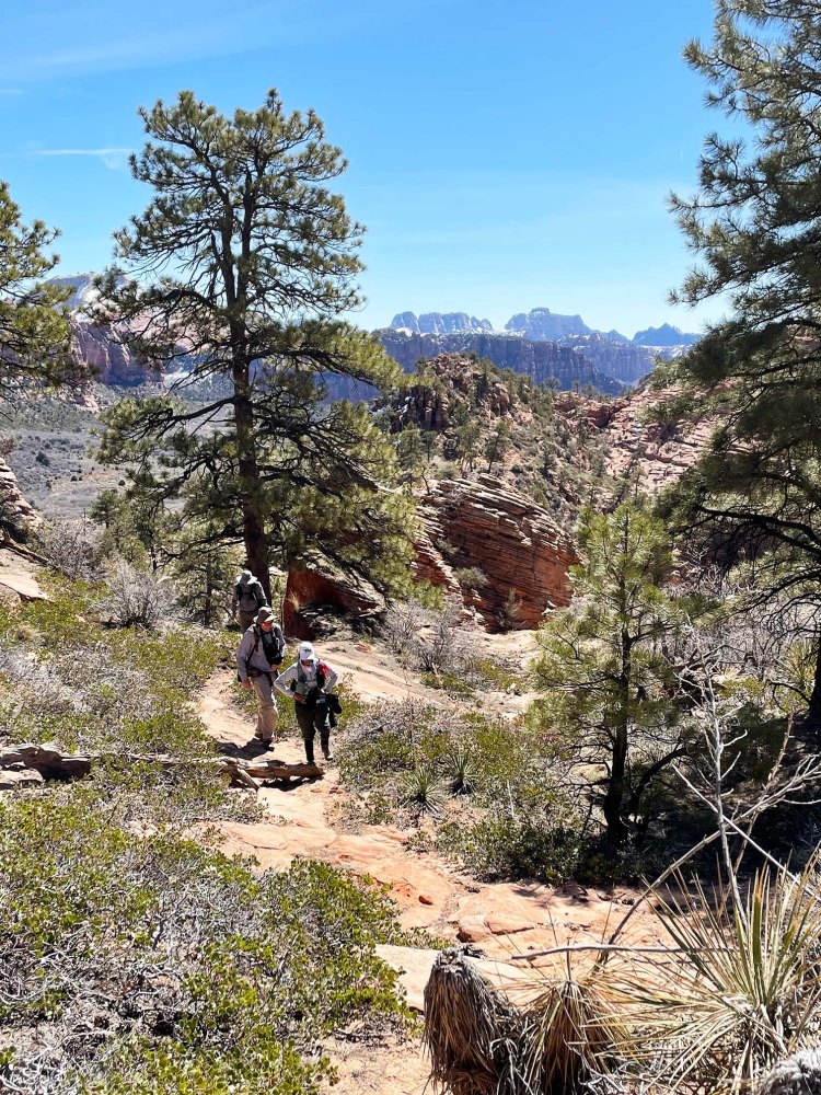
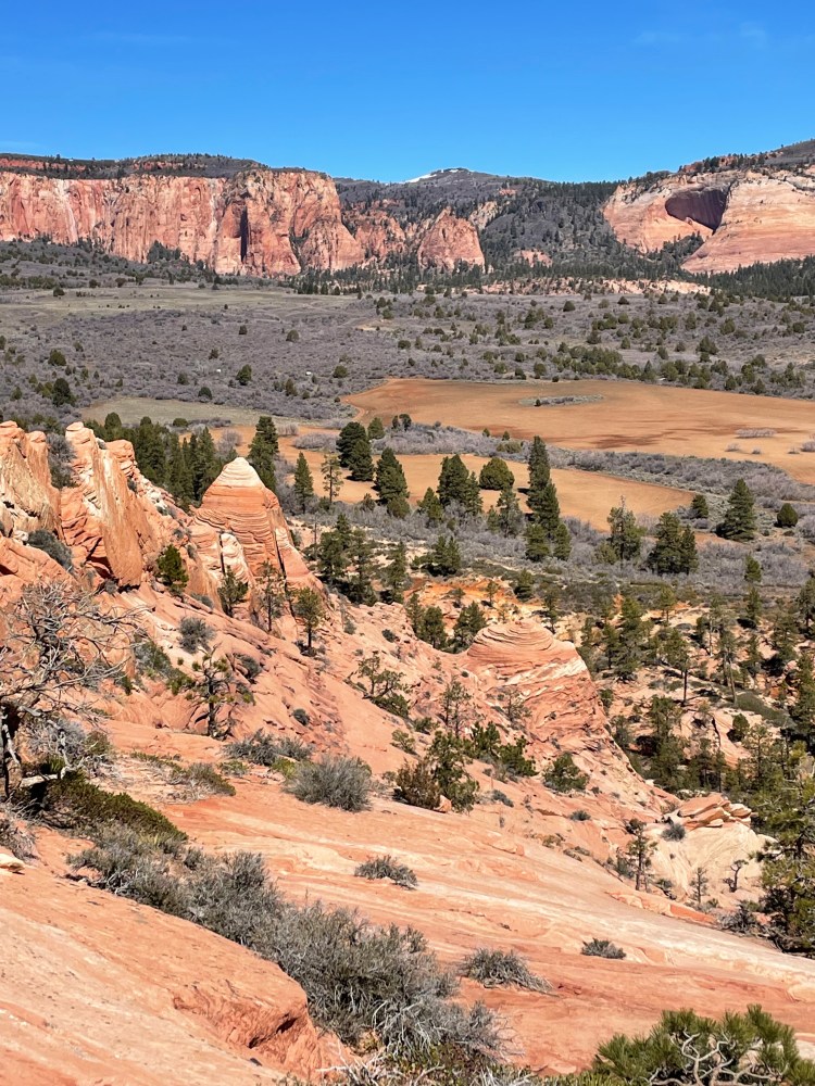
長い石がゴロゴロしている山道を登ってきて、突然、目の前に広がるこの景色はいつみても息をのみます。After a long rocky uphill, the view that suddenly spreads out in front of you makes everyone speechless.

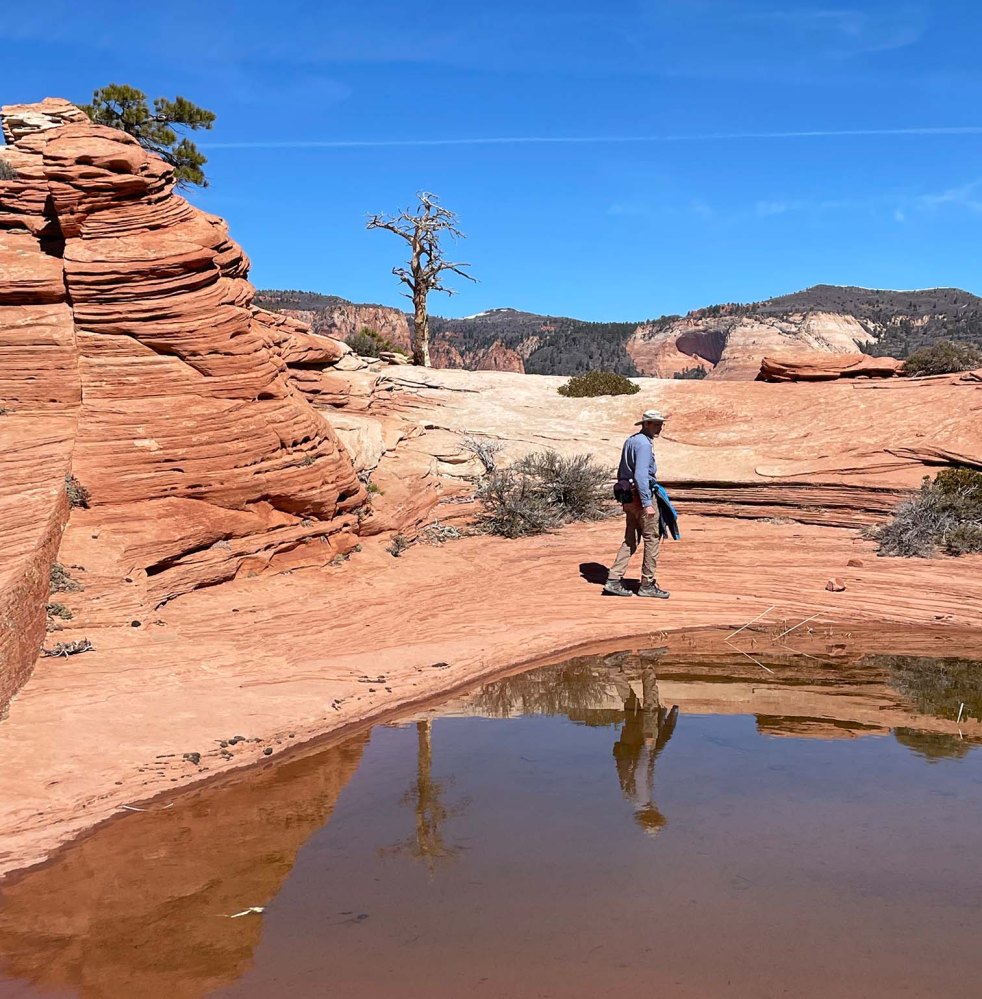
今日は800mmの超ロングレンズを持ってきました。鳥の巣を撮りたかったからです。でも、一生懸命岩肌を舐めるように見回しても一つも見つかりませんでした。We brought 800mm long lenses today because we wanted to capture any bird’s nest. I carefully went through all walls in the canyon, but found nothing.

諦めて後ろの岩を見上げると、I gave up and looked up at the rock behind me, and noticed the top of the rock was white.

てっぺんが白い。これは鳥のフンです。鳥の種類は分かりませんが、ここが一番高い場所ですから鳥が好んで止まる見張り場所になっているようです。 It must be bird’s poop! It’s the highest place around here. I don’t know what kind of bird it could be, but surely it liked to use that spot as a look-out place.

しばらく待っていましたが、誰も飛んで来てくれませんでした。We waited there for a while, but no birds flew over, so we gave up.

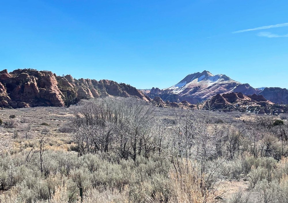
ここから見えるパインバレー山脈。北側にはまだ雪が積もっていて、冬の名残を感じさせてくれます。 We could see the Pine Valley Mountains from there. The snow on the north side of the hill made me feel cold.

でも、この高度の高い場所にも確実に春はやってきています。But, I know Spring is coming even here at such a high altitude. See?

ここにも、And here,

ここにも。 And here!

わー、もう少しでブーケになりそう。 This one is spreading a bunch of flower stems. It’s almost there to be a beautiful bouquet.

子犬 Puppy


ダンスの先生の家に1匹の子犬が来ました。まだ産まれてから1ヶ月半ぐらいの時です。 A puppy has come to our dance teacher’s house. He was one and a half months old when they brought him home.

まだ目が離せず、ダンススタジオに連れてきてくれました。He needed attention all the time then. Our dance teacher even brought him to the studio often.

その後も数回、見る度にグンと大きくなっている成長のスピードに驚きます。I am so amazed by the speed of his grouth. I can see the changes every time I see him.

犬はなぜ靴が好きなんでしょうか? Why do dogs like shoes?

だんだん抱き上げるのも難しくなってきました。 It’s getting harder to pick up and hold him.

私のダンス靴なんですけど。。My dance shoe…!

体重が増えたこともありますが、じっとしていないのが1番の理由でしょうか。 It’s because he is bigger and heavier, but also he simply doesn’t stay still at all.

3ヶ月が経ち、もう、「お座り」や「お手」などはできるようになりました。 Three months have passed, and he can do “sit” and “shake hand” now.

5K: 温度 Temperature


昨日の朝、近所を走ってみた。結果は38分16秒。自己ベストタイム! I ran around our neighborhood yesterday. The result was surprising: My best time! It was 38 minutes 16 seconds.

先週の金曜日に同じルートを走ったときの結果。42分近い。 I ran the same route last Friday, but it took nearly 42 minutes.

この差は断然、気温です。午前中の17度の気持ちいい時と、午後の一番暑かった29度の時との違いは歴然です。 What caused the difference? It is so clear that the temperature difference impacted my stamina. Yesterday was a comfortable 64F in the morning, but last Friday was a hot 84F in the afternoon.

レースの日まで、あと1ヶ月。やはり早起きして走ろう。It’s exactly one more month to go until the race day. I should start running early in the day.

Hike 12: Pushing Tin Loop


7.2km の面白い名前の道、”Pushing Tin” という道をぐるりと回って帰ってくるハイキングでした。The Pushing Tin loop is a 4.5 mile easy trail.

なぜか飛行機が次から次へと飛んでいました。We didn’t know why, but many airplanes were flying over us one after the other.

それがこの道の名前の由来になったのでしょうか。飛行機をアルミ缶に見立てて、どんどん押し込んでいく(飛ばしていく)管制官たちを描いた”Pushing Tin”という映画もあります。でも、誰も本当の理由は分かりません。 Someone said that that could be the reason for the name of the trail. There is a movie, “Pushing Tin“. It is about air traffic controllers at an airport. Their job is to push tins (airplanes) one after the other. But no one knows the true origin of the name.

タンブルウィードはコロコロと転がって、どこに行くのか考えたことがありますか? Have you ever thought about where tumbleweeds go after tumbling around?

赤ちゃんサボテンの赤い実。鳥の食べ物になるのでしょうか。We found a baby cactus with red fruits. Could they be food for birds?

春の朝、楽しい会話で一杯のハイキングでした。One spring morning, we had a conversation full of fun while we hiked.

Hike 11: Toe trail


Toe Trail は往復 5.8km 無理しないで歩ける、平らなトレイルです。 The Toe Trail is a flat and easy 3.6 mile trail.

毎日バスルームの窓から見えるレッドロックの麓を歩きます。 As you can see in the picture below, it’s very flat. Part of the trail runs right next to the bottom of the Red Rock which we see from our bathroom window everyday.

こちらが窓からの眺め。 This is the window view.

このレッドロックは二つの地層からできています。上層部がナバホ砂岩地層で、下層部がケヤンタ地層です。すごく分かりやすいですよね。 The Red Rock consists of two parts. The upper part is Navajo sandstone and the bottom is the Kayenta formation. Isn’t it easy to see the differences?

暖かくなってきたので、トカゲとかヘビとかに出会えるかなと期待しましたが、見られませんでした。でも、小鳥のさえずりが至る所から聞こえていました。それだけでも清々しかったです。 As it’s a little warmer these days, we hoped to see some lizards or snakes, but we didn’t see them. Instead, we heard little birds singing from the side of trail, and that made us feel so uplifted.

5K: ペース Pace


家の近くを走ってみました。 I ran around our neighborhood two days ago.

後で結果を見てみると、そんなに悪くないですね。でも、このペースを再現できるんでしょうか。トレッドミルなら自分でペースを調整することができますが、外を走る時はそれができない。 The result was pretty good. But I am not sure if I can reproduce the same pace again. When I run on a treadmill, I can control the pace but not when I run outside.

どうやったら、自分のペースを確立して、維持できるんでしょうか。 How can I establish my own pace and maintain it?

Hike 10: Shinob Kibe


Shinob Kibe は ハリケン断層ラインに立つ小高い丘です。登って降りて来ると2.5 km ほどなので、1時間もあれば帰って来られますが、興味深い歴史物が残っているので2時間ぐらい時間をかけたい。Shinob Kibe is a small mesa standing along the line of Hurricane fault. The distance is only about 1.5 miles round trip, so it takes only one hour or so. However, I recommend to spend two hours because there are interesting historical objects.

遺跡 1:”Medicine wheel“、「神聖な環」と訳しておきます。150年前に北米先住民族のパイユート部族の信仰、世界観の具現化された物です。 Historic Ruin 1: you can find a “Medicine wheel” made by Southern Paiute people around 150 years ago.

草が生い茂ってしまい、よく分かりません。ハイキングリーダーの後に私まで写っていますが、そこを中心に4-6本の線が伸びて円を描いています。ここでどんな儀式が行われていたのでしょうか。I couldn’t recognize it until our hike leader pointed it out, because plants covered the rocks in places. In the picture above, our hike leader and myself are standing at the center of the wheel. From there, lines of rocks are laid out to make a large wheel. I am now curious what kind of ceremony was held there.

遺跡 2:航空用の矢印。頂上にはコンクリートでできた大きな矢印があります。1926年にロスアンジェルスからソルトレイクシティ間のエアメールサービスが開始されました。その時に パイロットが迷子にならないように10マイル(約16km)ごとに同じ矢印が設置されました。かつては航空塔があり、そこから無数のランプを灯して光を放っていたそうです。詳しい事は、このサイトをご覧ください。 Historic Ruin 2: An Aviation Navigation Arrow is on top of the mesa. The air mail service between Los Angeles and Salt Lake City started in 1926. An arrow like this was placed every 10 miles all the way to Salt Lake to help guide the pilots. An aviation tower holding a very bright rotating beacon stood in the center of the arrow to indicate the location of the arrow in bad weather. Look at this site for the detail.

こうして歴史の勉強をして丘を下ってきたのですが、反対側の斜面の麓を見ると、なんか見覚えがあるような景色なんですね。 I was so happy learning two new historical facts before coming down the mesa. On the way to the bottom, I found something familiar at the bottom of the hill in front of me.

これはもしかして、私の5Kレースのコースかもしれない。Could it be my 5K race course?

家に帰って地図を見たら、やっぱりそうでした。バージン川を挟んで向こう側の遊歩道を走るんですね! I confirmed the course after coming back home. I will run the walking path on the other side of Virgin river!

5K: やり直し Do Over


膝の痛みを緩和するために、マッサージを始めました。とりわけ友人が教えてくれた膝に効くツボを重点的にしています。一週間継続して結果を見てみます。 I have started to massage my legs by myself to ease my knee pain. The focus is the pressure points for the knees which my friend taught me the other day. Let’s see how well it works, at least for a week or so.

その間、頑張らないで走ります。もう一度、最初からやり直してみよう。 In the meantime, I ran again, but with an easy pace. Let me start all over again.

引き出しの整理 Organizing Drawers


宅配サービスの箱で箱を作りました。I made organizer boxes out of delivery service boxes.

箱に合う色の中敷きも作りました。I also made liners for them with matching colors.

全部バスルームの引き出しの中に収まりました。All these boxes fit into my bathroom drawers.

整理整頓大好きです。毎日使う様々な小物が使いやすくなりました。I love organizing things. It became so much easier to use the little things I use everyday with these organizer boxes.

オオアオサギの観察 Observation Of Great Blue Heron


ビデオ1:サンタクララ川の向こう側、オオアオサギの群生地です。99%の場合、こんな風景です。Video 1: By the Santa Clara river, we can see Great Blue Herons. And it looks something like this 99% of the time.

ビデオ2:そして辛抱強く待った甲斐ありで、突然興奮状態が始まります。Video 2: But then, excitement suddenly starts after patiently waiting.

ビデオ3:もしもラッキーなら、0.01%の確率でこんなシーンが見られます。春ですから。(音量にご注意下さい。) Video 3: If you are extremely lucky, you could see something like this, perhaps 0.01% of the time. It’s because it’s Spring now. (Please control the volume of the sound. It may be too loud.)

Hike 9: North Of Kolob


名前のない岩の山。North Kolob Rd 沿いのLambs knollの駐車場に車を停めて、歩き出しました。往復、約8kmのハイキングでした。 It was about a 5 mile hike to an unnamed rock and back. We started walking from the parking lot of Lambs Knoll by North Kolob Road.

ザイオン国立公園のエンジェルズランディングに行く予定でしたが、修復作業の為、閉鎖されていました。それよりも何よりも、公園の入口前の道で1.5時間も待ってもまだ入れなかったので、断念しました。 We planned to hike up to Angel’s Landing In Zion NP but we gave up because it was closed for maintenance. Besides that, we couldn’t even get to the entrance gate. None of us knew that Spring break started yesterday in Utah. No wonder so many kids and cars were there.

その後、バージンの街まで戻り、そこからコロブテラスに向かう道を北上しました。 We waited for 1.5 hours in the line, but made a U-turn back to the town of Vergin, then went up north on North Kolob road.

Lambs Knollの駐車場から South Guardian Angelが見えます。

Lambs Knoll の岩場の駐車場から草原を越え、無名の岩山を登ります。From Lambs Knoll parking lot, we went up to an unnamed rock.

目指したのは、1872年に初めてここを訪れた写真家が撮った風景です。どこから撮ったのかわからないので、同じような風景の場所を探すしかありません。What we looked for was the same scenery that was a photographer, Jack Hiller, captured in his photograph in 1872. No one knows from where he took it, so we just had to guess about the location by comparing the scene in front of our eyes with his photo.

マッチする風景の一つ。 The same scene Jack Hiller used for one of his picture.

ここです!わーい!まさにジャック ヒラーさんが撮った場所です。This was it. This was one of the locations he had chosen.

左が。ジャックさんの写真。Jack’s picture on the left.

1870年代の写真現像プロセスの詳しいことは分かりませんが、写真を撮ってから15分以内に完了していなければいけなかったらしく、その為には水が必要だったらしいです。ラッキーなことに、この崖の上に小さな水場を発見した彼らは、予想外にたくさん写真を撮れたという話が残っています。 I don’t know well about the history of the development process around the 1870’s. But I was told that it had to be processed within 15 minutes, and water was one of the key materials they needed to use. Fortunately, they found a pool of water at the top of the rock, so they could take more pictures than they expected.

ジャックさんが現像に使った水場。 The same water pool Jack used in1872 was still there.

Hike 8: La Verkin Creek Trail


8km の緩やかなハイキングコースでした。It was an easy 5 mile long trail.

ラバーキンク川の横には溶岩の崖がそびえ立っています。High cliffs of lava rocks are standing right next to the La Verkin Creek.

その崖の窪みには無数のツバメの巣がありました。We found many swallow’s nests on the wall cavities.

グループの年齢層は広くて、20歳代から70歳代まで。それでも一緒に歩いていると楽しい。みんな子供になっちゃうんでしょうか。ハイキングの魅力の一つです。The age range of our hiking group is very wide, from 20’s to 70’s. But we could enjoy being together while walking. I think that is one of nice things about going for a hike in a group.