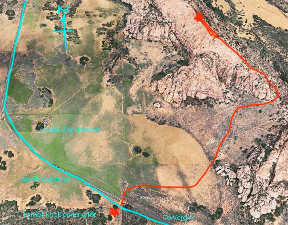
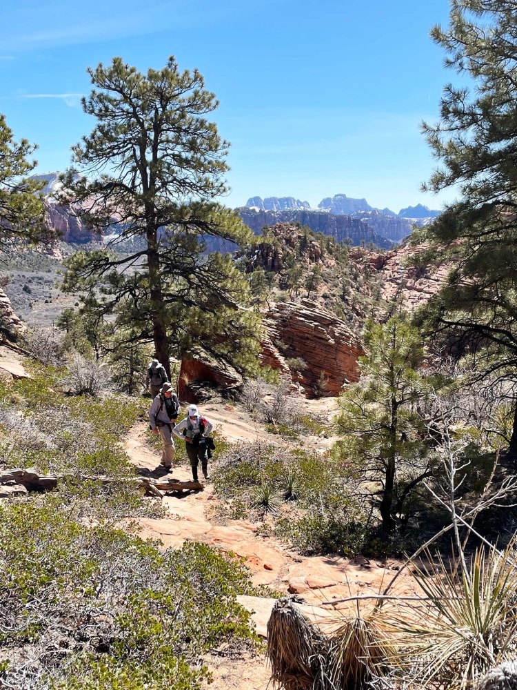
名前のない岩の山。North Kolob Rd 沿いのLambs knollの駐車場に車を停めて、歩き出しました。往復、約8kmのハイキングでした。 It was about a 5 mile hike to an unnamed rock and back. We started walking from the parking lot of Lambs Knoll by North Kolob Road.
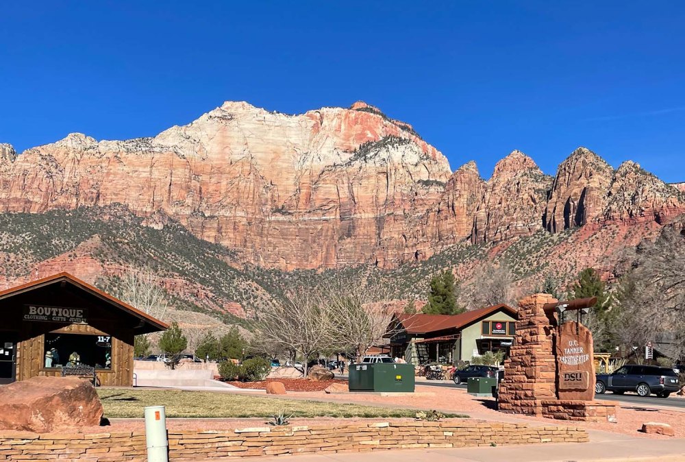
ザイオン国立公園のエンジェルズランディングに行く予定でしたが、修復作業の為、閉鎖されていました。それよりも何よりも、公園の入口前の道で1.5時間も待ってもまだ入れなかったので、断念しました。 We planned to hike up to Angel’s Landing In Zion NP but we gave up because it was closed for maintenance. Besides that, we couldn’t even get to the entrance gate. None of us knew that Spring break started yesterday in Utah. No wonder so many kids and cars were there.
その後、バージンの街まで戻り、そこからコロブテラスに向かう道を北上しました。 We waited for 1.5 hours in the line, but made a U-turn back to the town of Vergin, then went up north on North Kolob road.
Lambs Knoll の岩場の駐車場から草原を越え、無名の岩山を登ります。From Lambs Knoll parking lot, we went up to an unnamed rock.
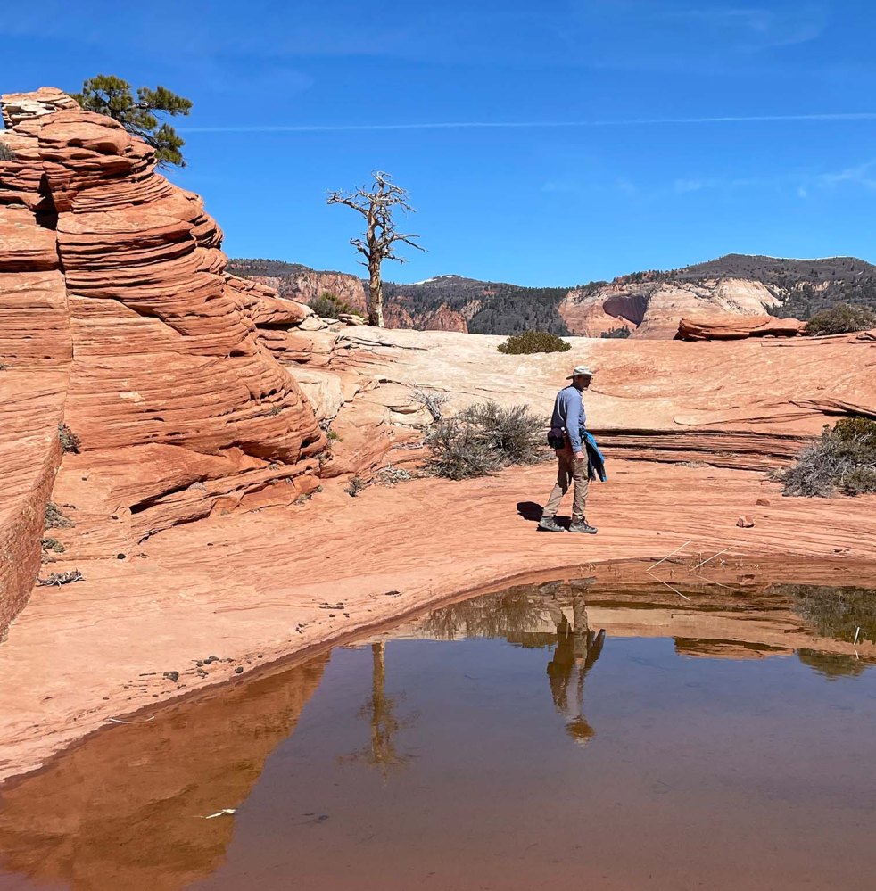
目指したのは、1872年に初めてここを訪れた写真家が撮った風景です。どこから撮ったのかわからないので、同じような風景の場所を探すしかありません。What we looked for was the same scenery that was a photographer, Jack Hiller, captured in his photograph in 1872. No one knows from where he took it, so we just had to guess about the location by comparing the scene in front of our eyes with his photo.
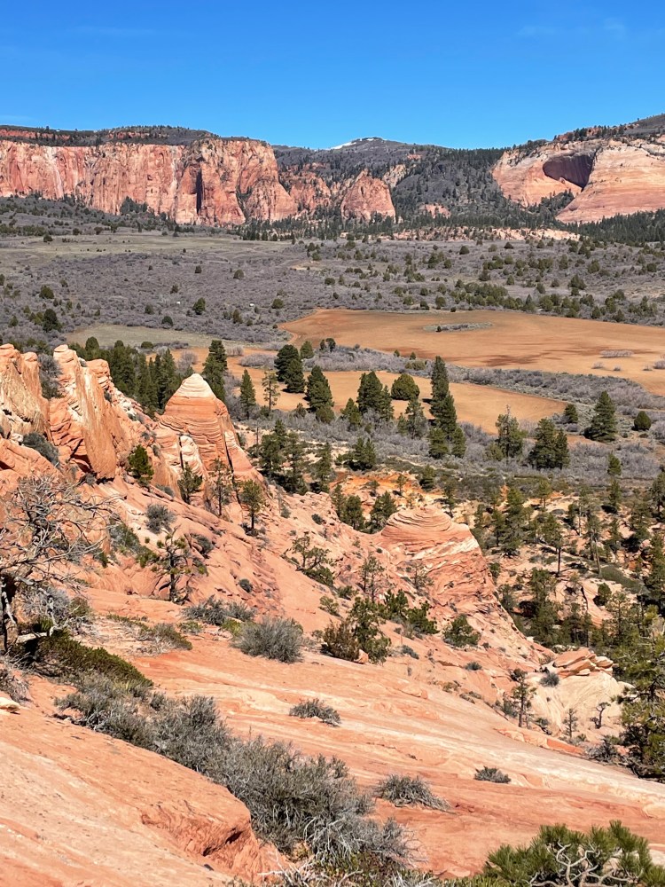
ここです!わーい!まさにジャック ヒラーさんが撮った場所です。This was it. This was one of the locations he had chosen.
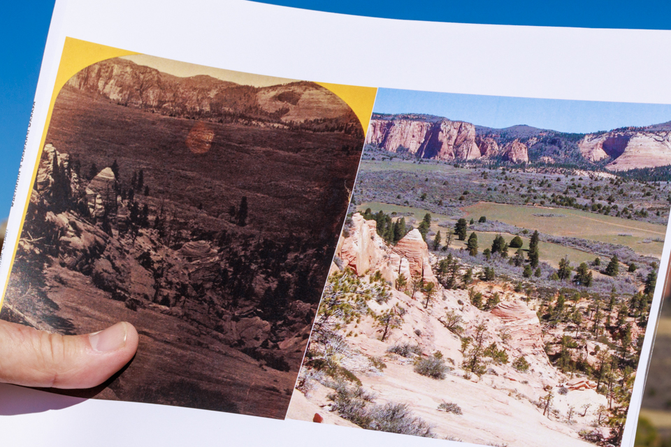
1870年代の写真現像プロセスの詳しいことは分かりませんが、写真を撮ってから15分以内に完了していなければいけなかったらしく、その為には水が必要だったらしいです。ラッキーなことに、この崖の上に小さな水場を発見した彼らは、予想外にたくさん写真を撮れたという話が残っています。 I don’t know well about the history of the development process around the 1870’s. But I was told that it had to be processed within 15 minutes, and water was one of the key materials they needed to use. Fortunately, they found a pool of water at the top of the rock, so they could take more pictures than they expected.