サブタイトルをつけるとしたら、「地獄からの脱出 」です。 If I were to give it a subtitle, it would be ‘Escape from Hell’.
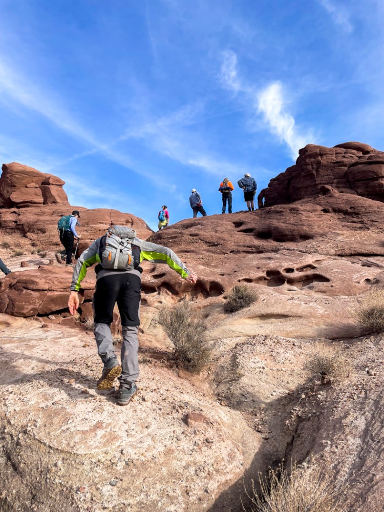
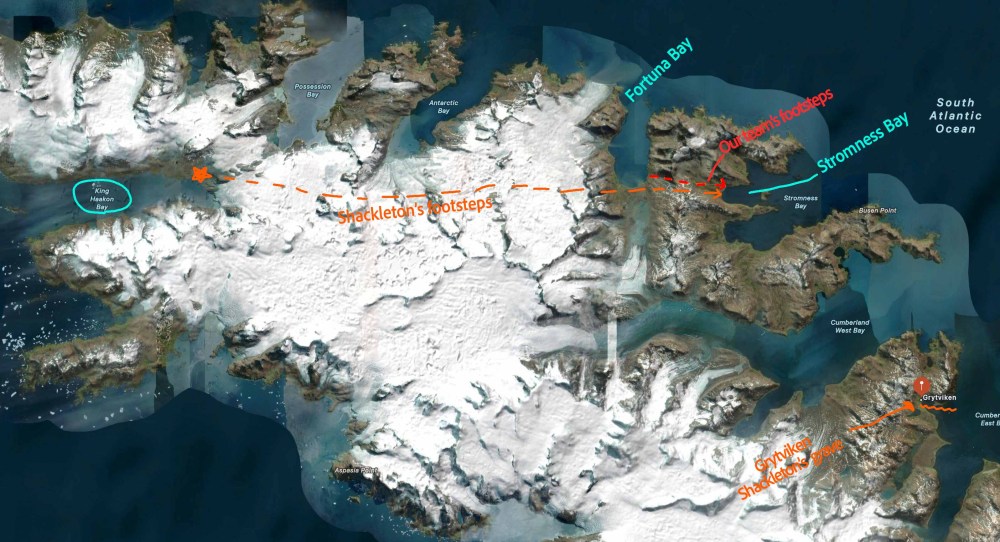
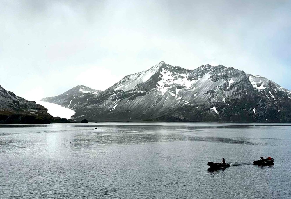
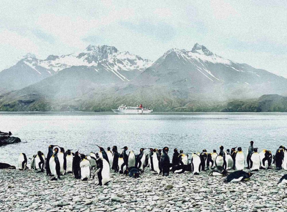
- 舞台はここ、サウスジョージア島。 The stage is here, on South Georgia Island.
- 時は、20世紀の初め、第一次世界大戦の真っ只中。The time was the early 20th century, in the midst of the First World War.
- 登場人物は、サー アーネス トシャクルトンとその乗組員。 The characters are Sir Ernest Shackleton and his crew.
- 航海の目的は、南極点を通って、南極大陸を横断すること。 The purpose of the voyage was to traverse the Antarctic continent via the South Pole.
- 方法は、シャクルトンの乗るエンデュアランス号と、食料や燃料を補給する基地を設置するためのオーロラ号の2隻がそれぞれ南極大陸の反対側からスタートすることで大陸横断を達成する。 To achieve the continental crossing, the method involved two ships: the Endurance, carrying Shackleton, and the Aurora, tasked with establishing bases to supply provisions and fuel for Shackleton and his team on the second half of his journey. Each ship would depart from opposite sides of the Antarctic continent.
- 実際には、南極大陸を目前にして氷に囲まれ身動きが取れなくなった。しばらく様子を見たものの、状況はますます悪化し、エンデュアランス号は沈没した。そのためエレファント島に避難した。もちろん、救助が来ることはないとわかっていたので、シャクルトンと5人だけで小さな救助船でサウスジョージア島の捕鯨基地を目指した。22人の乗組員はエレファント島に残った。15日間のサウスジョージア島への航海も苦難の連続で、嵐の海720海里の航海として語り継がれている。しかし、なんとか島にたどり着くことができたものの、捕鯨基地は島の反対側にあった。 In reality, with Antarctica in sight, they found themselves surrounded by ice and unable to move. After observing the situation for a while, it deteriorated further, and the Endurance sank. Consequently, they took refuge on Elephant Island. Fully aware that no rescue would come, Shackleton along with five men set out in a small lifeboat towards the whaling station on South Georgia Island. The remaining 22 crew members stayed behind on Elephant Island. The fifteen-day voyage to South Georgia was a continuous ordeal, remembered as a 720-nautical-mile journey through stormy seas. Though they somehow reached the island, the whaling station was located on the opposite side.
このブログの話はここからスタートします。 The story of this blog begins from here.
シャクルトンは再び決断を下さなければいけなくなった。荒れ狂う嵐の海に再び出ていくのか。それとも、歩いて山を越え、反対側にある捕鯨基地まで行くのか。山越は未踏だった。しかし、小さな救命ボートで島を回るよりは安全だと判断し、計画を決行することにした。3人はその場に残り、シャクルトンと他2名の3人で未到の地へ踏み出した。Shackleton was once again forced to make a decision. Should they venture back out onto the storm-tossed seas? Or should they walk over the mountains to the whaling station on the other side? Crossing the mountains was uncharted territory. However, judging it safer than circumnavigating the island in a small lifeboat, he resolved to carry out the plan. Three men remained behind, while Shackleton and the other two set out into the unknown.
シャクルトンの決断に異議を申し立てる者はいなかった。失敗した時のためのバックアッププランなど入れる余裕もなく、ただ、行動するしか生きる道はなかったからだ。 No one raised any objection to Shackleton’s decision. There was no room for a backup plan in case of failure; simply, action was the only way to survive.
方向を誤って引き返したり、山の上から決死の滑降もした。食糧もない36時間、32マイル (51km) の行程、体力も限界点に達していた。歩いて降りる余力はなかったのだ。 They had strayed off course and turned back, and had also made a desperate descent from the mountain summit. With no food for 36 hours and a 32-mile (51km) journey, their physical strength had reached its limit, leaving them no energy to walk down.
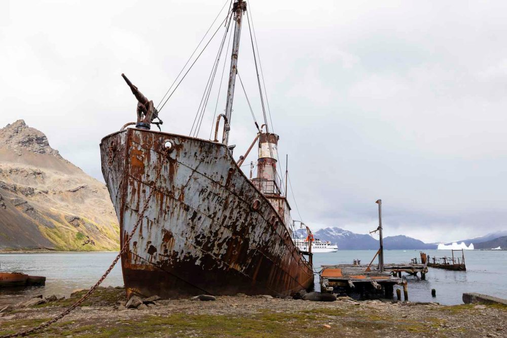
ストロムネスの捕鯨基地についてゾンビのように歩いている彼らは、不気味な動物と間違えられた。なぜなら、船が沈没してから半年以上、シャワーもしていなければ、髭も髪も切っていなかったため、到底普通の人間には見られなかったのだ。しかも、体を保護するためにアザラシの油を塗っていた。 They were mistaken for eerie beasts as they shuffled like zombies around the whaling station at Stromness. For over half a year since the ship sank, they had neither bathed nor trimmed their beards or hair, rendering them utterly unrecognisable as ordinary men. Moreover, they had smeared themselves with seal oil to protect their skin.
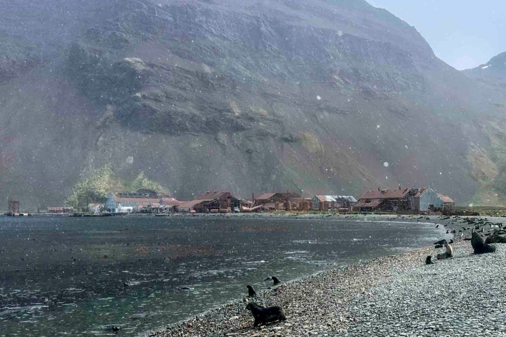
この捕鯨基地で保護された時には洋服を肌から引き剥がすこともできなかった。だから服をハサミで少しずつ切り落としていったらしい。その後、体力が回復すると、シャクルトンはすぐ、残してきた船員の救助に向かった。 When rescued at this whaling station, he was unable to pull his clothes off his skin. So they apparently cut them away bit by bit with scissors. Once his strength had recovered, Shackleton immediately set out to rescue the crew members left behind.
サウスジョージア島の反対側に残して来た3人はすぐに救助できたが、エレファント島の22人の救助は3回挑戦し、3回とも流氷に阻まれ失敗した。戦争中のこともあり、イギリス本土からの援助はなかった。その時に助けの手をさしのべてくれたのがチリの海軍であった。 The three men left behind on the opposite side of South Georgia Island were rescued promptly, but the attempt to rescue the 22 men on Elephant Island failed three times, each time thwarted by drift ice. Given the wartime circumstances, no assistance came from mainland Britain. It was the Chilean Navy that extended a helping hand at that time.
4ヶ月半も何もない島で、しかも助けられる保証は全くない状態での生活はどれほどの精神力を要するのだろうか。寒さとの戦いは言うまでもない。22人全員を救い出すことができたのは奇跡に等しい。 Living on a barren island for four and a half months, with absolutely no guarantee of rescue, must have demanded immense mental fortitude. Not to mention the constant battle against the cold. That all 22 were ultimately saved is nothing short of a miracle.
全員がイギリスに帰ることができたのは1917年5月のことであった。 1914年12月に南極を目指してサウスジョージア島を出港してから2年半が経っていた。It was May 1917 when all the men were able to return to Britain. Two and a half years had passed since they had set sail from South Georgia in December 1914, bound for the Antarctic.
シャクルトンと船員とのあいだには絶大な信頼関係があったと言われています。シャクルトンは手袋を無くした人には自分の手袋を差し出して自分は凍傷したり、キャンプの中でも一番寒い場所で寝起きしていたとも言われています。また、歌を歌ったりして船員の士気を高めることを忘れなかったとも言われています。 It is said that there was an immense bond of trust between Shackleton and his crew. Shackleton is said to have given his own gloves to those who had lost theirs, suffering frostbite himself, and to have slept in the coldest part of the camp. It is also said that he never forgot to boost the crew’s morale by singing songs.
彼の偉大さは、南極探検を目指したことではなく、極限状態での船員への思いやりと、一人も残さず全員を救いだしたことにあるのではないでしょうか。 His greatness lay not in aiming for an Antarctic expedition, but in his compassion for his crew in extreme conditions and in rescuing every single one of them without leaving a soul behind.
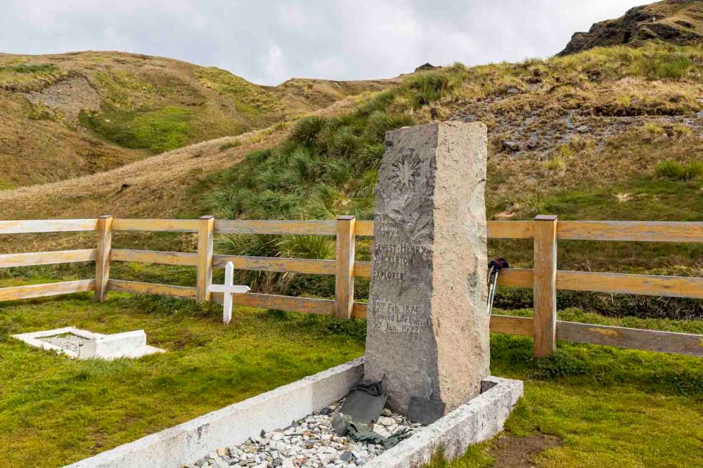
シャクルトンはその5年後、1922年に他界しています。47歳でした。サウスジョージアの山道を歩いている時にはすでに心臓に穴が空いていたのではないかという医師もいます。Shackleton passed away five years later, in 1922. He was 47 years old. Some doctors believe he may already have had a hole in his heart whilst walking the mountain trails of South Georgia.
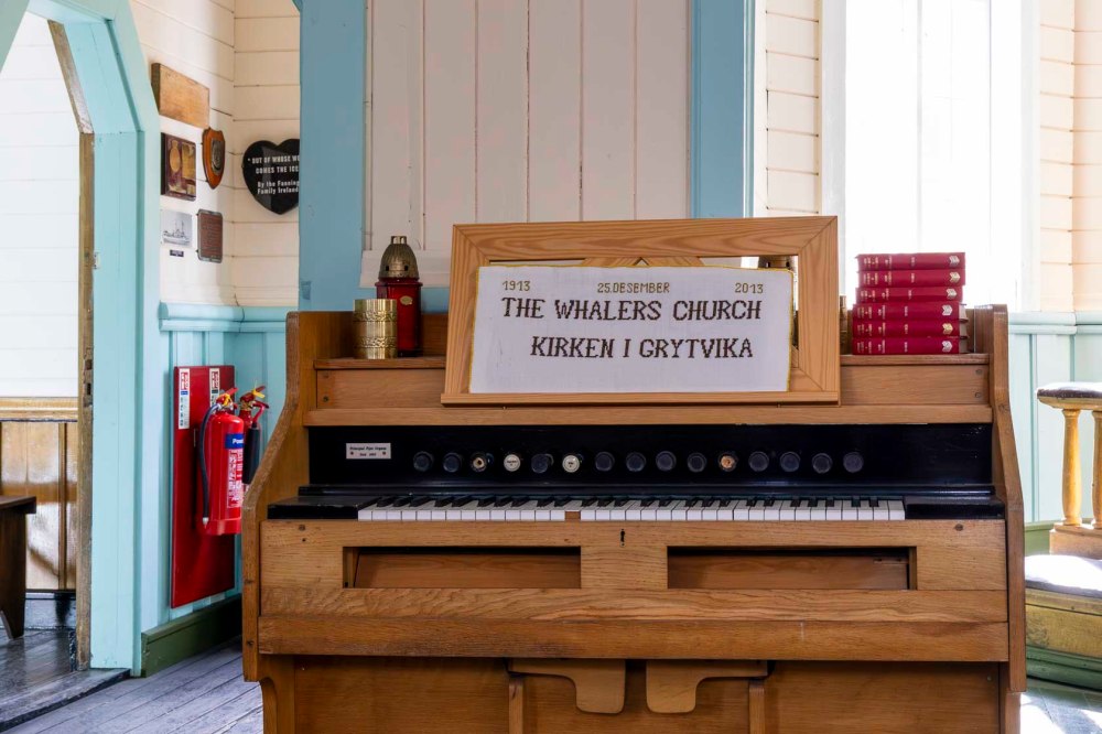
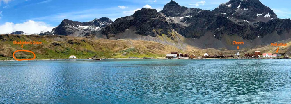
彼の葬式はグリトビケンのこの教会で行われました。私たちの船の船員たちはこの教会の中でシャクルトンを称えるミニコンサートを開いてくれました。 His funeral was held at this church in Grytviken. The crew of our ship held a mini-concert inside this church in honor of Shackleton.
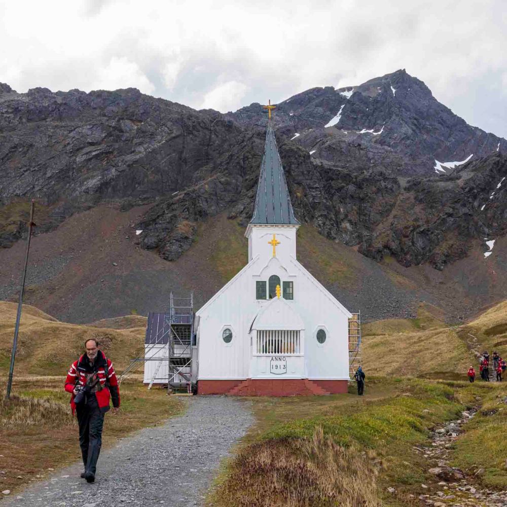
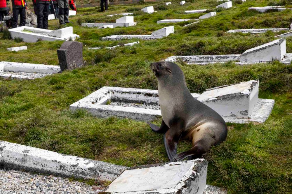
シャクルトンは彼の奥さんの希望により、この地に埋葬されました。墓跡は彼の憧れ続けた南極が見えるよう、南に向いています。 Shackleton was buried here at his wife’s request. His grave faces south, towards the Antarctic he had always longed to see.
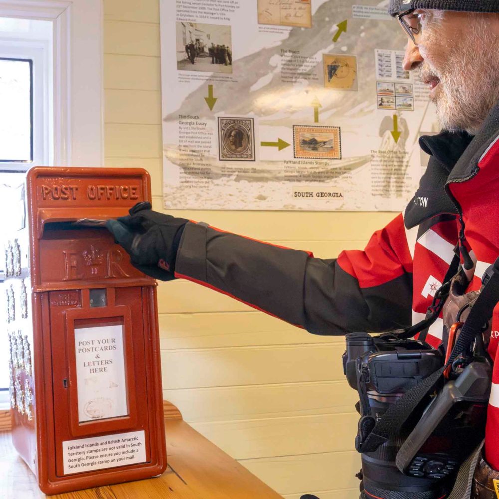
下の写真、左が墓地、右端が夏の間だけ営業の郵便局、そして、奥には教会があります。 In the photograph below, the left side shows the cemetery, the far right is the post office which operates only during the summer months, and in the background stands the church.
私たちは数人の友人と家族、そして自分たち宛にこの郵便局からハガキを出しました。 We sent postcards from this post office to several friends and family members, as well as to ourselves.
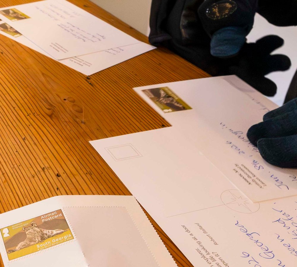
葉書が届いたのは、それから1ヶ月後、出したことすら忘れてしまったころのことでした。e-mail で瞬時にご挨拶できてしまう今、1ヶ月もかかって届けられたことに感激してしまいました。 The postcard arrived a month later, just when I’d forgotten I’d even sent it. In this age when greetings can be sent instantly by email, I was genuinely moved that it took a whole month to reach me.