Category Archives: Health

さて次は? What Next?


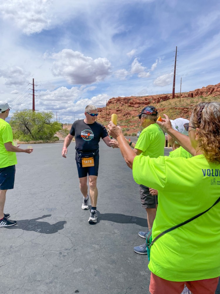
2023年のハーフ アイアンマン レースが昨日終わりました。合計70.3マイルを水泳、自転車、そして乱と3種目で完走する過酷なレースです。ここ、セイントジョージでの毎年恒例の行事となっています。こちらがウェブサイトです。The 2023 Half Ironman Race ended yesterday. This is a grueling race that requires swimming, cycling, and running to complete a total of 70.3 miles. It is an annual event here in Saint George. Here is the website.

https://www.ironman.com/im703-st-george

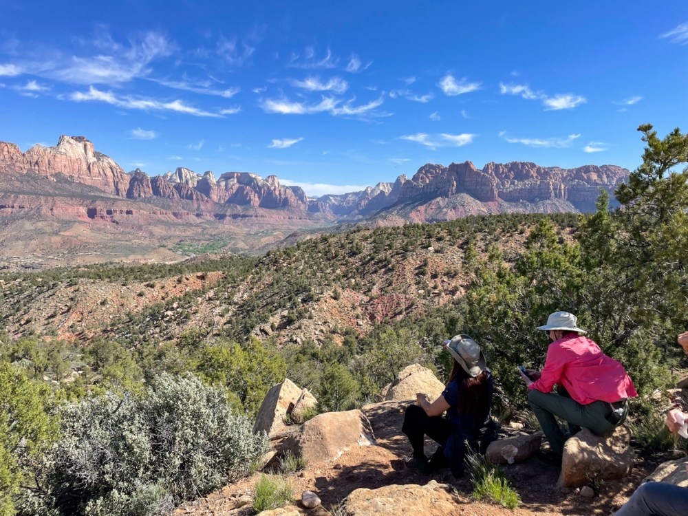
私も毎年ボランティアとして参加しています。なぜなら、このアイアンマンレースで感動をもらい、人生の軌道修正を少しするきっかけとなったからです。 I also participate as a volunteer every year. Because this Ironman race has moved me and inspired me to change the course of my life a bit.

いつもはプロのアイアンマンが走る頃、早朝のシフトですが、今回は一番最後のシフトを選びました。一般の人たちの頑張っている姿が見たかったからです。 I usually work the early morning shift, around the time the professional Ironmen run, but this time I chose the last shift. I wanted to see the general public challenging hard.

そのせいか、シフトはとてもリラックスしていました。 Perhaps because of this, the shift was very relaxed.

最後の走者を見届けて、片付けをして、帰る時には残り物をどっさりいただいてきました。We watched the last runner cross the finish line, cleaned up, and then got lots of leftovers when we left.

私が走る時に補給するのはこのブランドではありませんが、せっかくいただいたので、試してみます。 This is not the brand I refuel with when I run, but since they gave it to me, I will give it a try.

私の次のイベントへのトレーニングは、一週間前から始まっています。 My training for the next event started a week ago.

去年から始めた5キロ、10キロランです。去年の秋のレースでもう十分と思っていましたが、暖かくなってくると、やっぱりもう一度試してみたいという気持ちがムクムクと起きてきました。もう少し頑張れたのにという無念の気持ちがあったからです。 I started doing 5K and 10K runs last year. I thought I had done enough after last fall’s race, but as the weather warmed up, I felt the urge to give it another try. I had the regretful feeling that I could have done a little more.

まずは6月10日のユタ州のサマーゲームです。去年は年齢グループで1位を取りました。ただ、二人しかいなかったんで、最後の100メートルでダッシュして優勝となっただけです。 First up is the Utah Summer Games on June 10. Last year I won first place in my age group. But there were only two of us, so I just had to dash for the last 100 meters to win.

個人的には、今年は標高1980mにどう対処するかが課題です。また、時間を6分縮めたい。 Personally, my challenge this year is how to deal with the 6500 feet elevation. Also, I would like to shorten my time by 6 minutes.

Hike 18: ワシの岩山 Eagle Crags


グラフトンから見た岩山 Eagle Crags view from Grafton

ザイオン国立公園に向かう途中に必ず目撃するゴツゴツとした岩山は、ワシが住む岩山として知られています。 The craggy rocky mountains that you are sure to see on your way to Zion National Park are known as Eagle Crags.

距離は9.5km、標高差は368m。ゴツゴツとした岩場を登っていきました。 The hiking distance was 5.85 km and the elevation gain was 1,200 feet. We climbed up rugged, rocky terrain.

ザイオン国立公園の岩山を眺める場所で休憩です。 We took a break at a place with a view of the rocky looking mountains of Zion National Park.

ハイクリーダーが、その後、ますます険しくなる道のりを説明しているところです。 The hike leader explained to us about the increasingly rugged path from then on.

結局、この岩の麓まで登り、引き返してきました。ここから先はまさに岩登りになるからです。 In the end, we climbed up to the foot of this rock and turned around, because from this point onward, it would be a difficult rock climb needing ropes.

もう夏かと思わせる暑さで、野草は嬉しそうでした。It was so hot that one would think it was already summer. The wildflowers looked happy.

Hike 17: パルヌウィープ Parunuweap


朝5時半に家を出て、夜7時半に帰宅。ザイオン国立公園の東、パラヌウィープのルートのないルートを一周して帰ってくるハイクは17km、670mの標高差、所要時間10時間のハイキングでした。 We left home at 5:30 am, and returned home at 7:30 pm. This hike, in the east side of Zion National Park, is a total of 10.5 miles, 2,300 feet elevation gain, and 10 hours of hiking.

バンちゃん提供 Courtesy of Banchan

多分、私のハイキング歴の中でも一番苦しいハイクだったかもしれません。 It was probably the hardest hike of my hiking history.

ただ、息を呑む絶景だったことは確かです。 However, the views were breathtaking.

このハイクが予想以上に苦しいものになった大きな理由は、二つ。一つ目は、雪がまだ残っていたことと。 There were two main reasons why this hike turned out to be more difficult than expected. The first was that there was still snow on the ground.

二つ目は、雨の日が続いていたので、岩の至る所から水が流れてきていた事、ひいては普段はない乾いた川に水が流れていた事でしょう。 Second, it had been raining, so water was flowing out from the rocks, and by extension, usually dry washes, were flowing rivers.

橋のない川を渡るという洗礼を受け、クイックサンドに飲み込まれないように歩いていきました。ここでかなり神経をすり減らしてしまいました。下の写真の彼は膝の上まであっという間に沈んでしまいました。 We had the baptism of crossing a river with no bridge, and walked through the wash trying to avoid being swallowed by quicksand. I lost a lot of nerve here. The person in the photo below sank quickly above his knees.

ザイオン公園内はイースターバケーションでものすごく混んでいましたが、私たちのハイクは道のないルートなので、勿論、車を降りてから帰ってくるまで、私たち以外誰も見かけませんでした。 It was extremely crowded in Zion because of Easter Vacation, but our hike was on a trail-less route, so of course we saw no one but us from the time we got out of the car until we returned.

登りはお互いの足に捕まったり、お尻を押し上げてもらったりして急な岩場を登りました。 We climbed the steep rocky terrain using each other’s legs to hold onto and sometimes getting a helping hand to push our butts up.

降りは、お尻をズリズリと滑らせました。On the descent, we often slid down on our butts.

水が岩の隙間から流れ出していて、岩肌が滑りやすくなり、実際、仲間の一人が滑って転んでしまいました。その際、肩を脱臼してしまい、途中で下山し、病院に担ぎ込まれました。 Water was flowing out of the crevices of the rocks, making the rock face slippery. And in fact, one of our group members slipped and fell. In doing so, she dislocated her shoulder and was taken down the mountain to the hospital by a couple of our hikers.

雪投げをして楽しそうなハイクリーダーの隣で、私は小さな雪だるまを作ってあげました。 While our hike leader was having fun throwing snowballs, I made a little snowman for myself.

パルヌウィープの高原は1850mぐらいです。だから、それほど高いわけではないです。それでも頂上で生きる植物の生存のための努力は大変なものだろうと思われます。 The top of Parunuweap is about 6,200 feet. So it is not that high. Even so, survival for the plants plants living on the summit must be very hard.

下の写真には、左にウェストテンプル、右にイーストテンプルと、両方のテンプルが収まっています。 In the photo below, both temples fit together, with the West Temple on the left and the East Temple on the right.

崖の上から下を見下ろすと、バージン川が細くウネウネと流れていました。 Looking down from the top of the cliff, I saw the Virgin River flowing in what looked like a thin stream. far below.

頂上に溜まっていた水。これから暑くなると一気になくなってしまいます。 Water that had accumulated in a pool at the top, will disappear once it gets hot.

さあ、十分に頂上でくつろいだので、(とはいえ、大抵10分以内ですが)これから下の写真の下白い頭のフーデューの森を超えて下っていきます。 Now that we’ve had enough of relaxing at the top (though usually less than 10 minutes), we will now descend beyond the lower white-headed hoodoo forest in the photo below.

どこまで行っても自然が作り出したフォームは美しい。 Wherever you go here, the forms created by nature are beautiful.

私たちは謙虚な気持ちでそんな美しさの中を歩かせてもらいました。 We were humbled to walk in such beauty.

何回か携帯を落とし、一度は15mぐらい下に転がってしまい、もうダメかと思いましたがなんとか事でした。ただ、この写真を最後に、バッテリー切れとなりました。 I dropped my phone several times and once it rolled down about 50 feet and I thought it was done for. My cell phone was somehow safe, but after this picture, the battery ran out.

最後に、ザイオンのモキボールについて書きます。大きいです。家の近くのモキボールはこのぐらいです。Lastly, I would like to write about Zion’s Moqui Balls. They are big. The moqui balls near my house are about this big.

でも、ザイオンの茂木ボールは、こんなに大きい。 But Zion’s Moqui Balls are so much bigger.

私の顔と同じぐらいの大きさ。ザイオンの自然はデッカイ! About the same size as my face. Nature in Zion is huge!

バンちゃん提供。 Courtesy of Banchan

Hike 15: Top Of The World


スノーキャニオン州立公園は、私の大好きな場所です。この日はその中にあるホワイトロックの一番高い場所、トップオブザワールドロックに登りました。 Snow Canyon State Park is one of my favorite places. We climbed the highest point of the White Rocks called which we called “Top of the World” on the day of the hike.

雨が降り続いていたので至る所に水溜りができていました。 It had been raining so hard the past few days that there were puddles of water everywhere.

巨大な亀の甲羅のようなナバホ砂岩の上を、慎重に慎重に歩いてドンドン高度を上げました。 We walked carefully and cautiously over Navajo sandstone that looked like the shell of a giant turtle, and gained altitude rather quickly.

目指す頂上が見えてきました。 The summit we were aiming for was now in sight.

最後の登りの前、眺めはすでに最高です。 Before the final climb, the view was already great.

ハイーダーのジムの写真。私も一番手前に入ってます。 The hike leader Jim's photo.  I am at the very right.
ハイーダーのジムの写真。私も一番手前に入ってます。 Photo credit: Jim, the hike leader. I am at the very right.

でも、この岩場はとりわけ慎重に歩きました。 We were especially careful on the final rocky area.

これが頂上からの眺めです。 This is the view from the top.

狭いので、立つのもちょっと怖いほどでしたが、ハイクリーダーのジムはロッククライマーなのでマウンテンゴートのように軽やかに歩いてました。 It was so narrow at the top that it was scary to stand on for me, but Jim, the hike leader, is a rock climber, so he walked like a mountain goat.

平地に戻ってからトップオブザワールドロックを見上げ、「よくやったね!」と、自分を褒めてあげました。 When we got back to level ground, I looked up at the Top of the World Rock. I said, “You did great!” praising myself.

距離は6kmぐらいしかありませんでしたが、一歩一歩慎重に歩いたので、時間がかかりました。 The distance was only about 3.7 miles, but it took a long time because we walked carefully step by step.

雨あがりの後のハイキング、気持ちよかったです。 It was a nice hike after the rain.

Hike 14: 富士山 Mt. Fuji


トレッドミルを使った仮想登山です。テヘッ! This is a virtual hike with a treadmill. Why not?!

私の使っているトレッドミルのプログラムは、富士宮ルートを歩きます。4.3kmを7回に分け、1回分を20分から25分ぐらいにしています。 The treadmill program I use lets me walk the Fujinomiya route, which is 4.3 km divided into 7 parts, each part lasting about 20 to 25 minutes.

私は、2日間に分けて登頂完了しました。

パート1のスタート画面の写真を撮り損ったので、その代わりにこ結果画面です。 I forgot to take a picture of the start screen of part 1, so here is the result screen instead.

歩きはじめということもあり、上りがなだらかで、ちょっと気抜けしてしまいました。だからスピードをアップして歩きました。 Since it was the beginning of the walk, the uphill was gentle and I was a bit disappointed. So I changed to a faster speed.

パート2のスタートの画面。 Screen shot of the start of part 2.

パート2になると、突然勾配が30%と急上昇し、トレッドミルの上を歩くのもちょっと危ない程になりました。ここがバーチャルのいいところで、自分で勾配を変えられます。20%から10%、最後の方では8%ぐらいで歩いてました。 In part 2, the gradient suddenly spiked to 30%, making it a bit dangerous to walk on the treadmill. This is the nice thing about virtual, you can change the gradient yourself, from 20% to 10%, and towards the end I was walking at about 8%.

パート3。 Part 3.

パート3でも高度をたくさん稼いだことになります。 I gained a lot of virtual altitude in part 3. This is actually the case for parts 2 to the end.

わかったことは、時間が一定なので、スピードを上げても早く着く訳ではなく、距離を稼ぐだけだということです。だからスピードも勾配もプログラム通りにしておく方がいいです。 What I found out is that since the time is constant, increasing the speed will not get you there faster, it will only increase the distance. So it is better to keep both speed and gradient as programmed.

多くの人たちは、富士宮ルートの5合目から頂上までの4.3kmを4-5時間ぐらいで登るらしいです。標高が 2,400m から 3,776m まであるので早く歩くわけにはいかないんですね。 Most people climb the Fujinomiya route from the fifth station to the top, a distance of 4.3 km, in about 4-5 hours. The altitude ranges from 2,400 to 3,776 meters, so it is not possible for a normal person to walk fast.

もう20年以上前のことですが、私も富士山頂まで息子と二人で登りました。このルートではなかったと思いますが、二人とも高山病になってしまい、下山するまで苦しみました。 More than 20 years ago, my son and I hiked to the top. I don’t think it was this route, but we both got altitude sickness and suffered until we descended.

二日目。残りのパート4から7までを歩き、無事、頂上に立つ事ができました。へへッ! Second day. I walked the remaining parts 4 to 7 and successfully made it to the top. Grin.

パート4。Part 4.

このパートでも高度を稼ぎましたが、トレッドミルの勾配数を変えずに歩いてみました。 I gained altitude again in this part, but walked without changing the default gradient on the treadmill this day.

パート5のスタート。 Part 5.

勾配が30%もあると、それだけで汗ダラダラになります。 With a slope of 30%, it is enough to make you sweat a lot.

結構疲れてきていたためか、パート6のスタート画面を撮り忘れました。 Perhaps because I was getting quite tired, I forgot to take a picture of the start screen for part 6.

パート7のスタート。 Part 7.

頂上の火口近くなので、ここまでくると登りはそれほどなくなりました。 Since I was near the crater at the summit, there was not much more climbing to do up here.

30%の急勾配を歩いている最中に、「エベレストでも目指してるの?」なんて言われました。 As I was walking up the steep 30% grade, someone asked me, “Are you aiming for Mount Everest?”

アイディアいただきです。次回はエベレストに挑戦もできる! Thank you for the idea. Next time I can try for Everest!

雨が降る日には、仮想登山、楽しいです。 On rainy days, it’s fun to do a virtual hike.

初級ピックルボール Pickleball 101


雨の日が続きます。 Rainy days continue.

昨日ピックルボールのクリニックがあるはずでしたが、今日に延期になりました。 There was supposed to be a pickleball clinic yesterday, but it was postponed to today.

今日を期待したのに、やはり雨で、中止となりました。残念です。 I was hoping it would happen today, but it rained again. And the clinic was cancelled. Such a pity.

クラブの会員になったのに、練習の機会がないのは残念です。 It’s a shame that I became a member of the club but don’t have a chance to practice.

家の中で壁打ちの練習できないかな? I wonder if I can practice by using a wall inside the house…?

Hike 13: 月光の中のハイク Moonlight Serenade


日暮れを待って、近くの丘、私たちのMVロックのある丘からタートルウォールをぐるりと回って帰ってくる、6.5kmの道をご近所さん達と歩きました。 We waited for nightfall and walked with our neighbors on a 4 mile loop trail heading up to our MV rock, around the Turtle Wall and back.

暗くなってから月が出るまでの15分程度の時間は、ご近所さん達との情報交換をしました。 After dark and before moonrise, we spent about 15 minutes getting to know our neighbors.

この写真は友人提供です。This photo is courtesy of a friend.

近所を歩き回る事があまりないので、すぐ近くなのに知らなかった隣人とも話す事ができました。  Since I don’t often walk around the neighborhood, I was able to talk to neighbors I didn’t know even though they were right around the corner.

月を撮るのは難しい。 It is difficult to photograph the moon.

暗い山道をヘッドランプで歩くのは初めてです。楽しい思い出になりました。 This is the first time for me to walk on a dark mountain trail with a headlamp. It was a fun memory.

Hike 12: 石に刻まれたアート巡り Kirk’s Grotto and Babe’s Butte


ネバダ州のゴールドビュート国定公園には、面白い場所がぎっしり満載です。You can find so many interesting places to visit at Nevada’s Gold Butte National Monument.

12kmほどのハイキング。巨岩群の中にはペトログリフがびっしりと隠されていました。It was a 7.5 mile round trip hike. So many petroglyphs were hidden in the giant rocks.

巨岩を登ったり降りたりすると、次から次へとペトログリフが見つかります。 As we climbed up and down the huge rocks, we found one petroglyph after another.

ほとんどの物は意味不明ですが、逆さまに描かれている物は、死んでいることを意味しているそうです。 Most of the meanings are still unknown, but an object drawn upside down is said to mean that it is dead.

ほとんどの物は線画ですが、2点だけ、塗りつぶすように描かれていました。足のように見えます。 Most of the objects were line drawings, but I found only two drawings that were filled in like in the picture below. It looks like a foot to me.

ペトログリフは勿論見る価値ありですが、その周りの景色も最高です。 The petroglyphs are no doubt worth seeing, but the surrounding scenery is also excellent.

ここはリトルフィンランドと呼ばれています。 This place is called Little finland.

いつものことですが、自然の創造物は不思議で、その美しさにはかなわないと思い知らされます。 As always, I am reminded that nature’s creations are wondrous, and that there is no substitute for their beauty.

Hike 11: ヘルホール キャニオン Hellhole Canyon


突然誘われて、近所、ケヤンタのヘルホールキャニオンを歩きました。 Our friends invited us for a hike this afternoon, and we went to a nearby trail, Hellhole Canyon at Kayenta.

6.4kmと短いですが、大小の石の間や砂地を歩くトレイルで、注意が必要でした。 The trail was only 4 miles round trip, but we needed to pay attention to many rocks and sand.

雨の日が続いていたので、久しぶりのハイキングは気持ちが良かったです。 It felt so good to hike with our good friends after so many rainy days.

Hike 10: ピナクルズループ Pinnacles Loop


距離は10km、325mの標高差、アリゾナ州のバレーオブファイヤー州立公園内のピナクルズループは今回で2度目ですが、雨が降ったばかりのためか、景色がとても違って見えました。6.2 miles with 1,066 feet total climbing. We have been here once before, but Pinnacles loop at Valley of Fire in Arizona looked different. The rain the day before might be why.

歩き始めて程なく見えてくる景色。 This is the sight you could see after a short hike of half an hour or so.

もう、っこの日の目的は終わり、帰っても良いと思えるほどの絶景。 It was such a stunning view that I could have just gone home after seeing that.

実際、ほとんどの人たちが、この先に足を踏み入れません。 In fact, most visitors to the park stop right there and don’t go any farther.

なぜなら、その先はトレイルもないし、荒野があるだけだからです。 It’s because there is only wilderness beyond there without any trail.

私たちは、本当にラッキーです。なぜなら、私たちのハイクリーダーのジョンは私たちだけでは絶対行けない所まで連れて行ってくれるからです。 We are really lucky to have our hike leader. He could take us places where we could never get to on our own.

ハイクリーダーのジョンはチェスターという犬をよく連れてきます。Our hike leader, John, takes Chester out often on our hikes.

彼の大家さんの犬ですが、彼の犬のように懐いています。私たちも彼のリードに従って歩くので、チェスターのようにジョンに懐いていると言えないこともありません。 Chester is John’s landlord’s dog, but he is attached to John and follows him everywhere. Come to think of it, we also trust John and follow John’s instruction. Are we attached to John like dogs?

目指すは、ピナクルズと名付けられた場所。ギザギザの岩山が中央、奥に見えます。 Our destination was the Pinnacles where the pointy peaks are in the picture below.

迫ってきました。 It’s getting closer.

雨上がりなので、水たまりがたくさんあり、避けながら進むので、さすがのジョンも四つ這いになって崖の横を進みました。 Even John needed to get down on all fours. The recent rain created many ponds and we had to work our way around them.

ピナクルの真っ只中、景色は最高で、どのショットを見直しても捨て難いものばかりです。 All my shots from the Pinnacles are so good that it was very difficult to choose which to include in this blog.

こんな所まで来られたのが嘘のようです。 It’s hard to believe that we made it there.

ピナクルを通り抜け切る前にランチ休憩。 We had a short lunch break before leaving the Pinnacles.

ピナクルの向こう側の景色は再び変わり、赤い岩肌が見えてきます。 The other side of the Pinnacles had different views. It changed to red rocks.

雄大な自然、これこそがアメリカのアセットです。 Majestic great nature, it’s one of the greatest assets of America.

満足のハイク、ハイクリーダーに感謝、自然に感謝、私達の健康にも感謝です。 I was quite satisfied with the hike, and thankful for our hike leader, nature, and our health.

Hike 9: ゾウのアーチへ To Elephant Arch


14.5kmと距離もあり、標高差915m、しかも山道もない場所、難易度の高いハイキングでしたが、景色は最高でした。 The total hiking distance was 9 miles, 3000 feet altitude changes, and mostly off-trail. The difficulty level of the hike was was hard, but the view was incredible.

ヤントフラットからスタートから1時間後の景色です。 After walking from the Yant flat trailhead for one hour, the view opened before us like this.

これから先の場所を確認しています。 The hike leader explained to us the rough direction where we were heading.

ここから岩壁を降り、登り、そしてまた登りと繰り返しました。 We then went up and down, and up and down the rocky wall.

蜘蛛のように四つ這いになってよじ登り、ズルズルとお尻で降りてくるような場所でした。 We crawled up on the rock literally like spiders, and slid down with our butts.

日陰で見た鮮やかでビロードのような苔。真夏は茶色っぽいのに、水をもらうと復活するレザレクションモスです。 I saw vivid and gorgeous velvety moss at shady rocks. It’s resurrection moss. Although they look brownish when dry, they become like this once they get water.

日向ではすでに1cmしかない野草が咲いていました。真夏の暑い時には冬眠ならぬ、夏眠をするのでしょうか。 I saw these tiny flowers already blooming under the sun. I wonder if they hibernate during the hot summer?

超えてきた場所を振り返ります。あの巨岩群を超えてきたのかと思うと、感無量です。 This is the view of the rocky mountains where we walked through. An intense feeling of fulfillment came to me while looking back at them.

さて、ここからです。半分以上歩いたものの、ここからが難所でした。溶岩石の間を降りていくのは、このハイクの中で一番苦しく、また危険な場所でした。Now, the toughest part of the hike started from here at the last one third of the entire walk. It was the most dangerous part of the hike going through the lava rocks especially since we were quite tired already.

そして、7時間後、ようやく見えたゾウのアーチです。そこから駐車場までは40分ぐらい。 Here is Elephant Arch that we wanted to see. After 7 hours of hiking, we could see it, but it took only 40 minutes to get to the parking lot from there.

ドライブ時間も含めると、朝7時半から夜7時半までかかったハイキング。さすがに疲れてしまい、その夜はぐっすり眠ることができました。 We left home at 7:30 am and got back home at 7:30pm. What a hike it was. As expected, we were so tired and slept very well that night.

Hike 8: 仮想ハイク Virtual Hike


フィットネスセンターのトレッドミルは優れものです。 The treadmill at our fitness center is a wise machine.

自分でワークアウトを作ることが出来ます。そこで、さっそく作ってみました。 One of the features allows you to make your own workout. So I tried it.

コロブキャニオンズでハイキングができなかったので、そこを歩きたい。スタート地点と終了地点を地図上に入力すると、私のワークアウトが本当にできちゃいました。 My workout was in Kolob Canyons because we couldn’t hike there the other day. By entering the starting point and ending point on the map I could make my own workout that simulates this hiking course. Wow!

写真も可能な限り映し出してくれて、傾斜もコースに沿って作ってくれる。 It gave me images along the course. Not everywhere, but at some points along the route.

そうそう、去年このキャンプ場まで歩いて、引き返したんです。 My memory came back. We hiked up to the campground at the bend on the map below last year.

ここから先は未知の世界。ルンルンと歩いていら、55分を切った時点でクールダウンになってしまいました。 I don’t know beyond that point, it is an unknown world. I was so happy with this cool feature of the treadmill, but it suddenly switched to cooldown mode when it reached 55 minutes.

「優れ物」を撤回、かなり残念です。 I was so disappointed. I will take back my word, “wise machine”.

仕方がないので、もう一度やり直しました。 I tried to continue the course, but couldn’t. So I started it again reluctantly.

今度はテレビを見ながら走ったり、歩いたりのインターバルをしました。This time, I did walking and running intervals while watching TV.

コロブアーチまで7マイルm、11.25kmです。それを往復するので14マイル。この日のトレッドミルを4回繰り返すと完了する事になります。でも、実際は6-10時間だと言われています。標高2000メートル以上の場所ですから、それを考慮すると、走れませんよね。 It’s 7 miles to get to Kolob Arch, which is our goal. And the round trip is 14 miles. If I repeat the same workout 4 times, I could get to the arch and come back based on my calculation. But it’s been said it takes 6 -10 hours. The real trail is above 7000 feet. I guess we can’t run there like I do here at 3000 feet.

仮想ハイクは、行きたくてもいけない場所でハイキングの擬似体験をさせてくれます。1時間以内で歩ける距離なら、楽しいでしょう。 It’s fun exercising with a virtual hike if you can make a course finishing in less than one hour, especially at the places where you want to go, but you can’t.