Category Archives: Hike

Hike 23: Snow Canyon Overlook


スノーキャニオン州立公園を展望できる場所までは 4 km です。石がゴロゴロとある山道を登り、崖の端までくると、涙が出るほどの感動に襲われます。あまりにも美しい景色に苦労して登ってきた甲斐があったと思うからでしょうか。 It’s 2.5 miles to get to the Snow Canyon State Park Overlook. The trail requires your full attention on the ground all the time because the trail is full of oddly shaped rocks. Maybe because of that, everyone thinks the view is gorgeous. It is very well worth the hike up to see the view.

ここにはすでに4回も来ていますが、何回見ても飽きない景色です。 We’ve come here four times already, but I don’t mind seeing the view again and again.

ハイキンググループのメンバーとはここで別れて、私たちはここから更に先に進みます。なぜなら、今日は体力トレーニングが目的だったからです。合計 15 km 歩きました。 We said good-bye to the other members of our hiking group here, and walked farther on the trail by ourselves because the purpose of the hike for us for the day was to train our bodies and build our muscles. We hiked 9.2 miles total.

気温はどんどん上がって行きます。私たちの足音と鳥の鳴き声だけを聞きながら、ひたすら登って行きました。 The temperature was going up and up while we hiked up and up. There were no sound but only our footsteps and the chirping of birds.

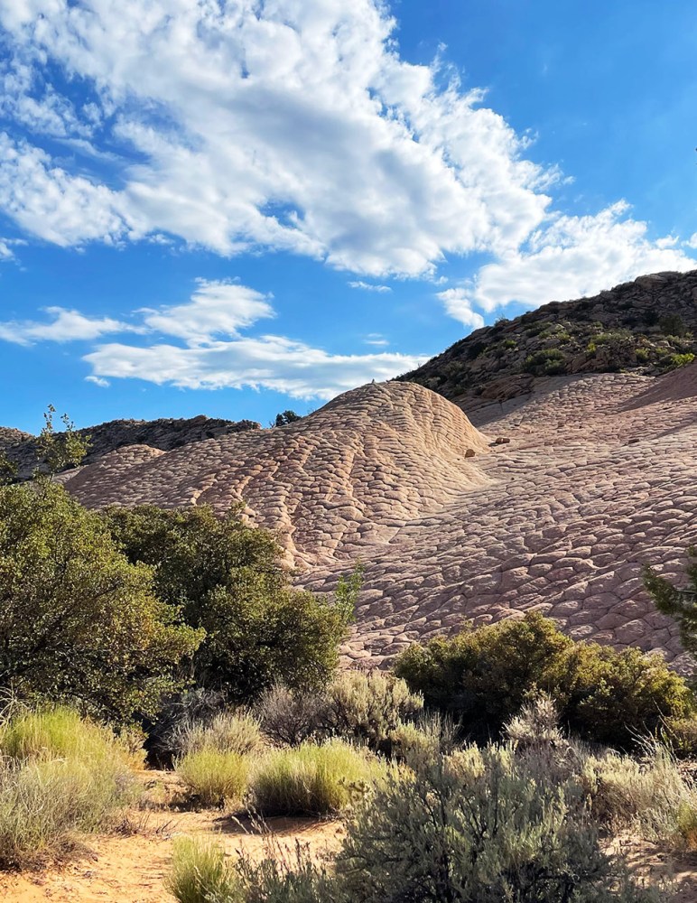
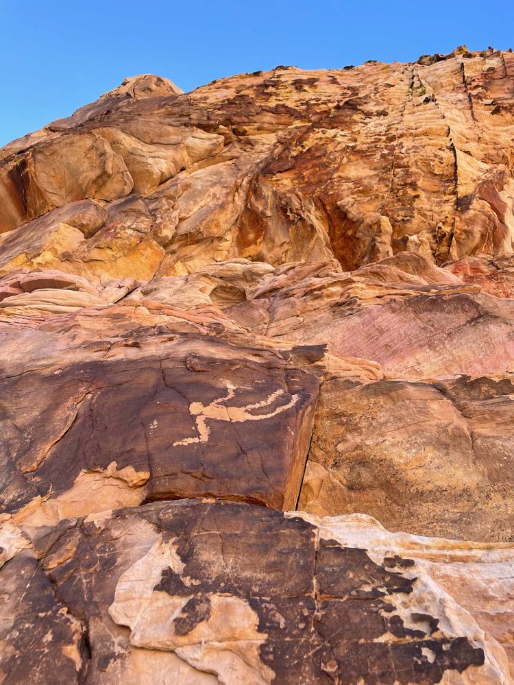
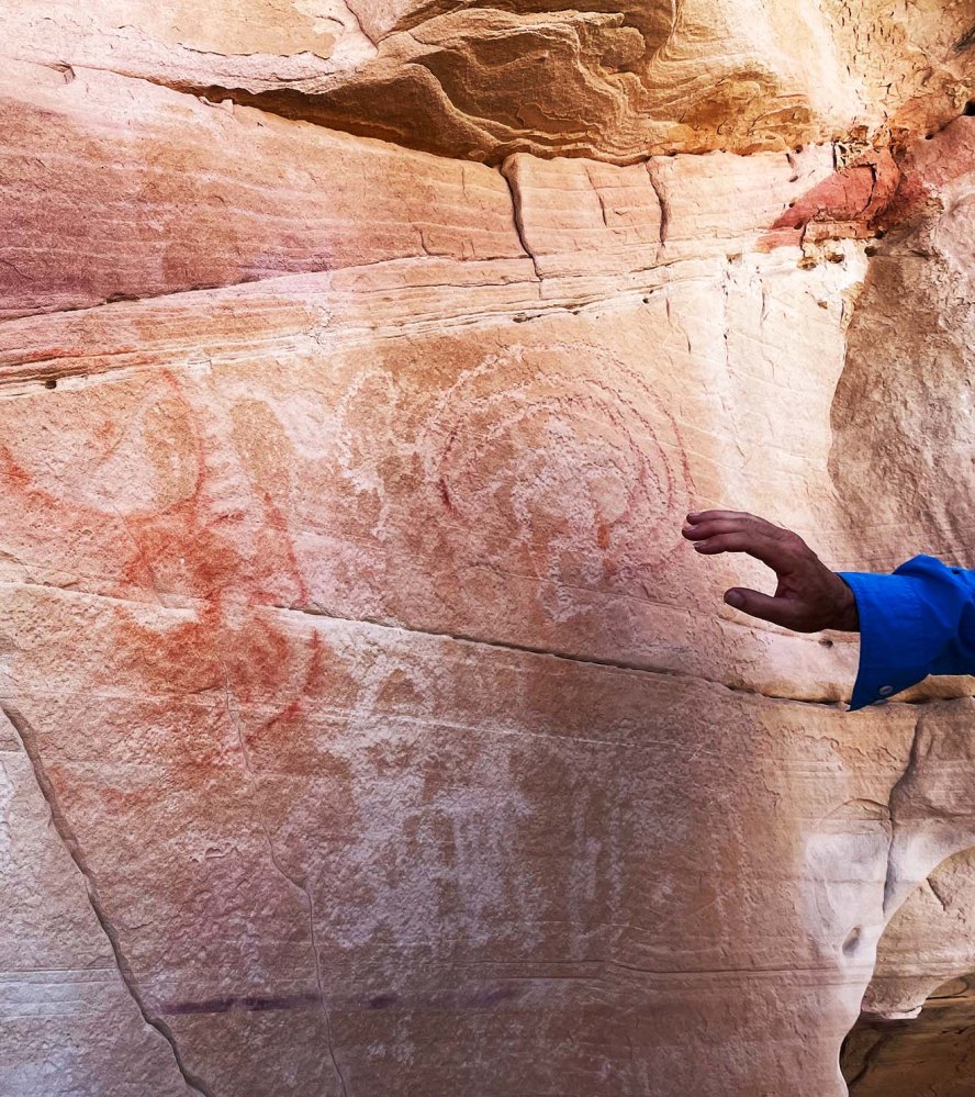
ナバホ砂岩の美しい模様がある場所を見つけたので、そこで一休み。予定していた距離には少し及びませんでしたが、すでに暑くなってきていたのでそこから戻ることにしました。 We decided to have a break when we got to a hill with pretty patterns. Great nature did a wonderful job on the Navajo Sandstone formation over the many years. Although we wanted to hike a little longer, we returned back to our car from there because it was getting so hot.

暑さを避けて朝7時にスタートしましたが、5時間後に車まで戻ってきた時には38度を超えていました。 次回はもっと涼しい場所でトレーニングしたいです。 We started at 7am to avoid the heat, but the temperature was over 100F by the time we got back to our car at noon. Gee, I want to train myself at a much cooler place next time.

Hike 21: イエローノール Yellow Knolls Loop


レッドクリフデザート保護区の中のイエローノール周辺をぐるりと回ってくる、8 km のハイキングでした。 The Yellow Knolls Loop is a 5 mile hike in the Red Cliffs Desert Preserve.

前半はトレイルを外れて、岩場を昇り降りしました。そこを超えると亀の甲羅模様が現れます。 Our hike was off trail and up on rocky hills, but the turtle shell patterned hills appeared once we went beyond the hill.

自然の作り出す模様は面白いですね。 Nature’s creations always fascinate me.

早起きは苦手ですが、早朝のハイキングはやっぱり気持ちがいい! I am not good at getting up early, but early morning hikes always make me feel so good.

Hike 20: Mustang Pass Trail


9.6 km 登り下りの穏やかなハイキングでした。 It was a 6 mile loop hike with no steep ups and downs. In other words, an easy hike.

見覚えのある山肌を違う角度から眺められてよかったです。 It was interesting to see familiar cliff faces from different angles.

カタツムリの岩と名付けました。 I named it “Snail rock.”

Hike 18: Black Brush Trail


久しぶりのハイキング。天気も良くて気持ちがいい。 We went for a hike after taking a break for a while. The weather was so pleasant and it was a perfect hike day.

サンタクララ川のそば、そんなに遠くないのに来たことがありませんでした。 It’s not so far from our house but we had never been to this area by the Santa Clara river.

ここにもヒーラモンスターがいるという噂です。 I’ve heard that the Gila monster lives here as well.

6.5 km の手頃なコースでした。 It was a short 4 mile long trail.

Hike 14: Falling Man


ネバダ州のゴールドビュート国定公園、4km と、とても短い距離ですが、4時間かけて岩場を歩く盛りだくさんのペトログリフ巡りをするハイキングでした。 The hike route was only 2.5 miles, but we spent more than four hours going through the rocky area at Gold Butte National Monument in Nevada. This was because there were petroglyphs everywhere.

説明し出すととても長くなります。だから要点だけをまとめます。アメリカ先住民によって描かれたペトログリフは、古いものは1万年前、新しいものはほんの数百年前のものまである様です。その見分け方は、岩の色、点描画のように、一点一点削られた後の色などで判断されるようです。 This is a very short summary of what I learned yesterday. The petroglyphs were carved by Native Americans. The old ones are 10 thousand years old but newer ones are only 200 years old. We can’t tell clearly but we could guess the age of the petroglyphs by looking at the rock color and the lines of petroglyphs created one dot at a time.

例えば以下の写真です。不鮮明ですが4本指の手が下の方に描かれています。上のヤギと比べるとペティナ(古色化)により多く覆われて、描かれた年代が古い事がわかります。 The picture below is one example. Can you see a hand with four fingers towards the bottom? It is covered by petina more, so it can tell us that the hand is older than the goats along the top.

突起する場所は3箇所です。The hike had three highlights.

  1. フォーリングマン(転落する男):ペトログリフはこの辺一体に散財しています。そのどれもがマッチ棒のような表現の仕方になっています。例えば、こんな感じ。 Falling Man: You can find so many petroglyphs at this particular area. And almost all of them are carved like stick man pictures. See below picture.

でも、ただ一つ、この絵は明らかに違いました。 However, one was clearly different.

描かれた場所から、親族、もしくは特別な誰かが高い崖の上から転落した様を伝えようとしているのではないかという事です。 正面から見たマッチ棒のような図では表現できない出来事だったので、こう描かれたのではないかということです。The location of the petroglyph is on the side of a high cliff. One theory is that someone very important to the artist had fallen down off the top of the cliff. So he/she couldn’t simply express it with a stick man figure. That caused him/her to do a totally different type of carving from the others.

2. ニュースペーパーロック(新聞岩):ペトログリフがギッシリ積み込まれた一枚岩です。ジムブーン博士が絵について諸説を説明してくれました。 Newspaper Rock: it’s named newspaper rock because many petroglyphs are packed onto a single wall of rock. Below picture is Dr. Jim Boone who guided us to these places. He talks about several theories how we could read them.

3. 21ぴきのヤギ:ちょっと疲れてきた頃、突然現れた岸壁です。みんなその壁に見入っているところです。 21 Goats: It was towards the end of the hike. We were tired, but the flat cliff face appeared suddenly in front of us. And it shocked us all.

なぜなら名前の通り、やぎが21頭、もしくはそれ以上描かれていたからです。列を成してどこかに行こうとしているところなのでしょうか。This is because 21 or more goats were carved on the rock surface. I wonder where they are going all lined up like that?

最後に、ペトログリフとペトログラフは別物である事です。ペトロは岩、グリフは彫刻、グラフは絵画です。以下の写真は、両方が混合しています。赤い線がペトログラフです。 For the last, I want to point out about the petroglyphs and petrographs. I didn’t know this, but “petro” is “rock”, and “glyph” is “carving”. And “graph” is “drawing”. The picture below includes both petroglyphs and petrographs. The red color drawings are petrographs.

Hike 13: Snow Canyon Overlook


久しぶりにスノーキャニオンを見渡せる場所に行きました。往復8.5kmのハイキングです。It is 5.3 miles round trip to Snow Canyon Overlook.

長い石がゴロゴロしている山道を登ってきて、突然、目の前に広がるこの景色はいつみても息をのみます。After a long rocky uphill, the view that suddenly spreads out in front of you makes everyone speechless.

今日は800mmの超ロングレンズを持ってきました。鳥の巣を撮りたかったからです。でも、一生懸命岩肌を舐めるように見回しても一つも見つかりませんでした。We brought 800mm long lenses today because we wanted to capture any bird’s nest. I carefully went through all walls in the canyon, but found nothing.

諦めて後ろの岩を見上げると、I gave up and looked up at the rock behind me, and noticed the top of the rock was white.

てっぺんが白い。これは鳥のフンです。鳥の種類は分かりませんが、ここが一番高い場所ですから鳥が好んで止まる見張り場所になっているようです。 It must be bird’s poop! It’s the highest place around here. I don’t know what kind of bird it could be, but surely it liked to use that spot as a look-out place.

しばらく待っていましたが、誰も飛んで来てくれませんでした。We waited there for a while, but no birds flew over, so we gave up.

ここから見えるパインバレー山脈。北側にはまだ雪が積もっていて、冬の名残を感じさせてくれます。 We could see the Pine Valley Mountains from there. The snow on the north side of the hill made me feel cold.

でも、この高度の高い場所にも確実に春はやってきています。But, I know Spring is coming even here at such a high altitude. See?

ここにも、And here,

ここにも。 And here!

わー、もう少しでブーケになりそう。 This one is spreading a bunch of flower stems. It’s almost there to be a beautiful bouquet.

Hike 12: Pushing Tin Loop


7.2km の面白い名前の道、”Pushing Tin” という道をぐるりと回って帰ってくるハイキングでした。The Pushing Tin loop is a 4.5 mile easy trail.

なぜか飛行機が次から次へと飛んでいました。We didn’t know why, but many airplanes were flying over us one after the other.

それがこの道の名前の由来になったのでしょうか。飛行機をアルミ缶に見立てて、どんどん押し込んでいく(飛ばしていく)管制官たちを描いた”Pushing Tin”という映画もあります。でも、誰も本当の理由は分かりません。 Someone said that that could be the reason for the name of the trail. There is a movie, “Pushing Tin“. It is about air traffic controllers at an airport. Their job is to push tins (airplanes) one after the other. But no one knows the true origin of the name.

タンブルウィードはコロコロと転がって、どこに行くのか考えたことがありますか? Have you ever thought about where tumbleweeds go after tumbling around?

赤ちゃんサボテンの赤い実。鳥の食べ物になるのでしょうか。We found a baby cactus with red fruits. Could they be food for birds?

春の朝、楽しい会話で一杯のハイキングでした。One spring morning, we had a conversation full of fun while we hiked.

Hike 11: Toe trail


Toe Trail は往復 5.8km 無理しないで歩ける、平らなトレイルです。 The Toe Trail is a flat and easy 3.6 mile trail.

毎日バスルームの窓から見えるレッドロックの麓を歩きます。 As you can see in the picture below, it’s very flat. Part of the trail runs right next to the bottom of the Red Rock which we see from our bathroom window everyday.

こちらが窓からの眺め。 This is the window view.

このレッドロックは二つの地層からできています。上層部がナバホ砂岩地層で、下層部がケヤンタ地層です。すごく分かりやすいですよね。 The Red Rock consists of two parts. The upper part is Navajo sandstone and the bottom is the Kayenta formation. Isn’t it easy to see the differences?

暖かくなってきたので、トカゲとかヘビとかに出会えるかなと期待しましたが、見られませんでした。でも、小鳥のさえずりが至る所から聞こえていました。それだけでも清々しかったです。 As it’s a little warmer these days, we hoped to see some lizards or snakes, but we didn’t see them. Instead, we heard little birds singing from the side of trail, and that made us feel so uplifted.

Hike 10: Shinob Kibe


Shinob Kibe は ハリケン断層ラインに立つ小高い丘です。登って降りて来ると2.5 km ほどなので、1時間もあれば帰って来られますが、興味深い歴史物が残っているので2時間ぐらい時間をかけたい。Shinob Kibe is a small mesa standing along the line of Hurricane fault. The distance is only about 1.5 miles round trip, so it takes only one hour or so. However, I recommend to spend two hours because there are interesting historical objects.

遺跡 1:”Medicine wheel“、「神聖な環」と訳しておきます。150年前に北米先住民族のパイユート部族の信仰、世界観の具現化された物です。 Historic Ruin 1: you can find a “Medicine wheel” made by Southern Paiute people around 150 years ago.

草が生い茂ってしまい、よく分かりません。ハイキングリーダーの後に私まで写っていますが、そこを中心に4-6本の線が伸びて円を描いています。ここでどんな儀式が行われていたのでしょうか。I couldn’t recognize it until our hike leader pointed it out, because plants covered the rocks in places. In the picture above, our hike leader and myself are standing at the center of the wheel. From there, lines of rocks are laid out to make a large wheel. I am now curious what kind of ceremony was held there.

遺跡 2:航空用の矢印。頂上にはコンクリートでできた大きな矢印があります。1926年にロスアンジェルスからソルトレイクシティ間のエアメールサービスが開始されました。その時に パイロットが迷子にならないように10マイル(約16km)ごとに同じ矢印が設置されました。かつては航空塔があり、そこから無数のランプを灯して光を放っていたそうです。詳しい事は、このサイトをご覧ください。 Historic Ruin 2: An Aviation Navigation Arrow is on top of the mesa. The air mail service between Los Angeles and Salt Lake City started in 1926. An arrow like this was placed every 10 miles all the way to Salt Lake to help guide the pilots. An aviation tower holding a very bright rotating beacon stood in the center of the arrow to indicate the location of the arrow in bad weather. Look at this site for the detail.

こうして歴史の勉強をして丘を下ってきたのですが、反対側の斜面の麓を見ると、なんか見覚えがあるような景色なんですね。 I was so happy learning two new historical facts before coming down the mesa. On the way to the bottom, I found something familiar at the bottom of the hill in front of me.

これはもしかして、私の5Kレースのコースかもしれない。Could it be my 5K race course?

家に帰って地図を見たら、やっぱりそうでした。バージン川を挟んで向こう側の遊歩道を走るんですね! I confirmed the course after coming back home. I will run the walking path on the other side of Virgin river!

Hike 8: La Verkin Creek Trail


8km の緩やかなハイキングコースでした。It was an easy 5 mile long trail.

ラバーキンク川の横には溶岩の崖がそびえ立っています。High cliffs of lava rocks are standing right next to the La Verkin Creek.

その崖の窪みには無数のツバメの巣がありました。We found many swallow’s nests on the wall cavities.

グループの年齢層は広くて、20歳代から70歳代まで。それでも一緒に歩いていると楽しい。みんな子供になっちゃうんでしょうか。ハイキングの魅力の一つです。The age range of our hiking group is very wide, from 20’s to 70’s. But we could enjoy being together while walking. I think that is one of nice things about going for a hike in a group.

Hike 7: Temple Quarry Trail


5.96km、88m の登り。簡単な半日ハイキングコースでした。私たちは、横道に逸れて別ルートも歩いたので、距離は少し長めです。 It is a half day hiking trail, 3.7 miles and 289 feet elevation gain. We went off on a side trail at the end, so the distance is little longer than the trail itself.

かつて使われていた飛行場を左に見ながら歩くコースです。今はレストランや学校などができてきます。この10年間、この街がいかに変わって来たのかを話しながら歩きました。The old St. George airport was on the left side of the trail. It’s now used for variety of purposes. We talked about the town and how it has changed in the past 10 years while walking.

このトレイルは石碑ができるほど由緒ある道です。写真にあるように、1871年から3年間、溶岩を切り出すために使われました。The trail has an historical background, and a monument plate was attached to a rock. According to the description, it was used to carry lava rocks from 1871 to 1874.

セイントジョージの街の中心にあるセイントジョージ寺院はモルモン教の開拓者が建立しました。その際、地盤として溶岩を使う必要がありました。The Mormon pioneers needed lava rocks for the foundation of the Saint George Temple standing in the center of town.

溶岩が必要だった理由は、この地域の土壌はアルカリ成分を多く含んでいるので、その浸透を防ぐためだと、石碑には書かれてありました。 According to the monument description, they needed to use the lava rock because the soil at the temple site is an alkali soil, and lava rock was impervious to alkali soil.

この道を切り開くためにダイナマイトが使われました。道脇には、ダイナマイトが差し込まれたであろう穴が残る石塊がまだ残っていました。The pioneers used dynamite charges to make the trail. We found rocks still containing holes for the dynamite charges on the side of the trail.

大きな機械がなかったころ、半端じゃない困難な作業だったに違いありません。Can you imagine how hard it was to carry such huge rocks down without any machinery?

でも、「不可能に立ち向かう」、それが人間の歴史でしたよね。だから宇宙にも行ける様になったんだ。思考が飛躍しました。でも、すごくない、私たち?人間万歳だ! But our history was always like that, wasn’t it? We kept challenging ourselves against impossibles, didn’t we? That’s why we could go to space. My thought leaped high from this, but, aren’t we great or what? Yes, Banzai human!

Hike 6: 化石の谷Fossil Canyon


再び、早朝のショートハイク。We went to another early morning short hike in fossil canyon. The distance was 5 km (3 miles.)

カンボジアの寺院、アンコールワット、を思い起こさせる岩が両側を囲みます。The rocks around there reminded me of temples in Cambodia, Angkor Wat.

ここはペルム紀から三畳紀の頃の地層であるらしい。そしてこのトレイルの名前通り、化石の山、Fossil Mountain という地層群なんですね。This area is the Fossil Mountain member of the Kaibab formation. The time period ranges from the Permian to the early Triassic.

だからこんな化石を発見することができました。We found tiny fossils like this.

貝殻かな、それとも植物の一部でしょうか。 Could it be a shell or a part of a plant?

距離はないのですが、谷間を進むので、結構難しい場所でした。The trail is not so long but it was challenging because we needed to go through a narrow canyon.

助け合いながら岩を登っていくハイクはとても楽しかったです。All in all, it was a fun hike with the hike members helping each other to go up and down rocks.