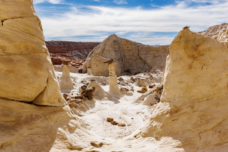
白い帽子をかぶっているのがバビロン地区の中にあるサンドストーン山です。 The white capped mountain is Sandstone Mountain in the Babylon area.
トレイルがあるわけではありませんでしたが、山の周りをぐるりと回る計画でした。でも急用を思い出し、山の裾まで行って引き上げるという、合計2.7kmの短いハイクとなりました。 Our plan was to go around Sandstone Mountain by bushwhacking. But we suddenly remembered an errand, so we needed to give up at the bottom of the Mountain, making it a short 1.7 mile hike.
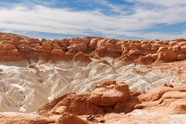
土柱予備軍のような岩壁です。 The rock looks like it is on the way to becoming hoodoos.
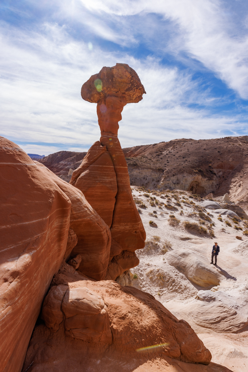
この光景は、山の神にひれ伏している信者のように見えます。 This sight reminded me of a follower who is kneeling before the mountain god.
この地区の地層は主にナバホ砂岩層が露出しています。 This area exposes mainly the Navajo Sandstone formation.
夕陽をこの辺で眺めようと決めていましたが、6時に閉店するパイ屋に行くことを思い出し、早々に引き上げました。食べ物の威力は偉大だ。 We wanted to view the sunset light around here. As I mentioned above, we needed to leave earlier than planned. This was because we needed to buy a pie before the shop closed at 6 pm. So, we reluctantly left there. The food power was greater than a beautiful sunset.
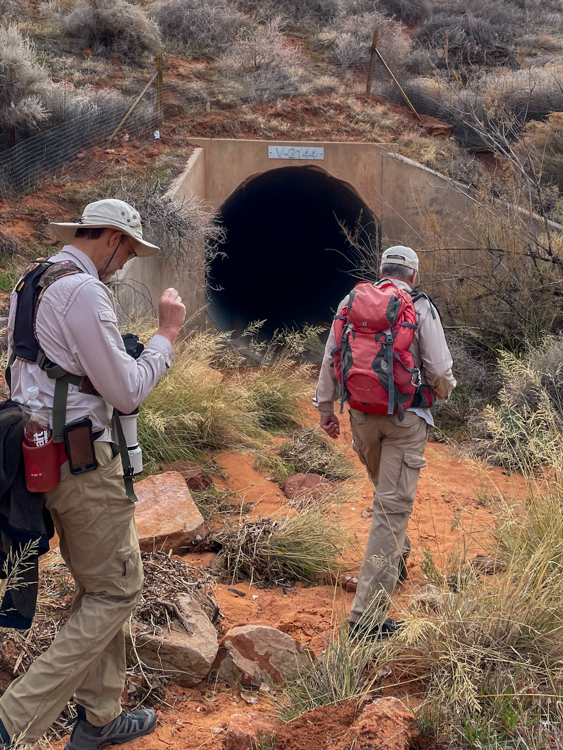
この日は Red Cliff Desert 保護区内で「ニシアメリカフクロウ」が見られと聞いたので行ってきました。ウロウロしたので正確な距離は分かりませんが、7.5kmを主にスパニッシュ ウォッシュに沿って歩きました。We went to Spanish wash in Red Cliff Desert Reserve because we heard that an owl had been seen there. We are not quite sure of the exact distance, but it was about 4.5 miles out and back along the Spanish wash.
まず、長いトンネルを通り抜けます。 We went through the long dark tunnel first.
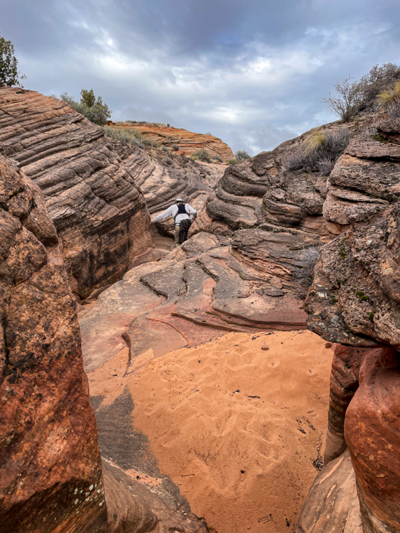
そして、こんな所をズンズン歩いて行きます。 Then, we went through places like this to get to deeper sections.
フクロウが最初に発見された場所がここです。 This was the place where the owl had first been spotted.
でも、残念ながら、全く姿が見えませんでした。 But we didn’t see any sign of owls there, unfortunately.
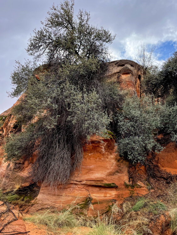
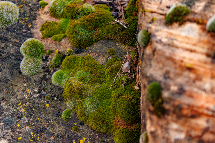
そこで、再びズンズン進んでいくと、周りの丘が夏に比べて緑色になっているのに気がつきました。苔が最近の雨で青々とし始めたんですね。 So we marched on. Then I realized that the hills were greener than before because the moss was greener.
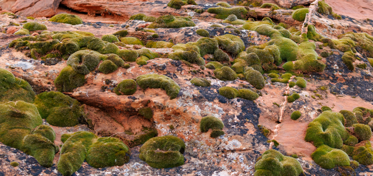
フカフカしています。 It looks so cushiony.
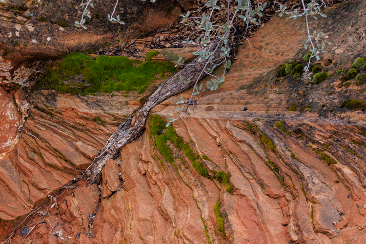
これの写真にも苔が生えているんですが、よく見ると岩の中を突き抜けて伸びているのが見えます。すごい生命力です。きっとこんな根っこがあと100万年もしたら木の化石になっているのかもしれません。 The picture below also shows the moss, but if you look at it closer, you can see a root stretched through the rock. How awesome to see such vitality. I imagine that it will become petrified wood in a million years.
それから更にズンズン進みましたが、フクロウの姿はついに見つけられませんでした。きっと、年末休暇をとっているのでしょう。 We went on a little further in the wash, but couldn’t find any owls. They must have gone on vacation for the end of the year.
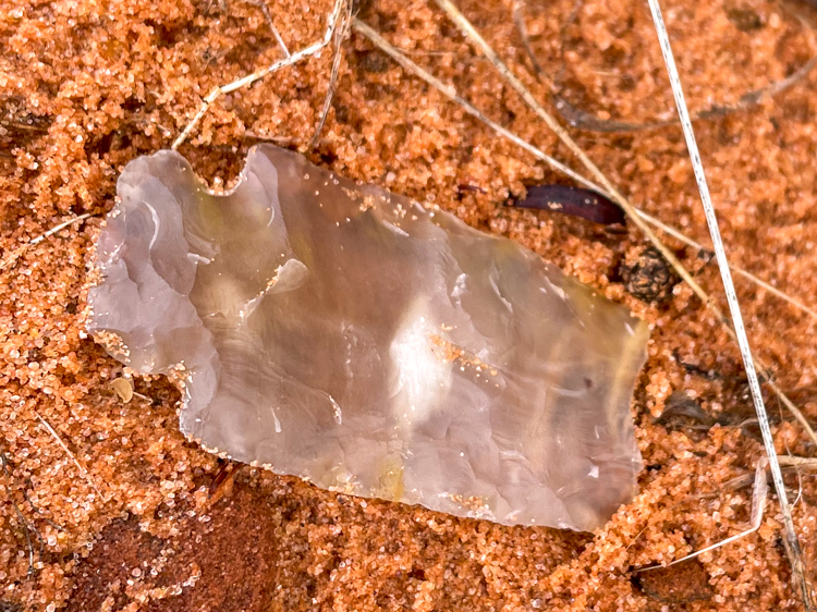
諦めた私たちは、帰途、矢じり探しに集中しました。 So we decided to go back along the same path we came in on, but this time, we focused on looking for arrowheads on the ground.
かつてアメリカ先住民が狩猟のためにたくさん作っていたのでしょう。いくつか発見できました。先端は破れてますが、左端の根元が矢じりであったことを証明してくれます。 I imagine that American indigenous people made many arrowheads for hunting. We found a few. The left side of the sample above indicates that it was an arrowhead, although the tip on the right side was broken off.
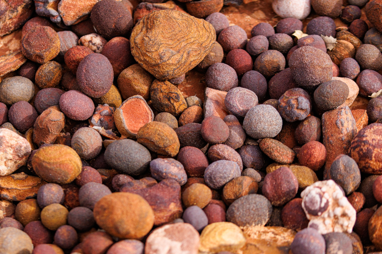
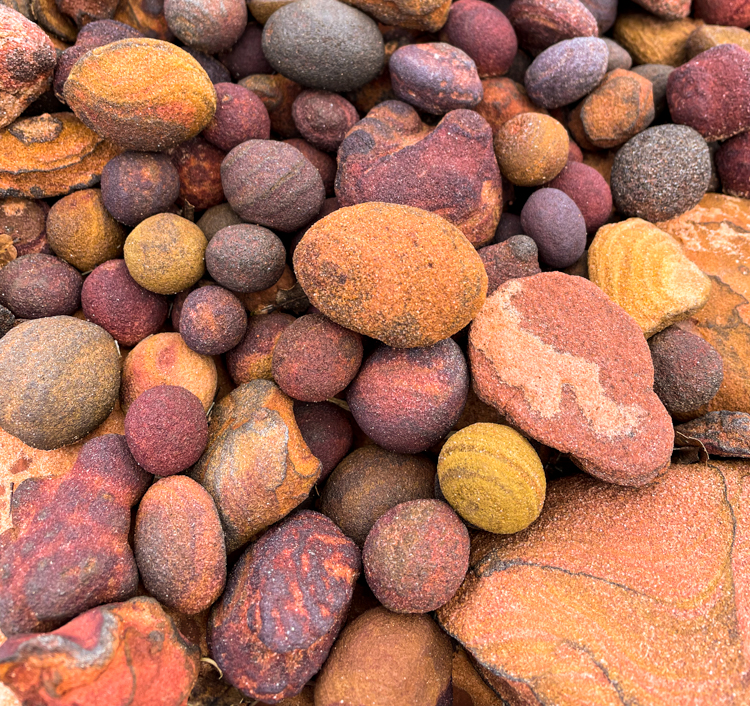
ところで、これはなんだと思いますか? By the way, what do you think these are?
美味しそうでしょ? Aren’t they delicious looking?
モキマーブルと名付けられているボール状の酸化鉄です。長い年月の後、ナバホ砂岩から鉄分が分離して、鉄が参加することによって赤みを帯び、ボール状になったものです。コンクリーションとも呼ばれています。 They are called “Moqui marbles” or “Moqui balls”. After millions of years, the iron separated from the Navajo sandstone, oxidized, and became a ball. It’s also called a “concretion.”
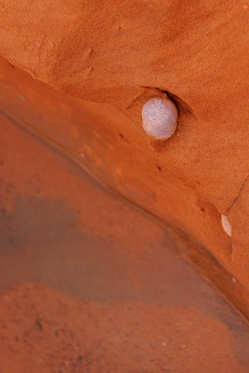
こちらの写真はモキマーブルがまだ完全に分離されていない段階です。雨が降って水にさらされることにより砂岩の侵食が進むと、ポロリと分離するんですね。面白いです。 The picture below shows a moqui ball that is still attached to the sandstone wall. I can see that rain water eroded some of the sand around it. I wonder how long it will take for this particular ball to come out from the wall as the erosion continues. Isn’t it interesting?
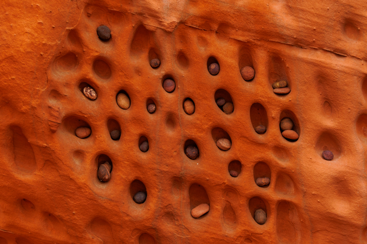
いやいや、こんなことありえないよね?岩壁に見つけたモキマーブルのアパート? At one point, we found a moqui ball apartment. I am sure this was not formed naturally.
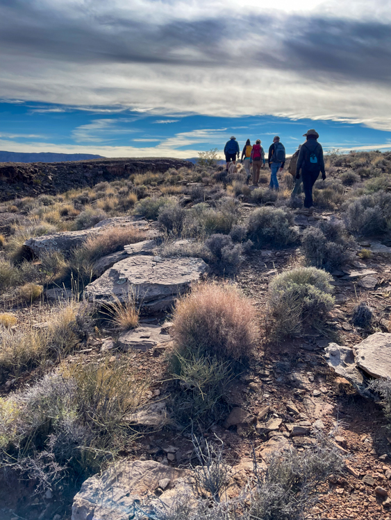
フォートピアース歴史保存跡からスタートして、13km 歩いて帰ってくるという、私たちにとっては少々チャレンジなハイキングでした。 The group hike was quite a challenging 8 mile hike starting from Fort Pearce Heritage site.
そこで、折衷案を出して、出かけました。 So, we made a compromise plan where we would turn back partway through.
結局、10.5kmと366mの高度を歩いて帰ってきました。 We hiked 6.5 miles total with 1000 feet of elevation change.
ここは2.5億年前、三畳紀の面白い地層が露出している場所です。 The area exposes many interesting strata from Triassic period, about 250 million years ago.
大陸移動の畝りを見ながらの小休憩です。 We had a short break with a great view looking out over layers of uplifted rock made by earth movement and erosion.
そこから更に進みます。犬のチェスターは疲れを知りません。We moved on further. Chester the dog doesn’t know the word fatigue.
でも、やはり、みんなと別れて歩いてきた道を引き返す時が来ました。バンちゃんの足底筋膜炎を治療中だからです。But the time came for us to turn back. Because Banchan is under treatment for his plantar fasciitis, we reluctantly said good-bye to everyone.
遠くに離れていくみんなを見送るのは、ちょっと寂しかった。 It was a little sad when we saw our group continue on.
でも、ゆっくりと化石化した木をチェックしたり、虫の観察をしたりしながら歩きました。But we walked slowly on the return, and rather enjoyed examining petrified wood and observing bugs.
虫といえば、こんなに近くで観察するつもりはなかったのに、口の中に飛び込んできたので、飲み込んでしまいました。ハエと同じぐらいの大きさの虫です。大丈夫だよね。死なないよね?Ugh, by the way, I didn’t mean to observe this close, but I swallowed a bug as it flew into my mouth accidentally. I hope it’s okay to eat a fly-sized bug. I won’t die from it, right?
砂利道を1時間弱、そこから2kmも歩くと、視界がパッと広がります。合計5.8kmのハイキングでした。 It is 3.6 mile round-trip hike. After driving on an unpaved road for less than one hour, and hiking about 1.5 miles, we found a gorgeous panoramic view in front of us suddenly.
雨がパラつく中、歩き始めてよかった。太陽が顔を出してくれました。 I am glad that we hiked, even though it was sprinkling. The sun came out from behind the thick clouds.
久しぶりに会う友との会話、寒いけれど新鮮な空気、風の音、みんな気持ちがいい。 The conversation with friends we haven’t met for a while, chilled fresh air, and the sound of the wind, were all very enjoyable.
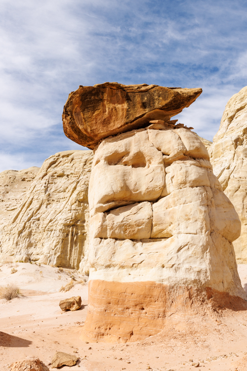
“Toadstool” は主に有毒キノコのことです。直訳すれば Toad=カエル+Stool=腰掛け「カエルの腰掛け」となりますが、それがなぜキノコを指すのかわかりませんでした。 A toadstool is a mushroom. I didn’t know it until now. I didn’t know why Toad + Stool become a mushroom either.
語源はイギリスの中世のおとぎ話にある様です。キノコの上にカエルがよく座っていたということから、「カエルが座る腰掛け」という名前になったらしいです。 Based on my research, the origin of the name came from fairytales from 17th century England. Frogs often sit on top of mushrooms as their stool, so it was named as “toadstool”.
ユタ州にあるトッドスツールズと名付けられたこの場所は、駐車場から1.3km 歩けばつける場所です。でも、面白い場所が奥の方まで続いているので、ぐるりと回ると往復4kmぐらいになります。 The Toadstools in Utah is about a 0.8 mile hike away from the parking lot of the highway. But you can keep going to deeper sections of the park where there are even more interesting toadstools. So, it is about a 2.5 mile round trip hike.
ここは白亜紀に形成されたダコタ砂岩層でできています。それが、浸食と風化作用により、土柱となり、その上に帽子が乗っている様な姿、もしくはキノコに似ているので、”Toadstool”と名付けられたらしいです。 The geological formation of this area is the Dakota sandstone formation. It was formed during the Cretaceous period. Many years of rain and rivers carved the ground and wind eroded away the excess sands. It is like Hoodoos at Bryce Canyon national park, but the difference is these have a rock sitting on top of it like a hat. Or some people say it’s a mushroom.
“Toadstool”がキノコのことだとは知らなかったので、見るまで全く違う解釈をしていました。 Because I didn’t know that a toadstool is a mushroom, I imagined a completely different thing until I saw it.
でも、語源を知って「サルノコシカケ」と同じようだと思いました。木の幹に生えている半円形のキノコです。日本語の語源は猿が腰掛けるのに丁度いいサイズに見えるから、そう名付けられたそうです。 But now I know the origin of it, I thought it’s just like a shelf fungus that grows on the side of trees. In the Japanese language, the name “Sarunokoshikake” is “Saru = Monkey + Koshikake = Stool”, Monkey’s stool. The origin of the word was simply the shape of it and the size of it looks perfectly good for a monkey to sit. So it was named that way.
6.1 km 2時間弱のハイキング。 It’s a 3.8 mile, under two hour, hike.
10Kレースの後、あまり体を動かす機会がなかったので、久しぶりの山道は気持ちがいい。タランチュラも気持ちよさそうに歩いていました。 I didn’t have many opportunities to do outdoor activities after the 10K race, so I felt so good simply being there.
鳥の巣を発見しました。小さいので、鷹より小さい鳥が使っていたに違いありません。来年の春、ここで雛が孵化したら観察できるかもしれないと思うと、楽しみが一つ増えました。 We found a bird nest in a hole on the side of a sandstone wall. It’s rather small. So it must be smaller than a hawk for sure, but we have no idea what kind of bird used it. I am already excited to simply think about observing the tiny chicks that may hatch there next spring.
外で体を動かすこと、やっぱり好きです! Indeed! I love going out there and doing some exercise.
10Kレースの後、何だかんだと忙しくしていました。そんな中久しぶりに山登りに出かけることができました。 I was busy with chores after the 10K race, butwe did go on a hike last week
スノーキャニオン州立公園内の道なき道、知る人ぞ知る天国への階段トレイルです。 The trail is called “Stairway to Heaven” inside Snow Canyon State Park, but it’s not on any map because it’s not an official trail.
登ったり、降ったりして奥地に向かいます。 We walked up and down, and went to a deeper section of the park.
ガイドがいたから来られた場所です。ちょっと話がそれますが、ガイドさんの二人もトレイルベストを着ていました。勿論私も。断然、楽! We couldn’t have found the way without our guides. This is off tangent, but both our guides were wearing trail vests which made me happy. Of course, I was wearing mine. It’s so much easier than a backpack in many ways. I love it.
そして、ここが「天国への階段」と呼ばれるようになった所以の階段のような場所です。 And finally this is the “Stairway to Heaven”. Can you see it looks like a staircase?
馴染みのある風景。そこでみんなでバンザイ。影の記念写真です。 After we got to a familiar place on a ridge, we took a shadow group picture all doing a Banzai pose.
砂丘の様なうねりを見せるナバホ砂岩。こんな景色を後何回見られるのかなと考えると、涙が出てきそう。 Navajo Sandstone shows many different faces. The fine lines like this reminded me of a sand dune and it made me feel a little sentimental. How many more times can I see such beauty?
ところで、ここは有名な映画「明日に向かって撃て!」のシーンにもなった場所です。まさにここにロバートレッドフォードとポールニューマンが立っていたそうです。 By the way, this particular place was used for the movie “Butch Cassidy and the Sundance Kid”. Paul Newman and Robert Redford were right here during filming.
映画の中にはザイオン国立公園も遠くに見えるシーンがあります。ロバートレッドフォードの家が公園の近くにありますが、きっと映画の撮影の時、好きになったんですね。I could recognize Zion National Park in the move as well. I can easily imagine that Robert Redford fell in love with this area so much during the making of this movie, and that’s why he built his house near the park.
5kmの登り降りのたくさんある中級者向けコースです。 The hike was only 3.1 miles but it’s an intermediate hike because you need to go up and down a lot over steep slopes of sandstone rock.
Broken Mesa Rim はレッドクリフ国立自然保護区の中にあります。 Broken Mesa Rim trail runs inside Red Cliffs National Conservation Area.
このトレイル自体はどこまでも続いているようですが、私たちは5kmほど歩いて、ちょうど地図の一番左辺りまで行った所で引き返してきました。往復10kmのハイキングでした。 The trail itself is quite long, but we walked 3 miles out and came back.
約1500mの高台に一度登ってしまうと、あとはなだらかな道になります。イエローノールというとても美しい砂岩のうねりを左に見下ろしながら歩きます。 Once we were up on the mesa at about 5000 feet elevation, the trail is almost flat. While walking, we saw Yellow Knolls on the left.
遠くにはザイオン国立公園も見えます。 We could see Zion National Park as well.
ここは、360度なんでも見える気持ちいい場所です。ただ、一昨年の山火事で、ここ一帯も全て焼けてしまいました。 In fact, it was such a flat and open area that We could see everything all around for 360 degrees. Only sad thing was that a wildfire burned everything around here a few years ago.
木が残っていても、こんなに根の深くまで焼けてしまった死んでいる木だけです。 Trees were standing, but they were burnt all the way to the roots which look like this.
パインバレー山脈をバックに立っている木は、もちろん死んでいますが、これはなんと稲妻に打たれて真っ二つになってしまった木です。 Now, the tree in the picture below is different. It was hit by lightning and split in half.
きもちのいい風が吹いていましたが、動物たちは全く見かけませんでした。ただ一つの例外は、Horned Lark という鳥です。目撃しましたが、あいにく、写真を撮ることはできませんでした。(日本語名は不明。角のあるヒバリ。)まだ見たことがない鳥だったので調べてみたら、本当に角のようなものが頭の上についているんですね。多分、羽根がツノのように見えているだけだと思います。ご興味のある方は、こちらのサイトをどうぞ。 While walking, we enjoyed the comfortable winds, but didn’t see any animals, except for a flock of Horned Larks. We saw them but couldn’t take any pictures. I have never seen them before, so we looked them up on the web. Sure enough, they have horns on their head just like their name. I assume the horns are feathers, but it is very interesting. If you are interested in them, check out this site.
5.8 kmの山道を2時間弱で回るコース。 It’s 3.6 miles, and takes less than two hours to go around the course.
家のすぐ近くだし、いい眺め。だから軽くトレーニングするのにいいコースです。 It’s a perfect place for me to train my endurance because it’s nearby my house and the view is great.
そして、なんと今日のサプライズはサバクゴファーガメの赤ちゃんでした。 And the highlight from today’s hike was two baby Desert Tortoises.
今年生まれたばかりに違いありません。5cmもないほど小さい。 They must have hatched this year. Their body length is less than two inches.
私の靴の横に来て休憩していました。It came to side of my shoes, and rested there.
1匹どころか、2匹も。昨日雨が降ったばかりで、急に気温が下がったから巣から出てきたのかもしれません。 We saw two of them not so far away from each other. I wondered that they came out from their den because we had rain yesterday, and the temperature dropped a little.
元気に育って、あと100年生きてほしいです。 I pray for you to grow safely and live another 100 years.
久しぶりのザイオンの東、7.5km、ナバホ砂岩層の登り300m以上、全行程7.5kmをぐるりと回るハイクでした。The hike was in the east side of Zion National Park, 4.5 miles round trip with 1000 feet of climbing. It’s been a while since I came to Zion for a hike.
朝3時半に起き、ハイク仲間と5時に待ち合わせ、まだ真っ暗な中を歩き始めました。 We woke up at 3:30am, met our hike friends at 5am, and started walking when it was still dark.
暑くなる前にハイキングを終わらせるためです。 We wanted to finish the hike before it got hot.
太陽の光が差し始めました。The light from the Sun started shining on the cliff.
山間の高台に着いた時には、イーストテンプルが光を受けて私たちを迎えてくれました。 When we got to a mesa between the canyons, the majestically lit East temple greeted us.
そこでしばらく休憩です。涙が出るほど美しい。 We had a short break there. It was so beautiful that it made me almost cry.
その後しばらくイーストテンプルの方向に歩いて行きます。 We continued toward the East temple after that.
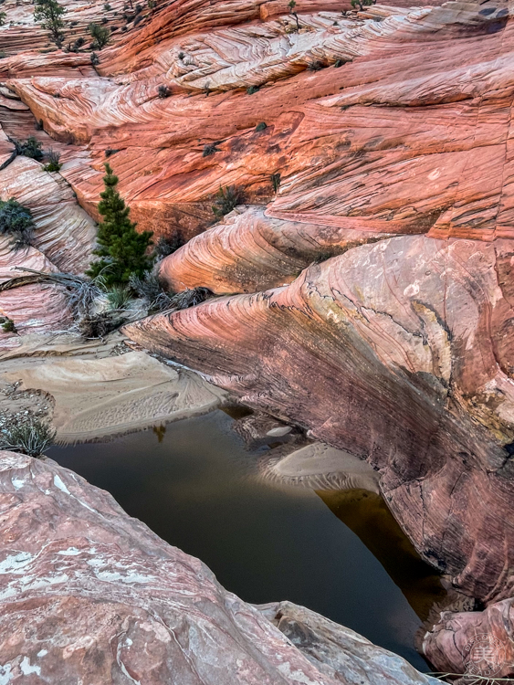
最近の嵐で水が流れ、水溜りが沢山できていました。 Because of the recent storms, many pools were created.
水溜りを避けながら、さらにズンズン進みます。 We kept going on avoiding the pools.
私たちのハイクも後半に入りました。下りが多くなります。 In the second half of our hike, we started going down more than going up.
それでも魅了される景色ばかり。 How majestic it was!
この雄大な景色の中、ただひたすら嬉しくて、やっぱりハイキングが大好きなんだと実感しました。 I was simply so happy in the grand nature, and realized again that I like hiking here.
トレイルのない山道です。だから観光客はほぼ皆無。静寂の世界。 There are no trails there, so almost no tourists go there. It was so peaceful.
久しぶりにパラダイスリムからスカウト洞窟まで歩いてきました。家のすぐそばなので、毎日でも来られるはずなのに、もう1年以上ご無沙汰していました。 We hiked from Paradise Rim to Scout Cave. It is so close to our house, but for some reason, the last hike we did here was more than a year ago.
往復7.5kmを1時間44分で終了しました。岩場、標高差を考慮すると、かなりスピードを上げて歩きました。気持ちいい〜! We completed the round trip in 1 hour and 44 minutes, and covered 4.6 miles on the rocky trail. Considering the elevation gain, we hiked at a much faster pace than normal. But it felt so good!
もっと早くスタートしていれば、もっと涼しくて気持ちがよかったかなと思いました。 It could have been much better if we started much earlier because we could have caught the cool morning air.
パドレ渓谷はスノーキャニオン州立公園内からトゥアカーン野外劇場に通じる渓谷です。私たちは、公園内からスタートして、トゥアカーン側に降っていく出前の尾根まで登り、同じ道を帰ってきました。往復7.8kmの山道でした。The Padre Canyon trail runs from Snow Canyon State Park to Tuacahn Amphitheater. We started from the Snow Canyon State Park side, hiked up to the saddle where sat at the highest point before going down to the Tuacahn side. It was a 4.8 mile long hike.
早朝の光を受けて金色に輝く岩壁が美しい。 The morning light shined on the red rock turning it golden.
朝6時半の空気はまだ優しい。 The air was still so gentle around 6:30 in the morning.
この後長い砂地を歩き、急な登りとなります。 We walked on a long sandy wash, then hiked up the steep trail.
スノーキャニオンはどこを見ても美しい。疲れは飛んでしまいます。Snow Canyon State Park is so pretty no matter where we go. Our fatigue disappeared in front of the views.
たった3時間のハイキングでこんなに素晴らしい景色が見られるなんて、私たちはなんてラッキーなんでしょう。。It took only three hours to go up and back to see this beautiful view. How lucky we are to be able to do so.